Browse / United States / Montana / Great Falls
Great Falls
Montanacity

Great Falls
Total population
60,329
Median home value
$257,000
Bachelor's+
Median income
$63,373
Founded
1883
Demographic figures from US Census Bureau · ACS 5-year estimates. Overview below cites Wikipedia and may reference a different year.
City facts
Facts from Wikidata (CC0).
Overview
Great Falls is the third most populous city in the U.S. state of Montana and the county seat of Cascade County. The population was 60,442 according to the 2020 census. The city covers an area of 22.9 square miles (59 km2) and is the principal city of the Great Falls, Montana, Metropolitan Statistical Area, which encompasses all of Cascade County. The Great Falls MSA's population was 84,414 according to the 2020 census.
Read more on WikipediaHistory & geography
History
For much of prehistory, no permanent settlements existed at or near Great Falls, though Salish Indians seasonally hunted bison in the region. Around 1600, Piegan Blackfeet Indians, migrating west, entered the area, pushing the Salish back into the Rocky Mountains and claiming the area now occupied by Great Falls. Meriwether Lewis and William Clark led the Lewis and Clark Expedition into the newly purchased territory from 1804 to 1806. The expedition came upon the "Great Falls of the Missouri River" on June 13, 1805. Politically, the future site of Great Falls passed through numerous hands in the 19th century. It was part of the unincorporated frontier until May 30, 1854, when Congress established the Nebraska Territory. On March 2, 1861, the site became part of the Dakota Territory. The Great Falls area was incorporated into the Idaho Territory on March 4, 1863, and then into the Montana Territory on May 28, 1864. He returned in 1883 with friend Robert Vaughn and some surveyors and platted a permanent settlement on the south side of the river. A planing mill, lumber yard, bank, school, and newspaper were established in 1885. In 1894, naturalist Vernon Bailey passed through and described Great Falls as "a very good town, appears prosperous and booming & I should judge contains 15000 inhabitants". By the early 1900s, Great Falls was en route to becoming one of Montana's largest cities. The rustic studio of famed Western artist Charles Marion Russell was a popular attraction, as were the famed Great Falls of the Missouri. Among structures built in the early years were the sandstone Central High School (completed in 1896), now the Paris Gibson Square Museum of Art; the ornate copper-domed Cascade County Courthouse (1903); and railroad passenger depots of the Great…
Geography
Great Falls is located near several waterfalls on the Missouri River. It lies near the center of Montana on the northern Great Plains. It lies next to the Rocky Mountain Front and is approximately south of the Canada–US border. According to the United States Census Bureau, the city has a total area of , of which is land and is water. The city of Great Falls lies atop the Great Falls Tectonic Zone, an intracontinental shear zone between two geologic provinces of basement rock of the Archean period which form part of the North American continent. The city lies at the southern reach of the Laurentide Ice Sheet, a vast glacial sheet of ice which covered much of North America during the last glacial period. Approximately 1.5 million years ago, the Missouri River flowed northward into a terminal lake. The Laurentide Ice Sheet pushed the river southward. Between 15,000 BCE and 11,000 BCE, the Laurentide Ice Sheet blocked the Missouri River and created Glacial Lake Great Falls. About 13,000 BCE, as the glacier retreated, Glacial Lake Great Falls emptied catastrophically in a glacial lake outburst flood. The Missouri River flowed eastward around the glacial mass, settling into its present course. Great Falls has a cold semi-arid climate (Köppen: BSk), with a notable amount of summer precipitation occurring in the form of thunderstorms. Winters are very cold, long and often snowy, though periods of chinook winds do cause warm spells and raise the maximum temperature above on an average of fifteen afternoons during the three-month winter period. In the absence of such winds, shallow cold snaps are common; there is an average of 20.8 nights with a low of or colder and 44 days failing to top freezing. The wettest part of the year is the spring. Summers are hot and dry,…
Excerpted from the corresponding Wikipedia article (CC BY-SA).
Demographics & economy
Race & ethnicity
Source: US Census Bureau — American Community Survey, 5-year estimates.
Geography
Coordinates & boundaries from the US Census TIGER/Line shapefiles.
Climate
Current forecast
Forecast for Great Falls, MT from NOAA NWS API.
Air quality
Industrial & pollution facilities
Natural hazard risk
Health (adults)
Age-adjusted prevalence estimates from CDC PLACES (latest release).
Walkability
Amenities nearby
Wildlife & biodiversity
Most-observed species
- Canada Goose (canadensis Group)Branta canadensis (Linnaeus, 1758) · Aves3,066
- MallardAnas platyrhynchos Linnaeus, 1758 · Aves2,527
- Black-capped ChickadeePoecile atricapillus (Linnaeus, 1766) · Aves2,437
- House FinchHaemorhous mexicanus (P.L.Statius Müller, 1776) · Aves2,327
- House SparrowPasser domesticus (Linnaeus, 1758) · Aves2,266
- European StarlingSturnus vulgaris Linnaeus, 1758 · Aves2,248
- American RobinTurdus migratorius Linnaeus, 1766 · Aves2,087
- Ring-billed GullLarus delawarensis Ord, 1815 · Aves1,854
Citizen-science & research observations from the Global Biodiversity Information Facility (GBIF).
Schools
Largest nearby schools
- Great Falls High SchoolHigh · Great Falls · 1,641 students · 15.8:1 ratio
- C M Russell High SchoolHigh · Great Falls · 1,454 students · 16.2:1 ratio
- East Middle SchoolMiddle · Great Falls · 788 students · 14.3:1 ratio
- North Middle SchoolMiddle · Great Falls · 724 students · 14.2:1 ratio
- Meadow Lark SchoolElementary · Great Falls · 555 students · 23.1:1 ratio
- West ElementaryElementary · Great Falls · 463 students · 16:1 ratio
- Mountain View SchoolElementary · Great Falls · 433 students · 14.4:1 ratio
- Giant Springs ElementaryElementary · Great Falls · 432 students · 17.3:1 ratio
Public K–12 schools within ~10 mi from Urban Institute Education Data Portal (NCES Common Core of Data, 2022).
Earthquake history
Most recent
- M 2.6 — 2026-02-2610 km NNE of Black Eagle, Montana
- M 3.7 — 2026-02-133 km SE of Black Eagle, Montana
- M 3.2 — 2026-02-013 km NW of Malmstrom Air Force Base, Montana
- M 2.7 — 2026-01-305 km NNW of Malmstrom Air Force Base, Montana
- M 4.2 — 2026-01-299 km N of Black Eagle, Montana
- M 2.5 — 2025-03-2023 km SSE of Craig, Montana
Events from the USGS Earthquake Catalog (global) (FDSN Event Web Service).
Photos
Sights & places nearby
Notable people from here


People born within ~10 km, from Wikidata (CC0). Click any name for their Wikipedia article.
Nearby places in Montana
Geography & sun
Elevation, sunrise/sunset and daylight from Open-Meteo. Solar climatology from NASA POWER.
Nearby airports
Public attention
Pageview totals from the Wikimedia Pageviews API.
Books about Great Falls

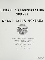

Search results from Open Library.
Recent natural events nearby
Ground air-quality sensors
Recently spotted species
Nearest stream gauge
Events
Gallery
Sources
- • Wikipedia
- • US Census Bureau (ACS 5-year estimates)
- • NOAA National Weather Service
- • Wikidata
- • USGS Earthquake Catalog (global feed)
- • NCES via Urban Institute Education Data Portal
- • GBIF (Global Biodiversity Information Facility)
- • CDC PLACES
- • Open-Meteo / sunrise-sunset.org
- • Wikipedia Pageviews API
- • Open Library