Browse / Malaysia / Sabah / Kampung Ranggal
Kampung Ranggal
Sabahvillage
Demographic figures from Department of Statistics Malaysia. Overview below cites Wikipedia and may reference a different year.
City facts
Overview
Kampung Ranggal is a village in Sabah, Malaysia. Geographically it lies in the northern hemisphere at a equatorial latitude (6.597°, 117.222°). Up-to-date population figures for this locality are not available in the open datasets we monitor. Its latitude implies a climate characterised by hot and humid year-round with little seasonal temperature variation. The sections below expand on demographics, weather, terrain, hazards and nearby points of interest using publicly available datasets.
Summary composed automatically from structured open data on this page. See our Terms for details.
History & geography
Geography
Coordinates & boundaries from the US Census TIGER/Line shapefiles.
Climate
Air quality
Walkability
Amenities nearby
Wildlife & biodiversity
Most-observed species
- Pacific SwallowHirundo javanica Sparrman, 1789 · Aves1
- Artamus leucorhynchosArtamus leucorhynchos · Aves1
- Polyrhachis ypsilon Emery, 1887Polyrhachis ypsilon Emery, 1887 · Insecta1
- White-nest SwiftletAerodramus fuciphagus (Thunberg, 1812) · Aves1
- Crested Serpent-EagleSpilornis cheela (Latham, 1790) · Aves1
- Little Egret/Western Reef-HeronEgretta garzetta (Linnaeus, 1766) · Aves1
- intermediate egretEgretta intermedia (Wagler, 1829) · Aves1
- Purple HeronArdea purpurea Linnaeus, 1766 · Aves1
Citizen-science & research observations from the Global Biodiversity Information Facility (GBIF).
Earthquake history
Most recent
- M 4.3 — 2025-07-2226 km SSW of Kudat, Malaysia
- M 4.9 — 2020-06-3048 km W of Kudat, Malaysia
- M 4.5 — 2019-08-0368 km ENE of Ranau, Malaysia
- M 5.2 — 2018-03-0816 km NNW of Ranau, Malaysia
- M 4.3 — 2018-01-0536 km W of Taman Rajawali, Malaysia
- M 4.6 — 2015-07-2641 km NNE of Ranau, Malaysia
Events from the USGS Earthquake Catalog (global) (FDSN Event Web Service).
Photos
Sights & places nearby
Notable people from here
Nearby places in Sabah
Geography & sun
Nearby airports
Public attention
Books about this place
Recent natural events nearby
Ground air-quality sensors
Recently spotted species
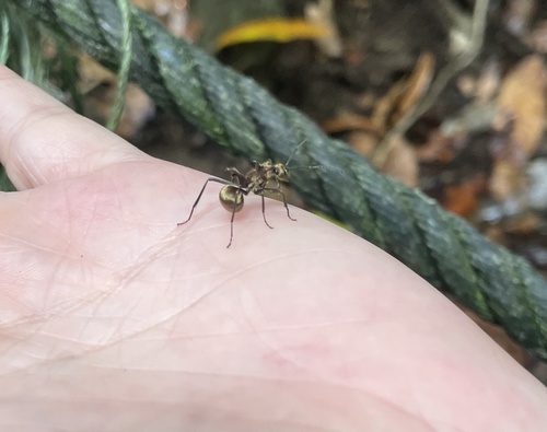
Research-grade observations from iNaturalist (within ~15 mi).
Events
Gallery
Sources
- • Wikidata
- • USGS Earthquake Catalog (global feed)
- • GBIF (Global Biodiversity Information Facility)
- • iNaturalist