Browse / Mozambique / Mozambique / Tete
Tete
Mozambiquecity

Tete
Total population
152,909
Demographic figures from INE Mozambique. Overview below cites Wikipedia and may reference a different year.
City facts
Facts from Wikidata (CC0).
Overview
Tete is the capital city of Tete Province in Mozambique. It is located on the Zambezi River, and is the site of two of the four bridges crossing the river in Mozambique. A Swahili trade center before the Portuguese colonial era, Tete continues to dominate the west-central part of the country and region, and is the largest city on the Zambezi. In the local language, Nyungwe, Tete means "reed".
Read more on WikipediaHistory & geography
History
The region was an important Swahili trade center before the Portuguese colonial era. On the east coast of Africa the Portuguese were drawn to Mozambique and the Zambezi river by news of a local ruler, the Munhumutapa, who was said to have had fabulous wealth in gold. In their efforts to reach the Munhumutapa, the Portuguese established in 1531 two settlements far up the Zambezi – one of them, at Tete, some from the sea. In 1561 Muslims at the Munhumutapa capital convinced the king to kill Gonçalo da Silveira. In retaliation the Portuguese launched a large campaign with 1000 men in 1568 and the Swahili presence at Tete was terminated. The Mutapa Empire and gold mines remained autonomous and mostly isolated from the Portuguese. But in this region of east Africa – as in Portuguese Guinea and Angola in the west – Portuguese involvement became sufficiently strong to survive into the third quarter of the 20th century. Under Portuguese influence Tete had become a market centre for ivory and gold by the mid-17th century. Given a Portuguese town charter in 1761, it became a city of the Portuguese Overseas Province of Mozambique in 1959. After the Portuguese Colonial War in Portuguese Africa and the April 1974 military coup in Lisbon, the then Portuguese Overseas Province of Mozambique become an independent state. The newly independent People's Republic of Mozambique, created in 1975 after the exodus of Mozambique's ethnic Portuguese, descended into civil war between 1977 and 1992.
Excerpted from the corresponding Wikipedia article (CC BY-SA).
Geography
Coordinates & boundaries from the US Census TIGER/Line shapefiles.
Climate
Air quality
Walkability
Amenities nearby
Wildlife & biodiversity
Earthquake history
Photos
Sights & places nearby
Notable people from here


People born within ~10 km, from Wikidata (CC0). Click any name for their Wikipedia article.
Nearby places in Mozambique
- Mbachile مباشيلي714.8 mi away
- Mboudajou مبوداجو716.5 mi away
- Mpaka717.9 mi away
- Bandamadji باندامادجي719.3 mi away
- Douniani دونياني729 mi away
- Ouhozi أوهوزي729.4 mi away
- Mnoungou731 mi away
- Mbéni731.7 mi away
- Buuni بوني732.8 mi away
- Wanani732.8 mi away
- Itsandzéni إتساندزيني733.1 mi away
- Ouzio أوزيو734.2 mi away
Geography & sun
Elevation, sunrise/sunset and daylight from Open-Meteo. Solar climatology from NASA POWER.
Nearby airports
Public attention
Pageview totals from the Wikimedia Pageviews API.
Books about Tete
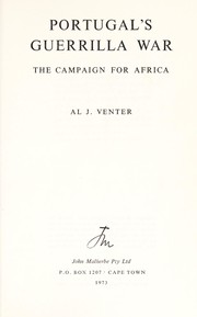
Search results from Open Library.
Recent natural events nearby
Ground air-quality sensors
Recently spotted species
Events
Gallery
Sources
- • Wikipedia
- • Wikidata
- • Open-Meteo / sunrise-sunset.org
- • Wikipedia Pageviews API
- • Open Library