Browse / United States / North Carolina / Cliffside
Cliffside
North CarolinaCDP
Total population
438
Median home value
$0
Bachelor's+
Median income
$51,438
Demographic figures from US Census Bureau · ACS 5-year estimates. Overview below cites Wikipedia and may reference a different year.
City facts
Facts from Wikidata (CC0).
Overview
Cliffside is an unincorporated community and census-designated place (CDP) in southeastern Rutherford County, North Carolina, United States. Its population was 530 as of the 2020 census. Cliffside has a post office with ZIP code 28024. U.S. Route 221 Alternate and North Carolina Highway 120 pass through the community.
Read more on WikipediaHistory & geography
History
Cliffside was founded as a company town by Raleigh Rutherford (R.R.) Haynes, who established a textile mill there on the Second Broad River in 1899. Haynes had previously helped to build up the mills and factories of nearby Henrietta and Caroleen It was entirely owned by Haynes and his business partners, who owned all of the property, homes and farmland in the town. The farm acreage was rented to tenant farmers, and the homes were rented to Haynes' employees at low rates. Homes cost about $0.25 weekly for each room in the house. Because it was privately owned, it had no town council or city limits, and minimal crime. Town residents had to have at least one member of their household employed by Haynes, and had to obey certain town rules, such as not keeping dogs on their property. The town reached its height in the 1950s, when it had about 2,500 residents. Millionaire Earl Owensby originally hailed from Cliffside, and built Earl Owensby Studios just 10 miles from the town.
Excerpted from the corresponding Wikipedia article (CC BY-SA).
Demographics & economy
Race & ethnicity
Source: US Census Bureau — American Community Survey, 5-year estimates.
Geography
Coordinates & boundaries from the US Census TIGER/Line shapefiles.
Climate
10-year averages from ERA5 reanalysis (Open-Meteo).
Current forecast
Forecast for Cliffside, NC from NOAA NWS API.
Air quality
Industrial & pollution facilities
Natural hazard risk
Health (adults)
Age-adjusted prevalence estimates from CDC PLACES (latest release).
Walkability
Amenities nearby
Wildlife & biodiversity
Schools
Largest nearby schools
- Thomas Jefferson Class AcademyOther · Mooresboro · 1,360 students · 17.2:1 ratio
- Chase High SchoolHigh · Forest City · 660 students · 13.2:1 ratio
- East Rutherford High SchoolHigh · Bostic · 659 students · 13.2:1 ratio
- Ellenboro Elementary SchoolElementary · Ellenboro · 595 students · 13.8:1 ratio
- East Rutherford Middle SchoolMiddle · Bostic · 552 students · 14.9:1 ratio
- Chase Middle SchoolMiddle · Forest City · 501 students · 14.3:1 ratio
- Forest City-Dunbar Elementary SchoolElementary · Forest City · 479 students · 13.3:1 ratio
- Harris Elementary SchoolElementary · Forest City · 445 students · 13.9:1 ratio
Public K–12 schools within ~10 mi from Urban Institute Education Data Portal (NCES Common Core of Data, 2022).
Earthquake history
Photos
Sights & places nearby
Notable people from here
Nearby places in North Carolina
- Caroleen2.7 mi away · pop. 116
- Boiling Springs5.7 mi away · pop. 4,757
- Ellenboro5.7 mi away · pop. 901
- Bostic8.9 mi away · pop. 433
- Spindale11.8 mi away
- Shelby12.7 mi away · pop. 22,100
- Rutherfordton13.7 mi away
- Light Oak16.5 mi away · pop. 277
- Cherryville23.7 mi away · pop. 6,226
- Glenwood28.2 mi away · pop. 226
- Crouse28.8 mi away · pop. 408
- Chimney Rock Village30.9 mi away · pop. 122
Geography & sun
Elevation, sunrise/sunset and daylight from Open-Meteo. Solar climatology from NASA POWER.
Nearby airports
Public attention
Pageview totals from the Wikimedia Pageviews API.
Books about Cliffside
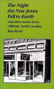


Search results from Open Library.
Recent natural events nearby
- Wildfire Main Trail, Chatham, GeorgiaWildfires · 2026-08-14 · 237 mi
Wildfires, storms and other events from NASA EONET (last 12 months, within 250 mi).
Ground air-quality sensors
Recently spotted species
Nearest stream gauge
Events
Gallery
Sources
- • Wikipedia
- • US Census Bureau (ACS 5-year estimates)
- • Open-Meteo (ERA5 reanalysis)
- • NOAA National Weather Service
- • Wikidata
- • NCES via Urban Institute Education Data Portal
- • CDC PLACES
- • Open-Meteo / sunrise-sunset.org
- • Wikipedia Pageviews API
- • Open Library
- • NASA EONET