Browse / United States / North Carolina / Harkers Island
Harkers Island
North CarolinaCDP

Harkers Island
Total population
1,060
Median home value
$313,100
Bachelor's+
Median income
$60,000
Demographic figures from US Census Bureau · ACS 5-year estimates. Overview below cites Wikipedia and may reference a different year.
City facts
Facts from Wikidata (CC0).
Overview
Harkers Island is a census-designated place (CDP) in Carteret County, North Carolina, United States. As of the 2020 census, Harkers Island had a population of 1,127. Harkers Island is unincorporated and receives most public services, including law enforcement and public education, from Carteret County. A membership cooperative provides the island with electric and water services. Major industries on the island include fishing, boat building, tourism, and waterfowl decoy carving.
Read more on WikipediaHistory & geography
History
Before the arrival of European explorers and settlers, Harkers Island was inhabited by Native Americans of the Coree tribe, who likely spoke a language of the Algonquian family, like most coastal tribes. The nearby Core Sound and Core Banks are named after the Coree. The Coree left little in the way of evidence of permanent habitation on Harkers Island, except for a large mound of oyster shells at Shell Point on the eastern end of the island. Similar shell mounds were found by Europeans on the Shackleford Banks and other islands of the Outer Banks. The exact purpose of the mounds for the Coree remains unknown, but varying cultures of indigenous peoples in the Southeast had been building major earthwork mounds since 3500 BCE, the Middle Archaic period, usually related to religious and ceremonial uses. In 1584, an English expedition financed by Sir Walter Raleigh and led by Philip Amadas and Arthur Barlowe explored the North Carolina coast for a suitable site for the first English colony in North America. Two Native Americans, Wanchese and Manteo, accompanied the expedition back to England in the fall of 1584. According to local island legend, Wanchese was a Coree from Harkers Island. The island was first charted on the maps drawn by John White during the 1584 expedition, but it was unnamed at the time. The island appears on a 1624 map of the greater Virginia coastline created by Captain John Smith. On that map, the island is labeled "Davers Ile", probably for Sir John Davers, one of the founders of Jamestown in 1607. On December 20, 1707, Farnifold Green obtained the first patent for land in the Core Sound area from the lord proprietor of the Carolina colony, which had been established by the English monarch Charles I in 1633. This patent included Harkers Island,…
Geography
Harkers Island is located south of the center of Carteret County. The Harkers Island census-designated place covers the entire island and extends slightly out into the surrounding water. According to the United States Census Bureau, the CDP has a total area of , of which is land and , or 41.76%, is water. At its highest point, the island is above mean sea level, in an area known as the "sand hole", on the western end of the island, made up of mostly white sand on rolling dunes. Harkers Island is protected from the Atlantic Ocean by the barrier islands of the Shackleford Banks to the south and the Core Banks to the east. The body of water directly south of the island is Back Sound. To the east is Core Sound, to the north is The Straits, and to the northwest is the mouth of the North River. The Straits are shallow but navigable by those with local experience. There are two small bays on the north side of the island, Westmouth Bay and Eastmouth Bay. North of Eastmouth Bay is Browns Island, which is accessible only by boat. Harkers Island Road, designated as State Road 1335, connects the island to the mainland by the Earl C. Davis Memorial Bridge, a steel swing bridge built in 1968 to replace a wooden bridge built in 1941.
Excerpted from the corresponding Wikipedia article (CC BY-SA).
Demographics & economy
Race & ethnicity
Source: US Census Bureau — American Community Survey, 5-year estimates.
Geography
Coordinates & boundaries from the US Census TIGER/Line shapefiles.
Climate
Current forecast
Forecast for Harkers Island, NC from NOAA NWS API.
Air quality
Industrial & pollution facilities
Natural hazard risk
Health (adults)
Age-adjusted prevalence estimates from CDC PLACES (latest release).
Walkability
Amenities nearby
Wildlife & biodiversity
Schools
Largest nearby schools
- East Carteret HighHigh · Beaufort · 530 students · 13.9:1 ratio
- Beaufort ElementaryElementary · Beaufort · 378 students · 11.8:1 ratio
- Beaufort MiddleMiddle · Beaufort · 258 students · 12.3:1 ratio
- Down East Middle and Smyrna ElementaryElementary · Smyrna · 249 students · 10.8:1 ratio
- Tiller SchoolElementary · Beaufort · 195 students · 11.5:1 ratio
- Harkers Island ElementaryElementary · Harkers Island · 117 students · 13:1 ratio
Public K–12 schools within ~10 mi from Urban Institute Education Data Portal (NCES Common Core of Data, 2022).
Earthquake history
Photos
Sights & places nearby
Notable people from here
Nearby places in North Carolina
Geography & sun
Elevation, sunrise/sunset and daylight from Open-Meteo. Solar climatology from NASA POWER.
Nearby airports
Public attention
Pageview totals from the Wikimedia Pageviews API.
Books about Harkers Island
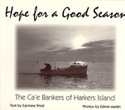
Search results from Open Library.
Recent natural events nearby
Ground air-quality sensors
Recently spotted species
Nearest stream gauge
Events
Gallery
Sources
- • Wikipedia
- • US Census Bureau (ACS 5-year estimates)
- • NOAA National Weather Service
- • Wikidata
- • NCES via Urban Institute Education Data Portal
- • CDC PLACES
- • Open-Meteo / sunrise-sunset.org
- • Wikipedia Pageviews API
- • Open Library