Browse / United States / North Carolina / Valle Crucis
Valle Crucis
North CarolinaCDP

Valle Crucis
Total population
242
Median home value
$463,800
Bachelor's+
Median income
$0
Founded
1842
Demographic figures from US Census Bureau · ACS 5-year estimates. Overview below cites Wikipedia and may reference a different year.
City facts
Facts from Wikidata (CC0).
Overview
Valle Crucis is an unincorporated community and census-designated place located in Watauga County, North Carolina, United States. As of the 2020 census, Valle Crucis had a population of 436. The name of the town is Latin for "Vale of the Cross," a reference to a valley in the area where three streams converge to form a shape similar to an archbishop's cross. The community is located along NC 194, between the towns of Banner Elk and Boone.
Read more on WikipediaHistory & geography
History
Before the 1840s, there has been scattered settlements in the area but not permanently until the Valle Crucis Episcopal Mission was established. Founded by Levi Silliman Ives, an Episcopal missionary, "Easter Chapel" served as the first Episcopal church in the area. Its successor, the Holy Cross Episcopal Church, was built in 1926 and modeled on a now-defunct medieval monastery in Wales and is noteworthy for its architecture.
Geography
Valle Crucis is located at the banks of Dutch Creek and Watauga River, at an elevation of above sea level. To its north and east is Tester Mountain and to its south and west is Valle Mountain. The community is also within the Pisgah National Forest boundary, which limits some development in the area. Weather ranges from warm summer days and cool summer evenings to cold or even bitterly cold winter nights. Rainfall is moderate, averaging per year. Severe storms are rare. Snowfall occurs in the winter with some accumulation to be expected several times between December and April. Snowfall averages per year. The area is also known for being one of the lowest and most quickly flooded in the region. The heart of Valle Crucis, including the bulk of the stores, the elementary school, and community park is a particularly low lying and flat in comparison to the mountainous terrain of the surrounding areas. Flooding is not an extremely rare event and can inhibit many functions of the town, such as the well known occasional flooding of the bridge on DeWitt Barnett Road, inhibiting access from that side of the town.
Excerpted from the corresponding Wikipedia article (CC BY-SA).
Demographics & economy
Race & ethnicity
Source: US Census Bureau — American Community Survey, 5-year estimates.
Geography
Coordinates & boundaries from the US Census TIGER/Line shapefiles.
Climate
Current forecast
Forecast for Valle Crucis, NC from NOAA NWS API.
Air quality
Industrial & pollution facilities
Natural hazard risk
Health (adults)
Age-adjusted prevalence estimates from CDC PLACES (latest release).
Walkability
Amenities nearby
Wildlife & biodiversity
Schools
Largest nearby schools
- Watauga HighHigh · Boone · 1,272 students · 12.8:1 ratio
- Hardin Park ElementaryElementary · Boone · 851 students · 10.9:1 ratio
- Blowing Rock ElementaryElementary · Blowing Rock · 431 students · 13.5:1 ratio
- Valle Crucis ElementaryElementary · Sugar Grove · 342 students · 11.4:1 ratio
- Green Valley ElementaryElementary · Boone · 309 students · 10.3:1 ratio
- Cove Creek ElementaryElementary · Vilas · 294 students · 10.1:1 ratio
- Watauga Innovation AcademyHigh · Boone · 274 students · 68.5:1 ratio
- Mabel ElementaryElementary · Zionville · 156 students · 8.2:1 ratio
Public K–12 schools within ~10 mi from Urban Institute Education Data Portal (NCES Common Core of Data, 2022).
Earthquake history
Photos
Sights & places nearby
Notable people from here


People born within ~10 km, from Wikidata (CC0). Click any name for their Wikipedia article.
Geography & sun
Elevation, sunrise/sunset and daylight from Open-Meteo. Solar climatology from NASA POWER.
Nearby airports
Public attention
Pageview totals from the Wikimedia Pageviews API.
Books about Valle Crucis
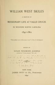




Search results from Open Library.
Recent natural events nearby
Ground air-quality sensors
Recently spotted species
Nearest stream gauge
Events
Gallery
Sources
- • Wikipedia
- • US Census Bureau (ACS 5-year estimates)
- • NOAA National Weather Service
- • Wikidata
- • NCES via Urban Institute Education Data Portal
- • CDC PLACES
- • Open-Meteo / sunrise-sunset.org
- • Wikipedia Pageviews API
- • Open Library