Browse / United States / North Carolina / Wesley Chapel
Wesley Chapel
North Carolinavillage

Wesley Chapel
Total population
9,090
Median home value
$535,500
Bachelor's+
Median income
$132,188
Demographic figures from US Census Bureau · ACS 5-year estimates. Overview below cites Wikipedia and may reference a different year.
City facts
Facts from Wikidata (CC0).
Overview
Wesley Chapel is a village in Union County, North Carolina, United States. The population was 8,681 at the 2020 census and was estimated to be 8,883 in 2021.
Read more on WikipediaHistory & geography
History
The village of Wesley Chapel's existence can be traced back to the establishment of Wesley Chapel United Methodist Church, one of many United Methodist churches to be named after Methodism founder John Wesley's chapel in London. The Wesley Chapel church was founded in 1832 on the remains of an abandoned campground outside nearby Mineral Springs known as McWhorter Campground. The community became first recognized in the early 20th century as residents of Monroe and Vance Township in the early 20th century declared themselves as part of the Wesley Chapel vicinity of Sandy Ridge Township, taking the name from the Methodist church. The village was originally known as Price's Mill, named after the family of Joseph Price and his son James Newton Price. The Price family began as farmers but acquired a significant portion of the land of Wesley Chapel and contributed to much of the village's early development. Wesley Chapel High School was the first rural public high school in North Carolina. The school burnt down in 1955 and reopened in 1961 as Wesley Chapel Elementary School following the opening of Sun Valley High School in Indian Trail. The school was destroyed in a fire and rebuilt again in 1966. Wesley Chapel was officially incorporated as a village of Union County in 1998.
Geography
Wesley Chapel is located in the townships of Monroe and Sandy Ridge in eastern Union County, North Carolina. Part of the Charlotte metropolitan area, it sits east of Weddington, north of Waxhaw, west of Monroe, and south of Indian Trail. According to the United States Census Bureau, the village has a total area of 9.8 square miles (25.39 km2). It has a population density of 787.4 people per square mile. The majority of the village's area is land, aside from Price Mill Creek and some small residential ponds. NC-84 passes through the village as Weddington Road. The village's main attractions are its central business district, known as Wesley Chapel Village Commons, and Dogwood Park.
Excerpted from the corresponding Wikipedia article (CC BY-SA).
Demographics & economy
Race & ethnicity
Source: US Census Bureau — American Community Survey, 5-year estimates.
Geography
Coordinates & boundaries from the US Census TIGER/Line shapefiles.
Climate
Current forecast
Forecast for Wesley Chapel, NC from NOAA NWS API.
Air quality
Industrial & pollution facilities
Natural hazard risk
Health (adults)
Age-adjusted prevalence estimates from CDC PLACES (latest release).
Walkability
Amenities nearby
Wildlife & biodiversity
Schools
Largest nearby schools
- Union AcademyOther · Monroe · 2,129 students · 17.2:1 ratio
- Marvin Ridge HighHigh · Waxhaw · 2,074 students · 22.3:1 ratio
- Cuthbertson HighHigh · Waxhaw · 1,938 students · 23.1:1 ratio
- Weddington HighHigh · Matthews · 1,836 students · 21.9:1 ratio
- Porter Ridge High SchoolHigh · Indian Trail · 1,754 students · 20.6:1 ratio
- Weddington MiddleMiddle · Matthews · 1,450 students · 23:1 ratio
- Sun Valley HighHigh · Monroe · 1,442 students · 18.7:1 ratio
- Marvin Ridge MiddleMiddle · Waxhaw · 1,358 students · 21.9:1 ratio
Public K–12 schools within ~10 mi from Urban Institute Education Data Portal (NCES Common Core of Data, 2022).
Earthquake history
Photos
Sights & places nearby
Notable people from here


People born within ~10 km, from Wikidata (CC0). Click any name for their Wikipedia article.
Nearby places in North Carolina
- Weddington2.6 mi away
- Hemby Bridge8.1 mi away
- Unionville11.2 mi away · pop. 6,954
- Mint Hill12.1 mi away · pop. 27,556
- Pineville12.8 mi away
- Marshville18.4 mi away
- Peachland24.2 mi away
- Red Cross25.9 mi away
- Aquadale30.6 mi away
- Spencer Mountain31.6 mi away
- Millingport33.5 mi away · pop. 522
- Davidson33.6 mi away · pop. 15,660
Geography & sun
Elevation, sunrise/sunset and daylight from Open-Meteo. Solar climatology from NASA POWER.
Nearby airports
Public attention
Pageview totals from the Wikimedia Pageviews API.
Books about Wesley Chapel



Search results from Open Library.
Recent natural events nearby
- Wildfire Main Trail, Chatham, GeorgiaWildfires · 2026-08-14 · 217 mi
Wildfires, storms and other events from NASA EONET (last 12 months, within 250 mi).
Ground air-quality sensors
Recently spotted species


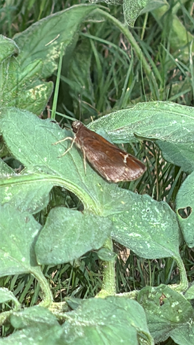

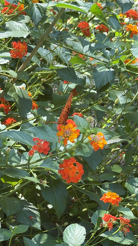




Research-grade observations from iNaturalist (within ~15 mi).
Nearest stream gauge
Events
Gallery
Sources
- • Wikipedia
- • US Census Bureau (ACS 5-year estimates)
- • NOAA National Weather Service
- • Wikidata
- • NCES via Urban Institute Education Data Portal
- • iNaturalist
- • CDC PLACES
- • Open-Meteo / sunrise-sunset.org
- • Wikipedia Pageviews API
- • Open Library
- • NASA EONET