Browse / United States / North Carolina / Whiteville
Whiteville
North Carolinacity

Whiteville
Total population
4,696
Median home value
$187,500
Bachelor's+
Median income
$31,167
Demographic figures from US Census Bureau · ACS 5-year estimates. Overview below cites Wikipedia and may reference a different year.
City facts
Facts from Wikidata (CC0).
Overview
Whiteville is the county seat of and the most populous city in Columbus County, North Carolina, United States. As of the 2020 census, Whiteville had a population of 4,766.
Read more on WikipediaHistory & geography
History
Columbus County was created in 1808. In 1810, an act authorized James Bunbury White to "lay off a town on his own lands in the county of Columbus" and appointed five commissioners, Isaac Powell, John Wingate, Arthur Simpson, William Burney and Warren Baldwin, "for the purpose of laying off a town on the lands of the said James B. White, in the county aforesaid, at the place fixed on to erect the public buildings for said county; which town, when laid off by said commissioners, or a majority of them, shall be named Whitesville, and the lots thereof shall be for the sole benefit and disposal of the said James B. White." Whiteville has had a post office since 1821. The town was sacked by Union forces during the latter stages of the American Civil War. The name Whitesville was officially changed to Whiteville by the U.S. Post Office in 1889. In 1950, Whiteville fielded a professional minor league baseball team in the Class D Tobacco State League. The Whiteville Tobs club lasted only one season before disbanding with the entire league. The Columbus County Courthouse was listed on the National Register of Historic Places in 1983.
Geography
Whiteville is located in north-central Columbus County within the Carolina Border Belt, a regional network of tobacco markets and warehouses along both sides of the North Carolina-South Carolina border. Combined U.S. Routes 74 and 76 bypass the city on its north side and lead east to Wilmington. US 74 leads northwest to Lumberton, and US 76 leads west to Florence, South Carolina. U.S. Route 701 passes through the western side of Whiteville, leading north to Elizabethtown and southwest to Conway, South Carolina. According to the United States Census Bureau, Whiteville has a total area of , all land. Whiteville has a humid subtropical climate (Köppen: Cfa) with long, hot summers and short, mild winters.
Excerpted from the corresponding Wikipedia article (CC BY-SA).
Demographics & economy
Race & ethnicity
Source: US Census Bureau — American Community Survey, 5-year estimates.
Geography
Coordinates & boundaries from the US Census TIGER/Line shapefiles.
Climate
Current forecast
Forecast for Whiteville, NC from NOAA NWS API.
Air quality
Industrial & pollution facilities
Natural hazard risk
Health (adults)
Age-adjusted prevalence estimates from CDC PLACES (latest release).
Walkability
Amenities nearby
Wildlife & biodiversity
Schools
Largest nearby schools
- Classical Charter Schools of WhitevilleElementary · Whiteville · 879 students · 33.8:1 ratio
- Whiteville HighHigh · Whiteville · 662 students · 15.4:1 ratio
- Williams TownshipElementary · Whiteville · 644 students · 15:1 ratio
- Whiteville PrimaryElementary · Whiteville · 501 students · 14.3:1 ratio
- Central MiddleMiddle · Whiteville · 462 students · 13.2:1 ratio
- Edgewood ElementaryElementary · Whiteville · 454 students · 13:1 ratio
- Hallsboro-Artesia ElementaryElementary · Hallsboro · 362 students · 15.1:1 ratio
- Columbus Career and College AcademyHigh · Whiteville · 249 students · 19.2:1 ratio
Public K–12 schools within ~10 mi from Urban Institute Education Data Portal (NCES Common Core of Data, 2022).
Earthquake history
Photos
Sights & places nearby
Notable people from here


People born within ~10 km, from Wikidata (CC0). Click any name for their Wikipedia article.
Nearby places in North Carolina
- Brunswick3.7 mi away · pop. 937
- Chadbourn7.1 mi away · pop. 1,352
- Lake Waccamaw10.9 mi away
- Cerro Gordo13 mi away · pop. 319
- Evergreen13.3 mi away · pop. 421
- Orrum19.9 mi away · pop. 56
- East Arcadia21.9 mi away
- Delco27.1 mi away
- Lumberton27.5 mi away · pop. 18,859
- Tar Heel28.3 mi away · pop. 69
- Barker Ten Mile29.3 mi away · pop. 1,156
- Ivanhoe31 mi away · pop. 275
Geography & sun
Elevation, sunrise/sunset and daylight from Open-Meteo. Solar climatology from NASA POWER.
Nearby airports
Public attention
Pageview totals from the Wikimedia Pageviews API.
Books about Whiteville


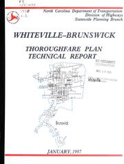
Search results from Open Library.
Recent natural events nearby
- Wildfire Main Trail, Chatham, GeorgiaWildfires · 2026-08-14 · 215 mi
Wildfires, storms and other events from NASA EONET (last 12 months, within 250 mi).
Ground air-quality sensors
Recently spotted species
Nearest stream gauge
Events
Gallery
Sources
- • Wikipedia
- • US Census Bureau (ACS 5-year estimates)
- • NOAA National Weather Service
- • Wikidata
- • NCES via Urban Institute Education Data Portal
- • CDC PLACES
- • Open-Meteo / sunrise-sunset.org
- • Wikipedia Pageviews API
- • Open Library
- • NASA EONET