Browse / United States / North Carolina / Williamston
Williamston
North Carolinatown

Williamston
Total population
5,112
Median home value
$107,100
Bachelor's+
Median income
$38,738
Founded
1779
Demographic figures from US Census Bureau · ACS 5-year estimates. Overview below cites Wikipedia and may reference a different year.
City facts
Facts from Wikidata (CC0).
Overview
Williamston is a town in and the county seat of Martin County, North Carolina, United States. The population was 5,248 at the 2020 census. It is located in North Carolina's Inner Banks region. The closest major city is Greenville, approximately 28 miles (45 km) to the southwest.
Read more on WikipediaHistory & geography
History
Williamston was founded in 1779 and named after William Williams, a local military commander during the American Revolution. Williamston was a focus of activity in the Civil Rights Movement. Beginning in June 1963, civil rights activists led by Golden Frinks protested at City Hall for 29 consecutive days. On August 3, 2023, Martin General Hospital in Williamston announced that Quorum Health, operator of the hospital, was filing for bankruptcy and closing the hospital. Martin General faced challenges as a result of a declining population and the preference of residents for other hospitals. Former hospital employees organized a protest, seeking the attention of an elected official, hoping to get the decision reversed. On August 14–15, Governor Roy Cooper visited Williamston to discuss the lack of medical care in rural parts of the state. He cited the recent hospital closure to explain why he supported expanding Medicaid across rural areas of North Carolina. On October 5, four clinics in Williamston also closed, further adding to the current healthcare crisis in the town.
Geography
Williamston is in eastern North Carolina, in central Martin County. It is bordered to the north by the Roanoke River, which serves as the Bertie County line. Major highways include US 13, US 17 and US 64. Tarboro is to the west and Plymouth is to the east, both by US 64. Washington is to the south by US 17, and Windsor is to the north via US 17 and 13 combined. Greenville is to the southwest via US 13 or by local highways. According to the U.S. Census Bureau, the town of Williamston has a total area of , all land.
Excerpted from the corresponding Wikipedia article (CC BY-SA).
Demographics & economy
Race & ethnicity
Source: US Census Bureau — American Community Survey, 5-year estimates.
Geography
Coordinates & boundaries from the US Census TIGER/Line shapefiles.
Climate
Air quality
Industrial & pollution facilities
Natural hazard risk
Health (adults)
Age-adjusted prevalence estimates from CDC PLACES (latest release).
Walkability
Amenities nearby
Wildlife & biodiversity
Schools
Largest nearby schools
- Riverside HighHigh · Williamston · 447 students · 15.4:1 ratio
- Bear Grass Charter SchoolHigh · Williamston · 433 students · 14.4:1 ratio
- Williamston PrimaryElementary · Williamston · 368 students · 16:1 ratio
- Riverside MiddleMiddle · Williamston · 364 students · 15.2:1 ratio
- South Creek ElementaryElementary · Robersonville · 316 students · 17.6:1 ratio
- E J Hayes ElementaryElementary · Williamston · 273 students · 14.4:1 ratio
- South Creek HighHigh · Robersonville · 236 students · 12.4:1 ratio
- Rodgers ElementaryElementary · Williamston · 220 students · 13.8:1 ratio
Public K–12 schools within ~10 mi from Urban Institute Education Data Portal (NCES Common Core of Data, 2022).
Earthquake history
Photos
Sights & places nearby
Notable people from here


People born within ~10 km, from Wikidata (CC0). Click any name for their Wikipedia article.
Nearby places in North Carolina
Geography & sun
Elevation, sunrise/sunset and daylight from Open-Meteo. Solar climatology from NASA POWER.
Nearby airports
Public attention
Pageview totals from the Wikimedia Pageviews API.
Books about Williamston

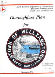


Search results from Open Library.
Recent natural events nearby
Ground air-quality sensors
Recently spotted species
Nearest stream gauge
Events
Gallery
Sources
- • Wikipedia
- • US Census Bureau (ACS 5-year estimates)
- • Wikidata
- • NCES via Urban Institute Education Data Portal
- • CDC PLACES
- • Open-Meteo / sunrise-sunset.org
- • Wikipedia Pageviews API
- • Open Library