Browse / United States / Nebraska / Osceola
Osceola
Nebraskacity

Osceola
Total population
896
Median home value
$148,400
Bachelor's+
Median income
$81,250
Founded
1868
Demographic figures from US Census Bureau · ACS 5-year estimates. Overview below cites Wikipedia and may reference a different year.
- Flood Watch · SevereFlood Watch issued September 30 at 1:17AM CDT until October 1 at 7:00PM CDT by NWS Hastings NE
- Dense Fog Advisory · ModerateDense Fog Advisory issued September 29 at 11:55PM CDT until September 30 at 11:00AM CDT by NWS Hastings NE
Source: NOAA National Weather Service.
City facts
Facts from Wikidata (CC0).
Overview
Osceola is a city in and the county seat of Polk County, Nebraska, United States. As of the 2020 census, Osceola had a population of 875.
Read more on WikipediaHistory & geography
History
According to the University of Nebraska–Lincoln, the first settlers of Osceola, which included the families of Reverend James Query and Vinson Perry Davis, arrived in October 1868. Davis is credited with naming the settlement after a city of the same name in Iowa, which had been named after Chief Osceola of the Seminole people. After three years of settlement and disputes over the permanent location, the town itself was organized by frontiersmen William Francis Kimmel and John Hopwood Mickey in the early fall of 1871. It had been decided in an election by a margin of 14 votes, prior to the formation that the "geographic center of the county" was best suited to be the settlement's site. A courthouse was erected the following spring and a general store was founded in May. During the summer, a post office was built, which served as a terminus between the cities of Lincoln and Ulysses. The town's first full year concluded with the establishment of a public school. The following year brought Methodism to the town, and a church for the faith had been completed by 1878. In the succeeding year, Nebraska Wesleyan college was founded in the church, serving 11 students by means of 4 instructors. The school would later move to Fullerton. The Omaha and Republican Valley Railroad, reached the town in 1879 and named a locomotive after the city, however it was ultimately renamed the number "9." Two years following the arrival of the railroad, the settlement was incorporated as a village on August 26, 1881 after accumulating a population of 200 citizens. The city would ultimately reach its peak of 1,200 residents in 1920. A newspaper titled The Homesteader was established in August 1873. It was renamed the Osceola Record in March 1876, and as of 1995 it is known as the Polk County…
Geography
According to the United States Census Bureau, the city has a total area of , all land. Using paved roads, Stromsburg and Shelby are tied as the closest cities to Osceola, located approximately away. Polk, which is in the same county as Osceola is located away. Outside of the county, Silver Creek is the closest city, found away. With regard to the largest cities of the state, Osceola is found northeast of Grand Island, northwest of Lincoln and to the west of Omaha. Osceola has a humid continental climate (Köppen Dfa), with cold, dry winters and warm, humid summers. Precipitation is highest in the late spring and summer months, with an annual average of . }}
Excerpted from the corresponding Wikipedia article (CC BY-SA).
Demographics & economy
Race & ethnicity
Source: US Census Bureau — American Community Survey, 5-year estimates.
Geography
Coordinates & boundaries from the US Census TIGER/Line shapefiles.
Climate
Current forecast
Forecast for Osceola, NE from NOAA NWS API.
Air quality
Industrial & pollution facilities
Natural hazard risk
Health (adults)
Age-adjusted prevalence estimates from CDC PLACES (latest release).
Walkability
Amenities nearby
Wildlife & biodiversity
Most-observed species
- Brown-belted Bumble BeeBombus griseocollis (De Geer, 1773) · Insecta161
- American RobinTurdus migratorius Linnaeus, 1766 · Aves153
- Red-winged BlackbirdAgelaius phoeniceus (Linnaeus, 1766) · Aves127
- Mourning DoveZenaida macroura (Linnaeus, 1758) · Aves100
- Common GrackleQuiscalus quiscula (Linnaeus, 1758) · Aves96
- Bumble beeBombus pensylvanicus (De Geer, 1773) · Insecta94
- Common Eastern Bumble BeeBombus impatiens Cresson, 1863 · Insecta89
- House SparrowPasser domesticus (Linnaeus, 1758) · Aves79
Citizen-science & research observations from the Global Biodiversity Information Facility (GBIF).
Schools
Largest nearby schools
- SHELBY - RISING CITY ELEMENTARY SCHOOLElementary · SHELBY · 212 students · 11.2:1 ratio
- CROSS COUNTY ELEMENTARY SCHOOLElementary · STROMSBURG · 169 students · 10.6:1 ratio
- CROSS COUNTY HIGH SCHOOLHigh · STROMSBURG · 123 students · 9.5:1 ratio
- OSCEOLA ELEMENTARY SCHOOLElementary · OSCEOLA · 119 students · 11.9:1 ratio
- SHELBY - RISING CITY HIGH SCHOOLHigh · SHELBY · 110 students · 9.2:1 ratio
- SHELBY - RISING CITY MIDDLE SCHOOLMiddle · SHELBY · 89 students · 17.8:1 ratio
- CROSS COUNTY MIDDLE SCHOOLMiddle · STROMSBURG · 75 students · 10.7:1 ratio
- OSCEOLA HIGH SCHOOLHigh · OSCEOLA · 68 students · 7.6:1 ratio
Public K–12 schools within ~10 mi from Urban Institute Education Data Portal (NCES Common Core of Data, 2022).
Earthquake history
Most recent
- M 2.7 — 2025-02-058 km SSE of Tilden, Nebraska
- M 2.8 — 2024-11-213 km W of Harvard, Nebraska
- M 3.3 — 2010-11-184 km E of Octavia, Nebraska
- M 3.3 — 2002-06-208 km NE of Scotia, Nebraska
Events from the USGS Earthquake Catalog (global) (FDSN Event Web Service).
Photos
Sights & places nearby
Notable people from here


People born within ~10 km, from Wikidata (CC0). Click any name for their Wikipedia article.
Geography & sun
Elevation, sunrise/sunset and daylight from Open-Meteo. Solar climatology from NASA POWER.
Nearby airports
Public attention
Pageview totals from the Wikimedia Pageviews API.
Books about Osceola
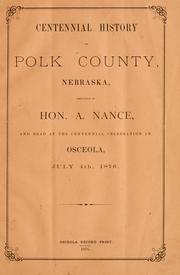
Search results from Open Library.
Recent natural events nearby
Ground air-quality sensors
Recently spotted species
Nearest stream gauge
Events
Gallery
Sources
- • Wikipedia
- • US Census Bureau (ACS 5-year estimates)
- • NOAA National Weather Service
- • Wikidata
- • USGS Earthquake Catalog (global feed)
- • NCES via Urban Institute Education Data Portal
- • GBIF (Global Biodiversity Information Facility)
- • CDC PLACES
- • Open-Meteo / sunrise-sunset.org
- • Wikipedia Pageviews API
- • Open Library