Browse / United States / Nebraska / Seneca
Seneca
NebraskaCDP

Seneca
Total population
45
Median home value
$0
Bachelor's+
Median income
$36,250
Demographic figures from US Census Bureau · ACS 5-year estimates. Overview below cites Wikipedia and may reference a different year.
City facts
Overview
Seneca is an unincorporated community in Thomas County, Nebraska in the Great Plains region of the United States. The population was 49 at the 2020 census.
Read more on WikipediaHistory & geography
History
The Chicago, Burlington and Quincy Railroad was constructed along the Middle Loup River in the late 1880s. Construction was halted for the winter of 1887–88 in western Thomas County, and the town of Seneca was established at that point in January 1888. Seneca became a division point on the railroad, with a depot, rail yard, and roundhouse, employing over 70 people. Railroad operations brought a measure of prosperity to the town, and promoted its growth. Between 1918 and 1923, the Potash Highway, running from Grand Island to Alliance, was constructed parallel to the Burlington's route; it ran through the center of Seneca. The town boasted a number of retail businesses, including hotels, banks, a lumberyard, a railroad cafe, and an automobile dealership. For some years, it was the largest municipality in Thomas County, reaching a peak population of 476 in 1920. In 1926, the Potash Highway was reconfigured as Nebraska Highway 2. In the early 1940s, a re-alignment to reduce the number of railroad crossings shifted the highway to the south of Seneca. The railroad moved its operations out of the town, eliminating jobs and causing the loss of population and the closing of additional businesses. In about 2013, a dispute arose over the village board's passage of an ordinance prohibiting the keeping of horses in the town. It gave rise to a petition to disincorporate Seneca. In May 2014, the residents voted 17–16 for disincorporation, and the village was disincorporated by the Thomas County Board at the end of June 2014.
Geography
According to the United States Census Bureau, the village has a total area of , all land.
Excerpted from the corresponding Wikipedia article (CC BY-SA).
Demographics & economy
Race & ethnicity
Source: US Census Bureau — American Community Survey, 5-year estimates.
Geography
Coordinates & boundaries from the US Census TIGER/Line shapefiles.
Climate
Current forecast
Forecast for Seneca, NE from NOAA NWS API.
Air quality
Industrial & pollution facilities
Natural hazard risk
Health (adults)
Walkability
Amenities nearby
Wildlife & biodiversity
Most-observed species
- Mourning DoveZenaida macroura (Linnaeus, 1758) · Aves116
- American RobinTurdus migratorius Linnaeus, 1766 · Aves93
- Western MeadowlarkSturnella neglecta Audubon, 1844 · Aves85
- Eurasian Collared-DoveStreptopelia decaocto (Frivaldszky, 1838) · Aves69
- Red-winged BlackbirdAgelaius phoeniceus (Linnaeus, 1766) · Aves56
- American CrowCorvus brachyrhynchos C.L.Brehm, 1822 · Aves52
- Common GrackleQuiscalus quiscula (Linnaeus, 1758) · Aves50
- MallardAnas platyrhynchos Linnaeus, 1758 · Aves49
Citizen-science & research observations from the Global Biodiversity Information Facility (GBIF).
Schools
Earthquake history
Most recent
- M 3 — 2025-01-014 km S of Brownlee, Nebraska
- M 2.6 — 2023-12-1634 km SSE of Nenzel, Nebraska
- M 3 — 2018-12-1310 km S of Arnold, Nebraska
- M 2.6 — 2018-09-088 km SE of Arnold, Nebraska
- M 2.6 — 2018-08-307 km WSW of Arnold, Nebraska
- M 2.6 — 2018-08-206 km SE of Arnold, Nebraska
Events from the USGS Earthquake Catalog (global) (FDSN Event Web Service).
Photos
Sights & places nearby
Notable people from here
Geography & sun
Elevation, sunrise/sunset and daylight from Open-Meteo. Solar climatology from NASA POWER.
Nearby airports
Public attention
Pageview totals from the Wikimedia Pageviews API.
Books about Seneca


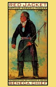
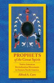
Search results from Open Library.
Recent natural events nearby
- Wildfire Needles, Oglala Lakota, South DakotaWildfires · 2026-09-04 · 115 mi
- Wildfire Rancher fire, Oglala Lakota, South DakotaWildfires · 2026-08-11 · 116 mi
- Wildfire Potato Creek, Jackson, South DakotaWildfires · 2026-08-01 · 122 mi
- Wildfire XU Hill, Oglala Lakota, South DakotaWildfires · 2026-08-11 · 136 mi
- Wildfire Duhamel, Pennington, South DakotaWildfires · 2026-07-29 · 180 mi
- Wildfire Moonshine, Albany, WyomingWildfires · 2026-09-07 · 231 mi
- Wildfire Cold Springs, Converse, WyomingWildfires · 2026-08-10 · 242 mi
Wildfires, storms and other events from NASA EONET (last 12 months, within 250 mi).
Ground air-quality sensors
Recently spotted species
Nearest stream gauge
Events
Gallery
Sources
- • Wikipedia
- • US Census Bureau (ACS 5-year estimates)
- • NOAA National Weather Service
- • Wikidata
- • USGS Earthquake Catalog (global feed)
- • GBIF (Global Biodiversity Information Facility)
- • Open-Meteo / sunrise-sunset.org
- • Wikipedia Pageviews API
- • Open Library
- • NASA EONET