Browse / United States / New Hampshire / Plymouth
Plymouth
New HampshireCDP

Plymouth
Total population
4,969
Median home value
$294,400
Bachelor's+
Median income
$89,500
Founded
1763
Demographic figures from US Census Bureau · ACS 5-year estimates. Overview below cites Wikipedia and may reference a different year.
City facts
Facts from Wikidata (CC0).
Overview
Plymouth is a New England town in Grafton County, New Hampshire, United States, in the White Mountains Region. It has a unique role as the economic, medical, commercial, and cultural center for the predominantly rural Plymouth, NH Labor Market Area. Plymouth is located at the confluence of the Pemigewasset and Baker rivers and sits at the foot of the White Mountains. The town's population was 6,682 at the 2020 census. It is home to Plymouth State University, Speare Memorial Hospital, and Plymouth Regional High School.
Read more on WikipediaHistory & geography
History
Plymouth was originally the site of an Abenaki village that was burned to the ground by Captain Thomas Baker in 1712. This was just one of the many British raids on American Indian settlements during Queen Anne's War. Part of a large plot of undivided land in the Pemigewasset Valley, the town was first named "New Plymouth", after the original Plymouth Colony in Massachusetts. Colonial Governor Benning Wentworth granted Plymouth to settlers from Hollis, all of whom had been soldiers in the French and Indian War. Some had originally come from Plymouth, Massachusetts. The town was incorporated in 1763. Parts of Hebron and Campton were annexed in 1845 and 1860. In 1806, then-lawyer Daniel Webster lost his first criminal case at the Plymouth courthouse, which now houses the Historical Society. The author Nathaniel Hawthorne, while on vacation in 1864 with former U.S. President Franklin Pierce, died in Plymouth at the second Pemigewasset House, which was later destroyed by fire in 1909. In the early 20th century, the Draper and Maynard Sporting Goods Company (D&M) sold products directly to the Boston Red Sox, and players such as Babe Ruth would regularly visit to pick out their equipment. The Plymouth Normal School was founded in 1871 out of the already existing Holmes Plymouth Academy, becoming the state's first teachers' college. It would later evolve into Plymouth Teachers' College in 1939, Plymouth State College in 1963, and finally Plymouth State University in 2003. Image:Main St., Plymouth, NH.jpg|Main Street in 1908 Image:Congregational Church & Town Hall, Plymouth, NH.jpg|Congregational Church and Town Hall Image:Kidder Block & Methodist Church, Plymouth, NH.jpg|Kidder Block Image:Railroad Station, Plymouth, NH.jpg|Railroad Station
Geography
Plymouth is in central New Hampshire, in the southeastern part of Grafton County, at the southern edge of the White Mountains. It is drained by the Pemigewasset River and its tributary, the Baker River, and lies within the Merrimack River watershed. Plymouth is north of Concord, the state capital, and south of the height of land in Franconia Notch. Plymouth Mountain, at the highest point in Plymouth, is in the south, and the slopes of Tenney Mountain are in the west. (The summit of Tenney Mountain lies to the west in the town of Groton.) According to the U.S. Census Bureau, the town has a total area of , of which are land and are water, comprising 1.94% of the town. |source 2 = XMACIS2 }}
Excerpted from the corresponding Wikipedia article (CC BY-SA).
Demographics & economy
Race & ethnicity
Source: US Census Bureau — American Community Survey, 5-year estimates.
Geography
Coordinates & boundaries from the US Census TIGER/Line shapefiles.
Climate
Current forecast
Forecast for Plymouth, NH from NOAA NWS API.
Air quality
Industrial & pollution facilities
Natural hazard risk
Health (adults)
Age-adjusted prevalence estimates from CDC PLACES (latest release).
Walkability
Amenities nearby
Wildlife & biodiversity
Schools
Largest nearby schools
- Plymouth Regional High SchoolHigh · Plymouth · 646 students · 12.7:1 ratio
- Plymouth Elementary SchoolElementary · Plymouth · 387 students · 9.4:1 ratio
- Newfound Regional High SchoolHigh · Bristol · 377 students · 11.8:1 ratio
- Campton Elementary SchoolElementary · Campton · 280 students · 10:1 ratio
- Ashland Elementary SchoolElementary · Ashland · 159 students · 8:1 ratio
- Holderness Central SchoolElementary · Holderness · 152 students · 8:1 ratio
- Bridgewater-Hebron Village SchoolElementary · Bridgewater · 135 students · 13.5:1 ratio
- Mountain Village Charter SchoolElementary · Plymouth · 108 students · 18:1 ratio
Public K–12 schools within ~10 mi from Urban Institute Education Data Portal (NCES Common Core of Data, 2022).
Earthquake history
Photos
Sights & places nearby
Notable people from here


People born within ~10 km, from Wikidata (CC0). Click any name for their Wikipedia article.
Geography & sun
Elevation, sunrise/sunset and daylight from Open-Meteo. Solar climatology from NASA POWER.
Nearby airports
Public attention
Pageview totals from the Wikimedia Pageviews API.
Books about Plymouth
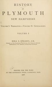

Search results from Open Library.
Recent natural events nearby
Ground air-quality sensors
Recently spotted species
Nearest stream gauge
Events
Gallery
Sources
- • Wikipedia
- • US Census Bureau (ACS 5-year estimates)
- • NOAA National Weather Service
- • Wikidata
- • NCES via Urban Institute Education Data Portal
- • CDC PLACES
- • Open-Meteo / sunrise-sunset.org
- • Wikipedia Pageviews API
- • Open Library