Browse / United States / New Jersey / East Orange
East Orange
New Jerseycity

East Orange
Total population
71,844
Median home value
$372,600
Bachelor's+
Median income
$65,313
Demographic figures from US Census Bureau · ACS 5-year estimates. Overview below cites Wikipedia and may reference a different year.
City facts
Sister cities
Facts from Wikidata (CC0).
Overview
East Orange is a city in Essex County, in the U.S. state of New Jersey. As of the 2020 United States census, the city's population was 69,612, an increase of 5,342 (+8.3%) from the 2010 census count of 64,270, which in turn reflected a decline of 5,554 (−8.0%) from the 69,824 counted in the 2000 census. The city was the state's 17th most populous municipality in 2020, after having been ranked 20th in 2010 and 14th statewide in 2000. The Census Bureau's Population Estimates Program calculated a population of 69,556 for 2023, making it the 544th-most populous municipality in the nation.
Read more on WikipediaHistory & geography
History
East Orange had its origins in Connecticut's New Haven Colony. In 1666, a group of 30 of New Haven's families traveled by water to found "a town on the Passayak" River. They arrived on territory now encompassing Newark, the Oranges, and several other municipalities. The area was situated in the northeast portion of a land grant conveyed by King Charles II of England to his brother James, Duke of York. In 1664, James conveyed the land to two proprietors, Lord John Berkeley and Sir George Carteret. Since Carteret had been Royal Governor of the Isle of Jersey, the territory became known as New Jersey. East Orange was initially a part of Newark and was originally known as Newark Mountains. On June 7, 1780, the townspeople of Newark Mountains officially voted to adopt the name Orange. At the time, there was a significant number of people in favor of secession from Newark. However, this would not occur until November 27, 1806, when the territory now encompassing all of the Oranges was finally detached. On April 13, 1807, the first government was elected, but not until March 13, 1860, was Orange officially incorporated as a city. Immediately, the new city began fragmenting into smaller communities, primarily because of local disputes about the costs of establishing paid police, fire, and street departments. South Orange was organized on January 26, 1861; Fairmount (later to become part of West Orange) on March 11, 1862; East Orange on March 4, 1863; and West Orange (including Fairmount) on March 14, 1863. East Orange was reincorporated as a city on December 9, 1899, based on the results of a referendum held two days earlier. East Orange was known, at one time, for the shade trees that lined the city's residential streets. This is still evident today, as many of the tall…
Geography
According to the U.S. Census Bureau, the city had a total area of 3.93 square miles (10.17 km2), all of which was land. Unincorporated communities, localities and place names located partially or completely within the city include Ampere and Brick Church. East Orange is officially divided into five wards, but is also unofficially divided into neighborhoods, still with many well maintained streets and homes. * Ampere: Anchored by the now defunct train station of the same name, The Ampere section was developed on land owned by Orange Water Works, after the construction of the Crocker Wheeler Company plant spurred development in the area. The station was named in honor of André-Marie Ampère, a pioneer in electrodynamics and reconstructed as a new Renaissance Revival station in 1907 and 1908. Roughly bounded by the Ampere North CDP in Bloomfield to the north, Lawton Street and Newark to the east, 4th Avenue to the south, and North Grove Street to the West. * Greenwood (Teen Streets): So named after Greenwood Avenue and the "teen" streets that run through it. It is often grouped together with Ampere. This area was severely disturbed by the construction of Interstate 280 and the Garden State Parkway. The Grove Street station of the former Delaware, Lackawanna and Western Railroad was located at Grove and Main streets. Roughly bounded by 4th Avenue to the North, North 15th Street/Newark to the east, Eaton Place/NJ Transit Morris & Essex Lines, and North Grove Street to the eest. * Presidential Estates: Recently designated due to the streets in this area being named after early presidents of the United States. There are many large well kept homes situated on streets lined with very old, very large shade trees in this neighborhood that are characteristic of the northern…
Excerpted from the corresponding Wikipedia article (CC BY-SA).
Demographics & economy
Race & ethnicity
Source: US Census Bureau — American Community Survey, 5-year estimates.
Geography
Coordinates & boundaries from the US Census TIGER/Line shapefiles.
Climate
Current forecast
Forecast for East Orange, NJ from NOAA NWS API.
Air quality
Industrial & pollution facilities
Natural hazard risk
Health (adults)
Age-adjusted prevalence estimates from CDC PLACES (latest release).
Walkability
Amenities nearby
Wildlife & biodiversity
Most-observed species
- House SparrowPasser domesticus (Linnaeus, 1758) · Aves99,127
- American RobinTurdus migratorius Linnaeus, 1766 · Aves90,941
- Mourning DoveZenaida macroura (Linnaeus, 1758) · Aves86,030
- European StarlingSturnus vulgaris Linnaeus, 1758 · Aves84,836
- Northern CardinalCardinalis cardinalis (Linnaeus, 1758) · Aves76,387
- Rock PigeonColumba livia J.F.Gmelin, 1789 · Aves67,485
- Blue JayCyanocitta cristata (Linnaeus, 1758) · Aves66,385
- White-throated SparrowZonotrichia albicollis (J.F.Gmelin, 1789) · Aves65,306
Citizen-science & research observations from the Global Biodiversity Information Facility (GBIF).
Schools
Largest nearby schools
- North Star Academy Charter SchoolOther · NEWARK · 6,352 students · 26.9:1 ratio
- TEAM Academy Charter SchoolOther · NEWARK · 6,096 students · 22.6:1 ratio
- East Side High SchoolHigh · NEWARK · 2,255 students · 16.2:1 ratio
- West Orange High SchoolHigh · WEST ORANGE · 2,151 students · 11.4:1 ratio
- Livingston High SchoolHigh · LIVINGSTON · 2,066 students · 11:1 ratio
- Bloomfield High SchoolHigh · Bloomfield · 2,029 students · 12.1:1 ratio
- Great Oaks Legacy Charter SchoolOther · Newark · 2,012 students · 19.9:1 ratio
- Montclair High SchoolHigh · MONTCLAIR · 1,968 students · 13.1:1 ratio
Public K–12 schools within ~10 mi from Urban Institute Education Data Portal (NCES Common Core of Data, 2022).
Earthquake history
Most recent
- M 2.8 — 2025-08-051 km N of Hillsdale, New Jersey
- M 3 — 2025-08-030 km W of Little Ferry, New Jersey
- M 2.9 — 2024-05-246 km E of Califon, New Jersey
- M 2.6 — 2024-05-011 km NW of Gladstone, New Jersey
- M 2.9 — 2024-04-277 km WSW of Gladstone, New Jersey
- M 2.6 — 2024-04-105 km WSW of Gladstone, New Jersey
Events from the USGS Earthquake Catalog (global) (FDSN Event Web Service).
Photos
Sights & places nearby
Notable people from here


People born within ~10 km, from Wikidata (CC0). Click any name for their Wikipedia article.
Nearby places in New Jersey
Geography & sun
Elevation, sunrise/sunset and daylight from Open-Meteo. Solar climatology from NASA POWER.
Nearby airports
Public attention
Pageview totals from the Wikimedia Pageviews API.
Books about East Orange
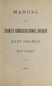
Search results from Open Library.
Recent natural events nearby
Ground air-quality sensors
Recently spotted species
Nearest stream gauge
Events
Gallery
Sources
- • Wikipedia
- • US Census Bureau (ACS 5-year estimates)
- • NOAA National Weather Service
- • Wikidata
- • USGS Earthquake Catalog (global feed)
- • NCES via Urban Institute Education Data Portal
- • GBIF (Global Biodiversity Information Facility)
- • CDC PLACES
- • Open-Meteo / sunrise-sunset.org
- • Wikipedia Pageviews API
- • Open Library