Browse / United States / New Jersey / Glassboro
Glassboro
New Jerseyborough

Glassboro
Total population
23,717
Median home value
$314,400
Bachelor's+
Median income
$87,278
Founded
1779
Demographic figures from US Census Bureau · ACS 5-year estimates. Overview below cites Wikipedia and may reference a different year.
- Coastal Flood Advisory · MinorCoastal Flood Advisory issued September 23 at 4:28AM EDT until September 25 at 4:00AM EDT by NWS Mount Holly NJ
Source: NOAA National Weather Service.
City facts
Facts from Wikidata (CC0).
Overview
Glassboro is a borough within Gloucester County, in the U.S. state of New Jersey, within the Philadelphia metropolitan area. As of the 2020 United States census, the borough's population was 23,149, its highest decennial count ever and an increase of 4,570 (+24.6%) from the 18,579 recorded at the 2010 census, which in turn had reflected a decline of 489 (−2.6%) from the 19,068 counted in the 2000 census. Much of the recent and projected growth in Glassboro have been attributed to the growth trajectory of Rowan University, founded in 1923 and formerly known as Glassboro State College. Glassboro and surrounding Gloucester County constitute part of South Jersey.
Read more on WikipediaHistory & geography
History
Glassboro's early industrial history was built on the manufacturing of glass. The town was first established in 1779 by Solomon Stanger as Glass Works in the Woods. Glass manufacturers over the years since include Heston-Carpenter Glass Works, Olive Glass Works, Harmony Glass Works, Temperanceville Glass Works, Whitney Brothers Glass Works, Owens Bottle Company, Owens Illinois Glass Company, and Anchor Hocking. Rowan University, formerly Glassboro State College, was founded in 1923. The university was the site of the Glassboro Summit Conference in 1967 between U.S. President Lyndon B. Johnson and Soviet Premier Alexei Kosygin. In 1958, a typhoid fever epidemic broke out in the predominantly African-American neighborhoods of Elsmere and Lawns, which was attributed to 20 years of municipal neglect of the sanitary infrastructure in these neighborhoods. The Glassboro Summit Conference between U.S. President Lyndon B. Johnson and Soviet Premier Alexei Kosygin took place in Glassboro. Johnson and Kosygin met for three days from June 23 to June 25, 1967, at Glassboro State College (later renamed Rowan University). The location was chosen as a compromise. Kosygin, having agreed to address the United Nations in New York City, wanted to meet in New York City. Johnson, wary of encountering protests against the Vietnam War, preferred to meet in Washington, D.C. They agreed in Glassboro because it was equidistant between the two cities. The summit's generally amicable atmosphere was referred to as the "Spirit of Glassboro," although the leaders failed to reach agreement on limiting anti-ballistic missile systems. On June 19, 1986, Ronald Reagan became the first sitting president to speak at a high school graduation when he spoke at the Glassboro High School commencement…
Geography
According to the U.S. Census Bureau, the borough had a total area of 9.36 square miles (24.24 km2), including 9.32 square miles (24.14 km2) of land and 0.04 square miles (0.10 km2) of water (0.41%). Glassboro borders the Gloucester County municipalities of Clayton Borough, Elk Township, Harrison Township, Mantua Township, Monroe Township, Pitman, and Washington Township. The area is characterized by hot, humid summers and generally mild to cool winters. According to the Köppen Climate Classification system, Glassboro has a humid subtropical climate, abbreviated "Cfa" on climate maps.
Excerpted from the corresponding Wikipedia article (CC BY-SA).
Demographics & economy
Race & ethnicity
Source: US Census Bureau — American Community Survey, 5-year estimates.
Geography
Coordinates & boundaries from the US Census TIGER/Line shapefiles.
Climate
Current forecast
Forecast for Glassboro, NJ from NOAA NWS API.
Air quality
Industrial & pollution facilities
Natural hazard risk
Health (adults)
Age-adjusted prevalence estimates from CDC PLACES (latest release).
Walkability
Amenities nearby
Wildlife & biodiversity
Schools
Largest nearby schools
- Washington Township High SchoolHigh · SEWELL · 2,075 students · 12:1 ratio
- Williamstown Middle SchoolMiddle · WILLIAMSTOWN · 1,819 students · 13:1 ratio
- Williamstown High SchoolHigh · WILLIAMSTOWN · 1,782 students · 14.4:1 ratio
- Gloucester County Institute of TechnologyHigh · Sewell · 1,609 students · 14.8:1 ratio
- Clearview Regional High SchoolHigh · MULLICA HILL · 1,431 students · 14.8:1 ratio
- Deptford Township High SchoolHigh · DEPTFORD · 1,084 students · 12.8:1 ratio
- Delsea Regional High SchoolHigh · FRANKLINVILLE · 1,074 students · 12.3:1 ratio
- Deptford Township Middle SchoolMiddle · SEWELL · 928 students · 12.7:1 ratio
Public K–12 schools within ~10 mi from Urban Institute Education Data Portal (NCES Common Core of Data, 2022).
Earthquake history
Photos
Sights & places nearby
Notable people from here


People born within ~10 km, from Wikidata (CC0). Click any name for their Wikipedia article.
Nearby places in New Jersey
Geography & sun
Elevation, sunrise/sunset and daylight from Open-Meteo. Solar climatology from NASA POWER.
Nearby airports
Public attention
Pageview totals from the Wikimedia Pageviews API.
Books about Glassboro
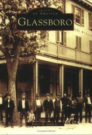
Search results from Open Library.
Recent natural events nearby
Ground air-quality sensors
Recently spotted species
Nearest stream gauge
Events
Gallery
Sources
- • Wikipedia
- • US Census Bureau (ACS 5-year estimates)
- • NOAA National Weather Service
- • Wikidata
- • NCES via Urban Institute Education Data Portal
- • CDC PLACES
- • Open-Meteo / sunrise-sunset.org
- • Wikipedia Pageviews API
- • Open Library