Browse / United States / New Jersey / Mays Landing
Mays Landing
New JerseyCDP

Mays Landing
Total population
6,406
Median home value
$263,700
Bachelor's+
Median income
$83,056
Demographic figures from US Census Bureau · ACS 5-year estimates. Overview below cites Wikipedia and may reference a different year.
- Coastal Flood Warning · SevereCoastal Flood Warning issued September 24 at 5:36AM EDT until September 26 at 2:00AM EDT by NWS Mount Holly NJ
Source: NOAA National Weather Service.
City facts
Facts from Wikidata (CC0).
Overview
Mays Landing is an unincorporated community and census-designated place (CDP) in and the county seat of Atlantic County, New Jersey, located within Hamilton Township. As of the 2020 census, Mays Landing had a population of 5,603.
Read more on WikipediaHistory & geography
History
The community was named for Captain George May, who sailed the Great Egg Harbor River in 1740, and purchased land in the area in 1756. The location was suitable for building ships using local timber and iron from Weymouth foundries. In February 1837, Atlantic County was created and Mays Landing was established as the county seat. The Atlantic County Courthouse was built here in 1838. The Weymouth Forge and Furnace, located along Route 559 just north of the Black Horse Pike (Route 322) in Atlantic County, New Jersey, is now part of the Atlantic County Park System. The site was established in the early 1800s after George Ashbridge and Charles Shoemaker purchased the land in 1800. Iron production began in 1802, using local bog iron and charcoal as fuel. By the 1850s, it had grown into a bustling industrial community with a furnace, forge, gristmill, sawmill, church, store, worker housing, and other facilities. The forge primarily produced cast iron water pipes and also supplied shot and bombs to the U.S. government during the War of 1812. However, by 1862, competition from Pennsylvania’s coal-powered forges made it unprofitable, and the facility was destroyed by fire that same year. In the decades that followed, the property hosted two paper mills—the Atlantic Paper Mills and Weymouth Paper Mills—which operated from the 1860s to 1897. After their closure, the area fell into decline: the dam broke in 1916, the mill pond drained, and the remaining buildings were scavenged for materials. In 1966, Atlantic County began acquiring portions of the original 85,973-acre tract to preserve its history. Today, the Weymouth Furnace site near Mays Landing remains a popular destination for visitors, offering views of the surviving ruins and access to canoeing on the Great Egg Harbor…
Geography
According to the U.S. Census Bureau, Mays Landing has a total area of , including of land and of water (11.91%). The community is located west of Atlantic City. The community known as Mizpah is located west of Mays Landing on U.S. Route 40 but is sometimes considered part of it, with ZIP codes of 08330 and 08342. McKee City is an unincorporated area east of Mays Landing on US 40. The climate in this area is characterized by hot, humid summers and generally mild to cool winters. According to the Köppen Climate Classification system, Mays Landing has a humid subtropical climate, abbreviated "Cfa" on climate maps.
Excerpted from the corresponding Wikipedia article (CC BY-SA).
Demographics & economy
Race & ethnicity
Source: US Census Bureau — American Community Survey, 5-year estimates.
Geography
Coordinates & boundaries from the US Census TIGER/Line shapefiles.
Climate
Current forecast
Forecast for Mays Landing, NJ from NOAA NWS API.
Air quality
Industrial & pollution facilities
Natural hazard risk
Health (adults)
Age-adjusted prevalence estimates from CDC PLACES (latest release).
Walkability
Amenities nearby
Wildlife & biodiversity
Most-observed species
- Tufted TitmouseBaeolophus bicolor (Linnaeus, 1766) · Aves4,781
- Northern CardinalCardinalis cardinalis (Linnaeus, 1758) · Aves4,714
- Carolina ChickadeePoecile carolinensis (Audubon, 1834) · Aves4,618
- Mourning DoveZenaida macroura (Linnaeus, 1758) · Aves4,402
- American RobinTurdus migratorius Linnaeus, 1766 · Aves4,291
- Red-bellied WoodpeckerMelanerpes carolinus (Linnaeus, 1758) · Aves3,857
- Carolina WrenThryothorus ludovicianus (Latham, 1790) · Aves3,816
- Blue JayCyanocitta cristata (Linnaeus, 1758) · Aves3,748
Citizen-science & research observations from the Global Biodiversity Information Facility (GBIF).
Schools
Earthquake history
Most recent
- M 4.1 — 2017-11-303 km NNE of Little Creek, Delaware
- M 2.78 — 2009-07-013 km ESE of Pennsville, New Jersey
Events from the USGS Earthquake Catalog (global) (FDSN Event Web Service).
Photos
Sights & places nearby
Notable people from here
Nearby places in New Jersey
Geography & sun
Elevation, sunrise/sunset and daylight from Open-Meteo. Solar climatology from NASA POWER.
Nearby airports
Public attention
Pageview totals from the Wikimedia Pageviews API.
Books about Mays Landing

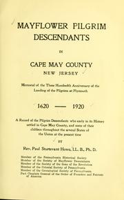


Search results from Open Library.
Recent natural events nearby
Ground air-quality sensors
Recently spotted species
Nearest stream gauge
Events
Gallery
Sources
- • Wikipedia
- • US Census Bureau (ACS 5-year estimates)
- • NOAA National Weather Service
- • Wikidata
- • USGS Earthquake Catalog (global feed)
- • GBIF (Global Biodiversity Information Facility)
- • CDC PLACES
- • Open-Meteo / sunrise-sunset.org
- • Wikipedia Pageviews API
- • Open Library