Browse / United States / New Jersey / Metuchen
Metuchen
New Jerseyborough

Metuchen
Demographic figures from US Census Bureau · ACS 5-year estimates. Overview below cites Wikipedia and may reference a different year.
City facts
Facts from Wikidata (CC0).
Overview
Metuchen is a suburban borough in Middlesex County in the U.S. state of New Jersey. The borough is a commuter town of New York City, located in the heart of the Raritan Valley region within the New York Metropolitan area. The borough, along with Edison, is a regional commercial hub for Central New Jersey. The borough is 6 miles (9.7 km) northeast of New Brunswick, 17 miles (27 km) southwest of Newark, 20 miles (32 km) southwest of Jersey City, and 22 miles (35 km) southwest of Manhattan. As of the 2020 United States census, the borough's population was 15,049, an increase of 1,475 (+10.9%) from the 2010 census count of 13,574, which in turn had reflected an increase of 734 (+5.7%) from the 12,840 counted at the 2000 census.
Read more on WikipediaHistory & geography
History
The earliest residents of the area were the Raritan people of the Lenape Native Americans, who lived in the area and travelled through it to the shore. In 1646, Chief Matouchin was part of a group that included 1,200 warriors. Until 1870, what is now Metuchen was part of Woodbridge Township. The settlers in the western part of the township developed their own separate identity, because they were so far removed from the main settlement of Woodbridge. The name "Metuchen" first appeared in 1688/1689, and its name was derived from the name of a Native American chief, whose name was variously spelled as Matouchin or Matochshegan. In 1701, an overseer of roads was appointed for "Metuchen district". In 1705, Main Street was laid out at the same time as the road from Metuchen to Woodbridge, which one source calls a "reworking of the original road". Sometime between 1717 and 1730, a meeting house was constructed for weekday meetings conducted by the pastor of the Woodbridge Presbyterian Church. In 1756, Metuchen Presbyterians succeeded in forming their own congregation, attesting to their growing numbers. In 1770, the congregations merged, with Metuchen getting 2/5 of the pastor's services and Woodbridge 3/5; by 1772, Metuchen had grown sufficiently to warrant half of his time. In 1793, the two churches again separated. Metuchen was little changed from the late 18th to the early 19th century. A map from 1799 shows ten buildings in the center of the community along Main Street. By 1834, a Presbyterian church, a store, two taverns and about a dozen dwellings could be found. The opening of the Middlesex and Essex Turnpike (now Middlesex Avenue, portions in concurrency with Route 27) in 1806, and the Perth Amboy and Bound Brook Turnpike in 1808 did not spur growth. Not until the…
Geography
According to the United States Census Bureau, the borough had a total area of 2.85 square miles (7.39 km2), including 2.85 square miles (7.38 km2) of land and 2) of water (0.07%). making it part of 21 pairs of "doughnut towns" in the state, where one municipality entirely surrounds another. Unincorporated communities, localities and place names located partially or completely within the township include Jefferson Park and Robinvale. Metuchen has been a state-designated "town center" since 1996 and "transit village" since 2001. The borough has been recognized for its smart growth development. Plans to build a residential and commercial center with 700 parking spaces on a parking lot adjacent to the train station were announced in July 2014.
Excerpted from the corresponding Wikipedia article (CC BY-SA).
Demographics & economy
Geography
Coordinates & boundaries from the US Census TIGER/Line shapefiles.
Climate
Air quality
Industrial & pollution facilities
Natural hazard risk
Health (adults)
Walkability
Amenities nearby
Wildlife & biodiversity
Schools
Earthquake history
Photos
Sights & places nearby
Notable people from here
Geography & sun
Elevation, sunrise/sunset and daylight from Open-Meteo. Solar climatology from NASA POWER.
Nearby airports
Public attention
Pageview totals from the Wikimedia Pageviews API.
Books about Metuchen


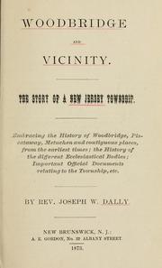
Search results from Open Library.
Recent natural events nearby
Ground air-quality sensors
Recently spotted species
Nearest stream gauge
Events
Gallery
Sources
- • Wikipedia
- • Wikidata
- • Open-Meteo / sunrise-sunset.org
- • Wikipedia Pageviews API
- • Open Library