Browse / United States / New Jersey / Millville
Millville
New Jerseycity

Millville
Total population
27,511
Median home value
$219,000
Bachelor's+
Median income
$70,275
Founded
1720
Demographic figures from US Census Bureau · ACS 5-year estimates. Overview below cites Wikipedia and may reference a different year.
City facts
Facts from Wikidata (CC0).
Overview
Millville is a city in Cumberland County, in the U.S. state of New Jersey. As of the 2020 United States census, the city's population was 27,491, a decrease of 909 (−3.2%) from the 2010 census count of 28,400, which in turn reflected an increase of 1,553 (+5.8%) from the 26,847 counted in the 2000 census.
Read more on WikipediaHistory & geography
History
Around 1720, a sawmill was believed to have existed at Leaming's Mill, known as "Shingle Landing" in its earliest days. The area also had a public road, a boat landing, and a bridge-like structure. In 1790, Joseph Smith and Henry Drinker purchased of land known as the Union Mills Tract. They formed the Union Estates Company, built lumber mills along the Maurice River and established a dam to power these new mills. Joseph Buck, an American Revolutionary War veteran who served under General George Washington, was part of a group that purchased the land in the area in 1795 and laid out the plans for what would become Millville. In 1806, an Irish immigrant, James Lee, opened the area's first glass factory, making use of the large amounts of silica sand and the ample wood that could be used to operate the plant. In the early 1850s, the Smith and Wood Iron Foundry and New Jersey Mills were constructed. In 1860, a bleachery and dye house were added to New Jersey Mills, which then became Millville Manufacturing. David Wood then constructed a dam, forming the largest man-made lake in the state, which powered the entire manufacturing organization. By 1870, the mill had 600 employees, and in 40 years this number doubled. In 1862, Charles K. Landis laid out the city of Vineland about east of the Maurice River. In 1864, Vineland was separated from Millville Township and joined the new Landis Township. Millville Airport was dedicated "America's First Defense Airport" on August 2, 1941, by local, state, and federal officials. In less than a year, construction of military base facilities began, and in January 1943, the Millville Army Air Field opened as a gunnery school for fighter pilots. Gunnery training began with Curtiss P-40 Warhawk aircraft, but after a few weeks was…
Geography
According to the U.S. Census Bureau, the city had a total area of 44.50 square miles (115.25 km2), including 42.00 square miles (108.78 km2) of land and 2.50 square miles (6.47 km2) of water (5.62%). The city borders the Cumberland County municipalities of Commercial Township, Deerfield Township, Downe Township, Fairfield Township, Lawrence Township, Maurice River Township and Vineland. Millville lies between the southern termini of the New Jersey Turnpike, the Garden State Parkway, Route 55 (which runs through the northeastern portion of the city) and the Atlantic City Expressway. The city has a humid subtropical climate (Cfa) and the hardiness zone is 7a bordering 6b.
Excerpted from the corresponding Wikipedia article (CC BY-SA).
Demographics & economy
Race & ethnicity
Source: US Census Bureau — American Community Survey, 5-year estimates.
Geography
Coordinates & boundaries from the US Census TIGER/Line shapefiles.
Climate
Air quality
Industrial & pollution facilities
Natural hazard risk
Health (adults)
Age-adjusted prevalence estimates from CDC PLACES (latest release).
Walkability
Amenities nearby
Wildlife & biodiversity
Schools
Largest nearby schools
- Vineland Senior High SchoolHigh · VINELAND · 2,780 students · 15.6:1 ratio
- Millville Senior High SchoolHigh · MILLVILLE · 1,640 students · 23.4:1 ratio
- Cumberland County Technical Education CenterHigh · Millville · 1,084 students · 12.2:1 ratio
- Lakeside Middle SchoolMiddle · MILLVILLE · 987 students · 10.6:1 ratio
- Thomas W. Wallace Jr. Middle SchoolMiddle · VINELAND · 778 students · 15.3:1 ratio
- Sgt. Dominick Pilla Middle SchoolMiddle · Vineland · 714 students
- Gloria M Sabater Elementary SchoolElementary · VINELAND · 713 students · 12.3:1 ratio
- Veterans Memorial MiddleMiddle · VINELAND · 638 students · 13:1 ratio
Public K–12 schools within ~10 mi from Urban Institute Education Data Portal (NCES Common Core of Data, 2022).
Earthquake history
Photos
Sights & places nearby
Notable people from here


People born within ~10 km, from Wikidata (CC0). Click any name for their Wikipedia article.
Nearby places in New Jersey
Geography & sun
Elevation, sunrise/sunset and daylight from Open-Meteo. Solar climatology from NASA POWER.
Nearby airports
Public attention
Pageview totals from the Wikimedia Pageviews API.
Books about Millville
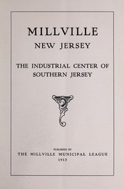
Search results from Open Library.
Recent natural events nearby
Ground air-quality sensors
Recently spotted species
Nearest stream gauge
Events
Gallery
Sources
- • Wikipedia
- • US Census Bureau (ACS 5-year estimates)
- • Wikidata
- • NCES via Urban Institute Education Data Portal
- • CDC PLACES
- • Open-Meteo / sunrise-sunset.org
- • Wikipedia Pageviews API
- • Open Library