Browse / United States / New Jersey / Palmyra
Palmyra
New Jerseyborough

Palmyra
Total population
7,485
Median home value
$234,800
Bachelor's+
Median income
$89,574
Founded
1894
Demographic figures from US Census Bureau · ACS 5-year estimates. Overview below cites Wikipedia and may reference a different year.
City facts
Facts from Wikidata (CC0).
Overview
Palmyra is a borough in Burlington County, in the U.S. state of New Jersey. As of the 2020 United States census, the borough's population was 7,438, an increase of 40 (+0.5%) from the 2010 census count of 7,398, which in turn reflected an increase of 307 (+4.3%) from the 7,091 counted in the 2000 census. The borough, and all of Burlington County, is a part of the Philadelphia metropolitan area.
Read more on WikipediaHistory & geography
History
The area that is now Palmyra was settled in the late 17th century by Swedes, marking the northernmost border of New Sweden. A farmhouse built in 1761 by the third generation of settlers still remains as the oldest house in Palmyra. Farming was the primary use of land in Palmyra and the surrounding area until after the construction of the Camden and Amboy Railroad in 1834 with a station in the area, after which railroad workers built homes on lots they purchased along the railroad right of way. The community was originally known as Texas, but a local landowner, Isaiah Toy, a descendant of the original Swedish settlers and a stockholder in the Camden and Amboy Railroad, who wanted to have a post office established in the community, convinced the railroad to change the name of the station in 1849 to Palmyra, which came from his love of ancient history. Palmyra was the name of an ancient trading center located in central Syria. The post office was established in 1851. Palmyra, along with the city of Burlington and the townships of Bordentown, Moorestown, and Mount Holly, established its high school in the late 1890s, making it one of the oldest high schools in Burlington County and in New Jersey. The community was laid out in 1850, when Joseph Souder's land was broken up into building lots to pay his debts, with the street names matching those of Center City, Philadelphia—Market, Arch, Race, and Vine (from south to north), and Front Street and numbered streets from the Delaware River. What is now Palmyra was part of Chester Township (now Maple Shade Township), which was created in 1694 and was one of the original 104 townships in New Jersey incorporated in 1798. Palmyra became a part of Cinnaminson Township when that township was set off from Chester in 1860. Palmyra…
Geography
According to the United States Census Bureau, the borough had a total area of 2.54 square miles (6.58 km2), including 1.85 square miles (4.79 km2) of land and 0.69 square miles (1.79 km2) of water (27.28%). The borough borders Cinnaminson Township and Riverton in Burlington County; Pennsauken Township in Camden County; and Philadelphia, across the Delaware River in Pennsylvania. The borough is connected to the Tacony section of Philadelphia via Route 73 by the Tacony-Palmyra Bridge, which is named for the two communities connected by the bridge. The bridge was completed in 1929 at a cost of $4 million. In 1999, a nature park, Palmyra Nature Cove, was opened along the banks of the Delaware which borders Palmyra on the west; in addition to serving as a bird sanctuary, the park offers educational programs for schools and hiking trails for walkers. The park is open from dawn to dusk; no pets or bicycles are allowed.
Excerpted from the corresponding Wikipedia article (CC BY-SA).
Demographics & economy
Race & ethnicity
Source: US Census Bureau — American Community Survey, 5-year estimates.
Geography
Coordinates & boundaries from the US Census TIGER/Line shapefiles.
Climate
Air quality
Industrial & pollution facilities
Natural hazard risk
Health (adults)
Walkability
Amenities nearby
Wildlife & biodiversity
Schools
Earthquake history
Photos
Sights & places nearby
Notable people from here


People born within ~10 km, from Wikidata (CC0). Click any name for their Wikipedia article.
Geography & sun
Elevation, sunrise/sunset and daylight from Open-Meteo. Solar climatology from NASA POWER.
Nearby airports
Public attention
Pageview totals from the Wikimedia Pageviews API.
Books about Palmyra
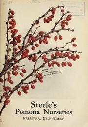
![Steeles' Pomona Nurseries, Palmyra, New Jersey ; [T. E. Steele & Son]](https://covers.openlibrary.org/b/id/7903292-M.jpg)


Search results from Open Library.
Recent natural events nearby
Ground air-quality sensors
Recently spotted species
Nearest stream gauge
Events
Gallery
Sources
- • Wikipedia
- • US Census Bureau (ACS 5-year estimates)
- • Wikidata
- • Open-Meteo / sunrise-sunset.org
- • Wikipedia Pageviews API
- • Open Library