Browse / United States / New Jersey / Point Pleasant Beach
Point Pleasant Beach
New Jerseyborough

Point Pleasant Beach
Total population
4,855
Median home value
$850,300
Bachelor's+
Median income
$141,716
Founded
1886
Demographic figures from US Census Bureau · ACS 5-year estimates. Overview below cites Wikipedia and may reference a different year.
City facts
Facts from Wikidata (CC0).
Overview
Point Pleasant Beach is a coastal borough situated on the Jersey Shore, and the northernmost community directly facing the Atlantic Ocean within Ocean County, in the U.S. state of New Jersey. It lies at the northern end of the Barnegat Peninsula, which serves as a barrier island separating Barnegat Bay from the open Atlantic Ocean. The borough's name is derived from its location.
Read more on WikipediaHistory & geography
History
The area that includes Point Pleasant Beach was first occupied by the Lenape Native Americans. On September 2, 1609, Henry Hudson and the crew of his ship, Half Moon, noticed the area on their way north to explore the Hudson River. Crew member Robert Juet noted in his journal, "This is a very good Land to fall with and a pleasant Land to see." The first European settlers were fisherman and farmers who first arrived in the 18th century. Summer tourism began in the early 19th century when Quaker Thomas Cook Jr. opened his farmhouse on the site of the current Antrim Elementary School to boarders, which began the trend that transformed the area into an oceanfront haven for visitors, a trend further established in the 1870 by Captain John Arnold, who built a roadway to the ocean, now known as Arnold Avenue. In 1875, he built the first bridge over the Manasquan River, linking the town to Brielle. He later convinced the Central Jersey Railroad to extend its service to Point Pleasant Beach, which it did beginning on July 3, 1880. The Borough of Point Pleasant Beach was established on June 2, 1886. The undamaged vessel was successfully re-floated on the spring tide of February 14 and continued on her voyage from Cape Town to New York. In October 2012, Point Pleasant Beach and numerous other Jersey Shore communities, such as Seaside Heights and Long Beach Island, were devastated by Hurricane Sandy. Nearly of the borough's boardwalk was destroyed, with the cost of repairs estimated as up to $2 million. After Hurricane Sandy a seawall was constructed to protect the area from future storms. In addition, the borough required residents who wished to rebuild their homes to elevate them on pilings above the height of Sandy's storm surge.
Geography
According to the United States Census Bureau, the borough had a total area of 1.74 square miles (4.50 km2), including 1.42 square miles (3.68 km2) of land and 0.32 square miles (0.82 km2) of water (18.22%). The borough borders the municipalities of Bay Head and Point Pleasant in Ocean County; and both Brielle and Manasquan in Monmouth County.
Excerpted from the corresponding Wikipedia article (CC BY-SA).
Demographics & economy
Race & ethnicity
Source: US Census Bureau — American Community Survey, 5-year estimates.
Geography
Coordinates & boundaries from the US Census TIGER/Line shapefiles.
Climate
Air quality
Industrial & pollution facilities
Natural hazard risk
Health (adults)
Age-adjusted prevalence estimates from CDC PLACES (latest release).
Walkability
Amenities nearby
Wildlife & biodiversity
Schools
Largest nearby schools
- Lakewood High SchoolHigh · LAKEWOOD · 1,423 students · 17.1:1 ratio
- Brick Township Memorial High SchoolHigh · BRICK · 1,320 students · 13.5:1 ratio
- Toms River Intermediate School EastMiddle · TOMS RIVER · 1,294 students · 14.2:1 ratio
- Brick Township High SchoolHigh · BRICK TOWN · 1,267 students · 12.5:1 ratio
- Lakewood Middle SchoolMiddle · LAKEWOOD · 995 students · 10.8:1 ratio
- Lake Riviera Middle SchoolMiddle · BRICK · 908 students · 11.5:1 ratio
- Point Pleasant Borough High SchoolHigh · POINT PLEASANT · 898 students · 11.1:1 ratio
- Veterans Memorial Middle SchoolMiddle · BRICK TOWN · 871 students · 10.8:1 ratio
Public K–12 schools within ~10 mi from Urban Institute Education Data Portal (NCES Common Core of Data, 2022).
Earthquake history
Photos
Sights & places nearby
Notable people from here


People born within ~10 km, from Wikidata (CC0). Click any name for their Wikipedia article.
Geography & sun
Elevation, sunrise/sunset and daylight from Open-Meteo. Solar climatology from NASA POWER.
Nearby airports
Public attention
Pageview totals from the Wikimedia Pageviews API.
Books about Point Pleasant Beach


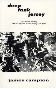

Search results from Open Library.
Recent natural events nearby
Ground air-quality sensors
Recently spotted species
Nearest stream gauge
Events
Gallery
Sources
- • Wikipedia
- • US Census Bureau (ACS 5-year estimates)
- • Wikidata
- • NCES via Urban Institute Education Data Portal
- • CDC PLACES
- • Open-Meteo / sunrise-sunset.org
- • Wikipedia Pageviews API
- • Open Library