Browse / United States / New Jersey / Toms River
Toms River
New JerseyCDP

Toms River
Total population
96,868
Median home value
$447,500
Bachelor's+
Median income
$98,384
Founded
1768
Demographic figures from US Census Bureau · ACS 5-year estimates. Overview below cites Wikipedia and may reference a different year.
City facts
Facts from Wikidata (CC0).
Overview
Toms River is a township located on the Jersey Shore in Ocean County, in the U.S. state of New Jersey. Its mainland portion is also a census-designated place of the same name, which serves as the county seat of Ocean County. Formerly known as the Township of Dover, voters in a 2006 referendum approved a change of the official name to the Township of Toms River, adopting the name of the largest unincorporated community within the township. The township is a bedroom suburb of New York City in the New York metropolitan area, and a regional commercial hub in central New Jersey.
Read more on WikipediaHistory & geography
History
Much of the early history of the settlement of Toms River is obscured by conflicting stories. Various sources list the eponym of the township as either English captain William Tom, or farmer and ferryman Thomas Luker. In 1992, as part of celebrations commemorating the township's 225th anniversary, official recognition was granted to the tradition that the "Tom" in "Toms River" was for Thomas Luker, who ran a ferry across Goose Creek (now the Toms River). During the 19th century, Toms River became a center for shipbuilding, whaling, fishing, and iron and lumber production. The settlement and the river were usually spelled "Tom's River" in its early days, though its current spelling has been standard since the middle of the 19th century. Located in the southern section of the Shrewsbury Township, a royal charter was granted on March 1, 1768, and Dover Township was formed. The incident greatly complicated the tense relationship between the British, loyalists, and colonists, and was a factor in prolonging the peace negotiations that were then in progress in Paris until 1783. The village of Toms River is listed on both the national and state registers of historic places. In 1850, Toms River became the county seat of the newly created Ocean County when it was formed out of southern Monmouth County. During the second half of the 19th century and the early decades of the 20th, many new towns were carved out of Dover Township, including Brick, Jackson, Lakewood, and Berkeley. The Village of Toms River attempted twice—in 1914 and 1926—to secede from Dover Township, but residents were unsuccessful. The part of Toms River on the south side of the river stretching down to Berkeley Township incorporated as South Toms River in 1927, but the core of the original village on the…
Geography
According to the United States Census Bureau, the township had a total area of 52.89 square miles (136.98 km2), including 40.55 square miles (105.03 km2) of land and 12.34 square miles (31.95 km2) of water (23.32%). Dover Beaches North (2020 Census population of 1,277), Dover Beaches South (1,331) and Toms River CDP (92,830) are census-designated places and unincorporated communities located within Toms River Township. Other unincorporated communities, localities and place names located partially or completely within the township include Andrew Point, Andrews, Bay Shore, Cattus Island, Cedar Grove, Chadwick, Coates Point, East Dover, Gilford Park, Gilmores Island, Green Island, Long Point, Normandy Beach, Ocean Beach, Ortley Beach, Pelican Island, Pine View, Pleasant Plains, Shelter Cove, Silverton, Tilton Point, West Dover, and White Oak Bottom. Toms River includes the ZIP Codes 08753, 08754, 08755, 08756, 08757, and 08739. The township is one of 11 municipalities in Ocean County that are part of the Toms River watershed. Toms River has a humid subtropical climate, with significant rainfall throughout the year. The Köppen climate classification of the area is Cfa. The township was severely affected by Superstorm Sandy in October 2012. Many low-lying areas of the township, including Silverton and the downtown area, saw their worst flooding ever when the storm surge overwhelmed the Barnegat Bay up and down the Jersey Shore. The barrier islands, just across the bridge, suffered even worse devastation from the storm surge brought by the hurricane. Extremes range from a record high of 105 °F on both July 19, 1999, and August 9, 1896, to a low of −24 °F on January 16, 1988.
Excerpted from the corresponding Wikipedia article (CC BY-SA).
Demographics & economy
Race & ethnicity
Source: US Census Bureau — American Community Survey, 5-year estimates.
Geography
Coordinates & boundaries from the US Census TIGER/Line shapefiles.
Climate
Current forecast
Forecast for Toms River, NJ from NOAA NWS API.
Air quality
Industrial & pollution facilities
Natural hazard risk
Health (adults)
Walkability
Amenities nearby
Wildlife & biodiversity
Schools
Earthquake history
Photos
Sights & places nearby
Notable people from here


People born within ~10 km, from Wikidata (CC0). Click any name for their Wikipedia article.
Geography & sun
Elevation, sunrise/sunset and daylight from Open-Meteo. Solar climatology from NASA POWER.
Nearby airports
Public attention
Pageview totals from the Wikimedia Pageviews API.
Books about Toms River

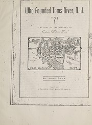
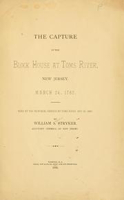
Search results from Open Library.
Recent natural events nearby
Ground air-quality sensors
Recently spotted species
Nearest stream gauge
Events
Gallery
Sources
- • Wikipedia
- • US Census Bureau (ACS 5-year estimates)
- • NOAA National Weather Service
- • Wikidata
- • Open-Meteo / sunrise-sunset.org
- • Wikipedia Pageviews API
- • Open Library