Browse / Netherlands / South Holland / Bodegraven
Bodegraven
South Hollandtown

Bodegraven
Total population
18,187
Demographic figures from CBS Netherlands. Overview below cites Wikipedia and may reference a different year.
City facts
Sister cities
Facts from Wikidata (CC0).
Overview
Bodegraven is a town and former municipality in the western Netherlands, in the province of South Holland. The former municipality covers an area of 38.50 km2 (14.86 sq mi) of which 1.02 km2 (0.39 sq mi) is water.
Read more on WikipediaHistory & geography
History
Bodegraven was already inhabited in the Roman Era. It was situated at the Roman Empire's northern border, the Limes Germanicus. As such, many army camps, ports, and roads were built by the Romans. Many settlements originated on the road along the Limes, including Bodegraven. Not much is known about Bodegraven after that. According to folklore, a lost map from 809 made reference to a fiefdom "Bodelo". There is certainty however that circa 1050 a small settlement had formed, probably near the current Dorpskerk (Village Church). After two centuries of dispute between the bishop of Utrecht and the Counts of Holland, Bodegraven eventually became part of Holland. In the late Middle Ages, large tracts of land around Bodegraven were prepared for cultivation by digging division ditches (kavelsloten) perpendicular to the rivers (such as Oude Rijn, Meije, and Oude Bodegrave) between land parcels and then ditches cross-wise some from and parallel to the rivers (achtersloten). This created the distinctive grid pattern of field divisions. Circa 1350, a lock was built at Bodegraven. In 1672 when war was declared between the Dutch Republic and England, France, Münster, and Cologne, Bodegraven was just behind the Water Defense Line. The Water Line was inundated and formed a barrier to the advancing French troops. But during the winter the French could advance over the frozen polders to Meije and Zwammerdam. Before reaching Alphen aan den Rijn they could be repelled by the Dutch. Thaw had set in so the only retreat route was along the dike of the Oude Rijn. The French therefore came through Bodegraven and destroyed it. Afterwards, the fort Wierickerschans was built just east of the town. Until 1870 Bodegraven prospered. But in that year fire broke out in a bakery which subsequently…
Geography
Bodegraven is centrally located in the Green Heart of the Randstad, roughly equally distant (about 30 km) from Amsterdam, Rotterdam, The Hague, and Utrecht. It is surrounded by the municipalities (clockwise, starting in the north): Nieuwkoop, Woerden, Reeuwijk (former municipality), Boskoop, and Alphen aan den Rijn. The town is situated on both shores of the Oude Rijn, in which a set of locks are in the middle of town. The oldest part of town is the Reformed St. Gallus Church, on the north side of the river.
Excerpted from the corresponding Wikipedia article (CC BY-SA).
Geography
Coordinates & boundaries from the US Census TIGER/Line shapefiles.
Climate
Air quality
Walkability
Amenities nearby
Wildlife & biodiversity
Most-observed species
- muskratOndatra zibethicus (Linnaeus, 1766) · Mammalia60,914
- Eurasian CootFulica atra Linnaeus, 1758 · Aves34,307
- Great EgretArdea alba Linnaeus, 1758 · Aves32,760
- MallardAnas platyrhynchos Linnaeus, 1758 · Aves30,557
- Common ChiffchaffPhylloscopus collybita (Vieillot, 1817) · Aves28,967
- Gray/Purple HeronArdea cinerea Linnaeus, 1758 · Aves28,410
- Mute SwanCygnus olor (J.F.Gmelin, 1789) · Aves28,021
- Great Crested GrebePodiceps cristatus (Linnaeus, 1758) · Aves25,602
Citizen-science & research observations from the Global Biodiversity Information Facility (GBIF).
Earthquake history
Most recent
- M 4.2 — 2011-09-083 km ENE of Heijen, Netherlands
- M 2.9 — 2008-10-1119 km WNW of Egmond aan Zee, Netherlands
Events from the USGS Earthquake Catalog (global) (FDSN Event Web Service).
Photos
Sights & places nearby
Notable people from here


People born within ~10 km, from Wikidata (CC0). Click any name for their Wikipedia article.
Nearby places in South Holland
- Zwammerdam1.8 mi away · pop. 1,924
- Nieuwerbrug aan den Rijn2.7 mi away · pop. 1,756
- Reeuwijk-Dorp3.2 mi away
- Waarder3.3 mi away · pop. 1,731
- Driebruggen3.5 mi away · pop. 1,901
- Boskoop3.8 mi away · pop. 15,536
- Aarlanderveen4.1 mi away · pop. 1,161
- Nieuwkoop4.7 mi away · pop. 9,165
- Waddinxveen4.9 mi away · pop. 32,015
- Alphen aan den Rijn5.3 mi away · pop. 71,428
- Gouda5.3 mi away · pop. 71,752
- Haastrecht5.8 mi away · pop. 4,130
Geography & sun
Elevation, sunrise/sunset and daylight from Open-Meteo. Solar climatology from NASA POWER.
Nearby airports
Public attention
Pageview totals from the Wikimedia Pageviews API.
Books about Bodegraven
Search results from Open Library.
Recent natural events nearby
Ground air-quality sensors
Recently spotted species




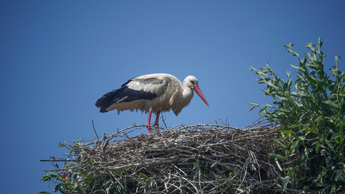
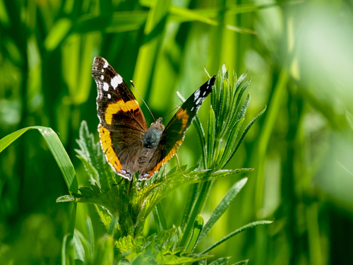


Research-grade observations from iNaturalist (within ~15 mi).
Events
Gallery
Geotagged photos within ~6 miles of Bodegraven, from Wikimedia Commons contributors.
 0.1 mi
 0.1 mi
.jpg) 0.1 mi
0.1 mi 0.1 mi
.jpg) 0.1 mi
0.1 mi 0.1 mi
 0.2 mi
 0.2 mi
 0.2 mi
 0.2 mi
 0.2 mi
 0.2 mi
 0.2 mi
 0.2 mi
 0.2 mi
 0.2 mi
 0.2 mi
.jpg) 0.2 mi
0.2 mi.jpg) 0.2 mi
0.2 mi 0.2 mi
 0.2 mi
 0.2 mi
 0.2 mi
 0.2 mi
Photos via Wikimedia Commons — see each image page for license & attribution.
Official Identifiers
CBS — Statistics Netherlands
- CBS code
- 0497
- Population (Wikidata)
- 17,954
- Wikidata
- Q832938
Gemeente codes via Wikidata P382
Sources
- • Wikipedia
- • Wikimedia Commons
- • Wikidata
- • USGS Earthquake Catalog (global feed)
- • GBIF (Global Biodiversity Information Facility)
- • iNaturalist
- • Open-Meteo / sunrise-sunset.org
- • Wikipedia Pageviews API
- • Open Library
- • CBS — Statistics Netherlands, municipality code via Wikidata P382
- • CBS — Statistics Netherlands — Gemeente codes via Wikidata P382