Browse / United States / New Mexico / Angel Fire
Angel Fire
New Mexicovillage

Angel Fire
Total population
1,111
Median home value
$546,800
Bachelor's+
Median income
$107,554
Founded
1967
Demographic figures from US Census Bureau · ACS 5-year estimates. Overview below cites Wikipedia and may reference a different year.
City facts
Facts from Wikidata (CC0).
Overview
Angel Fire is a village in Colfax County, New Mexico, United States. The population was 1,192 at the 2020 census. Angel Fire Resort is a popular skiing and snowboarding destination, with over 500 acres (2.0 km2) of slopes. Angel Fire and nearby communities experience cold winter temperatures and mild temperatures in the summer.
Read more on WikipediaHistory & geography
Geography
Angel Fire is located in southwestern Colfax County. The village center is in the valley of Cieneguilla Creek, with housing developments climbing mountain slopes to the east and west. Angel Fire Resort, entirely within the village limits, is on the east side of the valley, with a base elevation of and a summit elevation of . Agua Fria Peak, with a summit elevation of , rises to the southeast of the ski area; the summit is near the southeast corner of the village limits. The village limits extend north as far as U.S. Route 64 at a point south of Eagle Nest. To the west, US 64 climbs over Palo Flechado Pass in the Sangre de Cristo Mountains and leads to Taos. New Mexico State Road 434 connects the center of Angel Fire with US 64 to the north and leads south from the village center to Mora. According to the United States Census Bureau, the village of Angel Fire has a total area of , of which is land and , or 0.14%, is water.
Excerpted from the corresponding Wikipedia article (CC BY-SA).
Demographics & economy
Race & ethnicity
Source: US Census Bureau — American Community Survey, 5-year estimates.
Geography
Coordinates & boundaries from the US Census TIGER/Line shapefiles.
Climate
Air quality
Industrial & pollution facilities
Natural hazard risk
Health (adults)
Walkability
Amenities nearby
Wildlife & biodiversity
Schools
Earthquake history
Photos
Sights & places nearby
Notable people from here
Nearby places in New Mexico
Geography & sun
Elevation, sunrise/sunset and daylight from Open-Meteo. Solar climatology from NASA POWER.
Nearby airports
Public attention
Pageview totals from the Wikimedia Pageviews API.
Books about Angel Fire
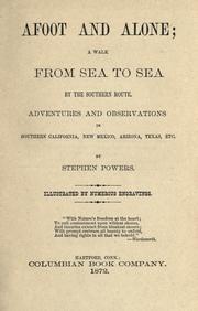


Search results from Open Library.
Recent natural events nearby
Ground air-quality sensors
Recently spotted species
Nearest stream gauge
Events
Gallery
Sources
- • Wikipedia
- • US Census Bureau (ACS 5-year estimates)
- • Wikidata
- • Open-Meteo / sunrise-sunset.org
- • Wikipedia Pageviews API
- • Open Library