Browse / Nepal / Bagmati / Kathmandu
Kathmandu
Bagmaticity

Kathmandu
Total population
975,000
Air quality index
Demographic figures from National Statistics Office (Nepal). Overview below cites Wikipedia and may reference a different year.
City facts
Facts from Wikidata (CC0).
Overview
Kathmandu is the capital and largest city of Nepal, situated in the central part of the country within the Kathmandu Valley. Kathmandu is the main governmental, financial, industrial, and cultural centre of Nepal. As per the 2021 Nepal census, it has a population of 845,767 residing in 105,649 households, with approximately 4 million people in the surrounding metropolitan area. The city stands at an elevation of 1,324 metres (4,344 ft) above sea level. From ancient times until the medieval period, Kathmandu was known as Kantipur and is also referred to as Kasthamandap.
Read more on WikipediaHistory & geography
History
Archaeological excavations in parts of Kathmandu have found evidence of ancient civilizations. The oldest of these findings is a statue, found in Maligaon, that was dated at 185 AD. The excavation of Dhando Chaitya uncovered a brick with an inscription in Brahmi script. Archaeologists believe that it is two thousand years old. Father Cabral reported that they reached "Cadmendu", the capital of Nepal kingdom. The ancient history of Kathmandu is described in its traditional myths and legends. According to the scripture of Swayambhu Purana, present-day Kathmandu was once a huge and deep lake where dwelt mythical serpents (Nāgas) like Karkotaka, Takshaka and Kulika and the Buddhas, bodhisattvas, hermits, yogis, gods and goddesses as well as other celestial beings used to come for ablution in its water. Vipassī Buddha, who lived ninety-one kalpas (aeon) ago, came on a pilgrimage and sowed the seed of a lotus in the lake which grew into a lotus flower with thousand petals. The flower emitted eternal radiant form of light with the Five Great Buddhas, Vairocana, Akshobhya, Ratnasambhava, Amitābha and Amoghasiddhi appearing on each side of the differently coloured rays of the light. Following on the footsteps of Vipassī Buddha, Sikhī Buddha and Vessabhū Buddha came to pay homage to the lotus flower thirty-one kalpas ago. Later on, Bodhisattva Manjushri came to the lake and pondered how to drain the lake so that people can traverse and pay homage to the radiant light. Out of his compassion, he drained the lake out of the valley by cutting the mountain with his indestructible sword; and created other lakes nearby to give shelter to the mythical serpents. The self-arisen ray of light in a thousand - petaled lotus came to be worshipped as Swayambhu. Manjushri then established a…
Geography
Kathmandu is in the northwestern part of the Kathmandu Valley to the north of the Bagmati River and covers an area of . The average elevation is above sea level. The city is bounded by several other municipalities of the Kathmandu valley: south of the Bagmati by Lalitpur Metropolitan City (Patan), with which it forms one urban area surrounded by a ring road, to the southwest by Kirtipur and to the east by Madyapur Thimi. To the north the urban area extends into several municipalities; Nagarjun, Tarakeshwor, Tokha, Budhanilkantha, Gokarneshwor and Kageshwori Manohara. However, the urban agglomeration extends well beyond the neighbouring municipalities, e.g. to Bhaktapur, and nearly covers the entire Kathmandu Valley. Kathmandu is dissected by eight rivers, the main river of the valley, the Bagmati and its tributaries, of which the Bishnumati, Dhobi Khola, Manohara Khola, Hanumante Khola, and Tukucha Khola are predominant. The mountains from where these rivers originate are in the elevation range of , and have passes which provide access to and from Kathmandu and its valley. An ancient canal once flowed from Nagarjuna Hill through Balaju to Kathmandu; this canal is now extinct. The city of Kathmandu and the surrounding valley are in the Deciduous Monsoon Forest Zone (altitude range of ), one of five vegetation zones defined for Nepal. The dominant tree species in this zone are oak, elm, beech, maple and others, with coniferous trees at higher altitude. File:2015-03-08 Swayambhunath, Katmandu, Nepal.jpg| Haphazard settlement seen near Swoyambhu, 2015. File:Kathmandu, Nepal.JPG|The green, vegetated slopes that surround the Kathmandu metro area (light grey, image centre) include both forest reserves and national parks File:Kathmandu City during monsoon.jpg|Araniko…
Excerpted from the corresponding Wikipedia article (CC BY-SA).
Geography
Coordinates & boundaries from the US Census TIGER/Line shapefiles.
Climate
Air quality
Current readings from Open-Meteo Air Quality API (Copernicus CAMS European reanalysis).
Walkability
Amenities nearby
Wildlife & biodiversity
Most-observed species
- Rock PigeonColumba livia J.F.Gmelin, 1789 · Aves16,925
- House CrowCorvus splendens Vieillot, 1817 · Aves16,747
- Black KiteMilvus migrans (Boddaert, 1783) · Aves14,173
- Common MynaAcridotheres tristis (Linnaeus, 1766) · Aves11,331
- Red-vented BulbulPycnonotus cafer (Linnaeus, 1766) · Aves11,287
- House SparrowPasser domesticus (Linnaeus, 1758) · Aves10,459
- Oriental Magpie-RobinCopsychus saularis (Linnaeus, 1758) · Aves9,584
- Barn SwallowHirundo rustica Linnaeus, 1758 · Aves9,435
Citizen-science & research observations from the Global Biodiversity Information Facility (GBIF).
Earthquake history
Most recent
- M 5 — 2025-02-2711 km SSW of Kodāri̇̄, Nepal
- M 4.6 — 2023-12-3127 km E of Nagarkot, Nepal
- M 3.8 — 2023-11-2214 km W of Kirtipur, Nepal
- M 4 — 2023-10-2228 km NE of Bharatpur, Nepal
- M 5.2 — 2023-10-2236 km NE of Bharatpur, Nepal
- M 4.5 — 2023-04-0138 km SSE of Kodāri̇̄, Nepal
Events from the USGS Earthquake Catalog (global) (FDSN Event Web Service).
Photos
Sights & places nearby
Notable people from here


People born within ~10 km, from Wikidata (CC0). Click any name for their Wikipedia article.
Nearby places in Bagmati
Geography & sun
Elevation, sunrise/sunset and daylight from Open-Meteo. Solar climatology from NASA POWER.
Nearby airports
Public attention
Pageview totals from the Wikimedia Pageviews API.
Books about Kathmandu
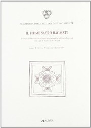

Search results from Open Library.
Recent natural events nearby
Ground air-quality sensors
Recently spotted species
Events
Notable, recurring, and historical events associated with Kathmandu, sourced from Wikidata.
- 2019 Pulsar Sports AwardJul 2, 2019award ceremony
- Nepal Pride Paraderecurring event
Pride Parade celebrated in Nepal on second saturday of June, the first and largest pride parade in Nepal.
Source: Wikidata (CC0).
Gallery
Geotagged photos within ~6 miles of Kathmandu, from Wikimedia Commons contributors.


_(19364433970).jpg)


_(sakarbhusal)_2024-07-20_03H23M42S634.jpg)
_(sakarbhusal)_2024-07-20_03H23M42S968.jpg)
Photos via Wikimedia Commons — see each image page for license & attribution.
Sources
- • Wikipedia
- • Wikimedia Commons
- • Wikidata
- • Open-Meteo Air Quality (CAMS)
- • USGS Earthquake Catalog (global feed)
- • GBIF (Global Biodiversity Information Facility)
- • Open-Meteo / sunrise-sunset.org
- • Wikipedia Pageviews API
- • Open Library