Browse / United States / New York / Canastota
Canastota
New Yorkvillage

Canastota
Founded
1835
Demographic figures from US Census Bureau · ACS 5-year estimates. Overview below cites Wikipedia and may reference a different year.
City facts
Facts from Wikidata (CC0).
Overview
Canastota is a village within the town of Lenox in Madison County, New York, United States. The population was 4,556 at the 2020 census, down from 4,804 in 2010.
Read more on WikipediaHistory & geography
History
Kniste Stota was the historic name of Canastota, a term used by the local Oneida people, meaning "cluster of pines near still waters". The area that makes up Canastota was once inhabited by people of the Oneida Nation, a member of the Haudenosanee confederacy. The Nation's homelands before European settlement of central New York consisted of more than six million acres from the St. Lawrence River to the Susquehanna River. The village was founded by Captain Reuben Perkins, a veteran of the Revolutionary War who served in the battles of Plattsburgh, Saratoga, and Stony Point. In 1800 Captain Perkins moved his family to a log cabin on Quality Hill, along the Seneca Turnpike. In 1810, Captain Perkins purchased of land from the Oneida Nation and permanently settled his family in a cabin at the intersection of what would become James Street and Main Street. Perkins later won a contract for the two miles of the Erie Canal through Canastota, and served as its superintendent. In 1814 Perkins sold of his land, and in 1832 he sold his remaining land holdings. Construction of the Erie Canal through Canastota began in 1817. As the waterway was opened from 1819 through 1825, it caused a surge of growth and development in the area. Workers and their employers soon moved their families to the area, and eventually schools, businesses, and religious organizations sprung up. As soon as this section of the canal was opened, a line of packets was established, making regular trips between Syracuse and Utica, stopping at all intermediate towns. Trade sprang up at once between Canastota and other villages, making it one of the foremost villages in central New York. The first post office was established in 1829 with Ichabod S. Spencer as postmaster, and by 1831 there were three public…
Geography
Canastota is in the southern part of the town of Lenox. Interstate 90, the New York State Thruway, passes through the northern part of the village, with access from Exit 34. I-90 leads east to Utica and west to the Syracuse area. New York State Route 13 passes through the center of Canastota as Peterboro Street and leads north to Sylvan Beach at the east end of Oneida Lake. State Route 5 runs along the southern border of Canastota, leading east to Oneida and west to Chittenango. According to the U.S. Census Bureau, the village of Canastota has a total area of , of which , or 0.12%, are water. Canastota Creek flows through the center of the village and joins Cowaselon Creek in the village's north end, which continues northwest to Oneida Lake at Lakeport.
Excerpted from the corresponding Wikipedia article (CC BY-SA).
Demographics & economy
Geography
Coordinates & boundaries from the US Census TIGER/Line shapefiles.
Climate
Air quality
Industrial & pollution facilities
Natural hazard risk
Health (adults)
Walkability
Amenities nearby
Wildlife & biodiversity
Schools
Earthquake history
Photos
Sights & places nearby
Notable people from here
Geography & sun
Elevation, sunrise/sunset and daylight from Open-Meteo. Solar climatology from NASA POWER.
Nearby airports
Public attention
Pageview totals from the Wikimedia Pageviews API.
Books about Canastota
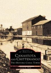
Search results from Open Library.
Recent natural events nearby
Ground air-quality sensors
Recently spotted species
Nearest stream gauge
Events
Gallery
Sources
- • Wikipedia
- • Wikidata
- • Open-Meteo / sunrise-sunset.org
- • Wikipedia Pageviews API
- • Open Library