Browse / United States / New York / Corning
Corning
New Yorkcity

Corning
Total population
10,643
Median home value
$158,400
Bachelor's+
Median income
$61,760
Founded
1796
Demographic figures from US Census Bureau · ACS 5-year estimates. Overview below cites Wikipedia and may reference a different year.
City facts
Sister cities
Facts from Wikidata (CC0).
Overview
Corning is a city in Steuben County, New York, United States, on the Chemung River. The population was 10,551 at the 2020 census. It is named for Erastus Corning, an Albany financier and railroad executive who was an investor in the company that developed the community. The city is best known as the headquarters of Fortune 500 company Corning Incorporated, formerly Corning Glass Works, a manufacturer of glass and ceramic products for industrial, scientific and technical uses. Corning is roughly equidistant from New York City and Toronto, being about 220 miles (350 km) from both.
Read more on WikipediaHistory & geography
History
The first settlement in the town of Corning was made near the site of the future city in 1796. The community was incorporated as a village in 1848. Corning was incorporated as a city in 1890. As the glass industry developed, Corning became known as the "Crystal City" which was supported by companies such as Hawkes, Sinclair, and Hunt - which produced some of the finest American Brilliant Period cut glass between 1880 and 1915. The Corning area's first real industry was lumber. The first settlers used the area's river systems to transport logs and finished lumber in fleets downstream to buyers. This gave rise to large mills which helped to develop the area. Rafting of lumber began to wane as timber was depleted. At one time the mills of the Corning area were reputed to be among the biggest in the world. After the lumber was depleted the great mills moved north to new forests. East, across the Chemung River from Corning, lies Gibson, the site of a feeder canal for the Chemung Canal system. Some of Corning's early prosperity came from the feeder canal system exposure. Canal cargoes from Corning included soft coal, timber, tobacco, grain, and whiskey. From April 22 to December 11, 1850, the canal season that year, the newspaper reported that 1,116 boats left the port of Corning. Tolls for the year totaled $54,060.39. Among items shipped were 46,572,400 pounds of coal. The canal's best peacetime year was 1854 when 270,978 tons of freight were hauled. The Civil War brought an abnormal amount of business, with a peak of 307,151 tons hauled in one year. After the Civil War, an industrial boom occurred in the region. Ingersoll Rand opened during this period in Painted Post, just north of Corning. Corning became a railroad town in the 1880s, many smaller railroad lines…
Geography
Just upstream from Corning, the Cohocton River and the Tioga River merge to form the Chemung River which flows through downtown. The river was an important source of power in the early history, and is part of the attractiveness of the region today. The river is prone to floods, as rain water runs off quickly from the steep hillsides of the area. In 1972 the remnants of Hurricane Agnes dropped fifteen or more inches of rain in the area within a short time causing extensive flooding. Eighteen people were killed in the immediate Corning-Painted Post area. The entire downtown area was flooded, with severe damage. Flooding is now controlled by a system of dams upstream from Corning. I-86 (the Southern Tier Expressway), NY 17, NY 352, NY 414, and NY 415 are major highways connecting in Corning. County Road 40 leads into the city from the south and County Road 41 from the north. I-99 and US 15 proceeds southward from Painted Post, west of Corning. According to the United States Census Bureau, the city has a total area of , of which, of it is land and of it (5.18%) is water.
Excerpted from the corresponding Wikipedia article (CC BY-SA).
Demographics & economy
Race & ethnicity
Source: US Census Bureau — American Community Survey, 5-year estimates.
Geography
Coordinates & boundaries from the US Census TIGER/Line shapefiles.
Climate
Current forecast
Forecast for Corning, NY from NOAA NWS API.
Air quality
Industrial & pollution facilities
Natural hazard risk
Health (adults)
Age-adjusted prevalence estimates from CDC PLACES (latest release).
Walkability
Amenities nearby
Wildlife & biodiversity
Schools
Earthquake history
Photos
Sights & places nearby
Notable people from here


People born within ~10 km, from Wikidata (CC0). Click any name for their Wikipedia article.
Nearby places in New York
Geography & sun
Elevation, sunrise/sunset and daylight from Open-Meteo. Solar climatology from NASA POWER.
Nearby airports
Public attention
Pageview totals from the Wikimedia Pageviews API.
Books about Corning
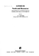

Search results from Open Library.
Recent natural events nearby
Ground air-quality sensors
Recently spotted species
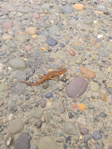




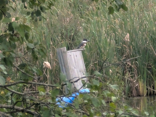



Research-grade observations from iNaturalist (within ~15 mi).
Nearest stream gauge
Events
Gallery
Sources
- • Wikipedia
- • US Census Bureau (ACS 5-year estimates)
- • NOAA National Weather Service
- • Wikidata
- • iNaturalist
- • CDC PLACES
- • Open-Meteo / sunrise-sunset.org
- • Wikipedia Pageviews API
- • Open Library