Browse / United States / New York / Irondequoit
Irondequoit
New YorkCDP

Irondequoit
Total population
50,657
Median home value
$182,500
Bachelor's+
Median income
$79,162
Founded
1839
Demographic figures from US Census Bureau · ACS 5-year estimates. Overview below cites Wikipedia and may reference a different year.
- Freeze Watch · SevereFreeze Watch issued October 16 at 12:42PM EDT until October 18 at 9:00AM EDT by NWS Buffalo NY
Source: NOAA National Weather Service.
City facts
Facts from Wikidata (CC0).
Overview
Irondequoit is a town in Monroe County, New York, United States. As of the 2020 census, the coterminous town-CDP had a population of 51,043. Irondequoit is a suburb of the city of Rochester, lying just north and east of the city limits. The name is of Haudenosaunee origin and means "where the land meets the water".
Read more on WikipediaHistory & geography
History
In 1687 the Marquis de Denonville led an army of French soldiers and Wyandot warriors on a punitive expedition against the Haudenosaunee through Irondequoit Bay, beginning the long enmity between the Haudenosaunee and the French. After the American Revolution, this area was part of the Phelps and Gorham Purchase. The Town of Irondequoit was founded in 1839 when it separated from the town of Brighton. During the last part of the 19th century, the north edge of the town was developed as a tourist and vacation area for Rochester residents, and was once known as the "Coney Island of Western New York". After World War II, Irondequoit experienced significant population growth, with returning veterans looking for housing. Irondequoit became the first suburb in Monroe County to see substantial migration of residents from the city of Rochester, with the population growing from 23,376 in 1940 to 55,337 in 1960, an increase of 136%. Irondequoit remained the most-populated suburb in Monroe County until the 1970s, when it was surpassed by the town of Greece, a community with three times the land area of Irondequoit. In 1965, Irondequoit became part of civil rights history by being part of the first totally voluntary desegregation program in U.S. history. The Urban Suburban Interdistrict Transfer Program, which still operates today, was begun with 25 first graders from the inner city of Rochester who embarked on their K-12 education in the West Irondequoit school district. Ultimately, 15 of the original 25 students graduated together in 1977 as part of the first graduating class ever to go through a full 12 years of voluntary desegregation. The achievement was acknowledged in a letter from the White House and a notation in the U.S. Congressional Record. The program has continued…
Geography
The town is in north-central Monroe County, lying between the Genesee River on the west and Irondequoit Bay on the east. The north border of the town is defined by the shoreline of Lake Ontario. Because it is bounded by water on three sides, it is considered a geographical headland. Irondequoit is bordered by the city of Rochester to the south and west, the town of Brighton at Irondequoit's southeast corner, and the towns of Penfield and Webster to the east. The eastern boundary of the town follows the center of Irondequoit Bay from the mouth of Irondequoit Creek north to Lake Ontario. An unusual boundary exists between the Town of Irondequoit and the adjacent City of Rochester. On the western border of Irondequoit, the city limits include a thin strip of land that extends northward along the east bank of the Genesee River from Seneca Park to Lake Ontario, at some points less than from the shore. The result is that the City of Rochester claims the entire eastern shore of the Genesee, and the border of the Town of Irondequoit never reaches the river. Similarly, the northern half of Durand-Eastman Park (including Durand Beach) is part of the City of Rochester, along with a narrow strip running along Culver Road for approximately southward to Norton Street, where it connects to the main part of Rochester. This leads to much confusion, even among long-term residents, about whether places such as Seneca Park or Durand Park lie within the Town of Irondequoit or the City of Rochester. Seneca Park was annexed by the City of Rochester in 1891, and Durand Eastman Park was given to the city in 1908. According to the U.S. Census Bureau, the town of Irondequoit has a total area of , of which are land and , or 10.75%, are water.
Excerpted from the corresponding Wikipedia article (CC BY-SA).
Demographics & economy
Race & ethnicity
Source: US Census Bureau — American Community Survey, 5-year estimates.
Geography
Coordinates & boundaries from the US Census TIGER/Line shapefiles.
Climate
Current forecast
Forecast for Irondequoit, NY from NOAA NWS API.
Air quality
Industrial & pollution facilities
Natural hazard risk
Health (adults)
Age-adjusted prevalence estimates from CDC PLACES (latest release).
Walkability
Amenities nearby
Wildlife & biodiversity
Most-observed species
- Northern CardinalCardinalis cardinalis (Linnaeus, 1758) · Aves51,831
- American RobinTurdus migratorius Linnaeus, 1766 · Aves46,581
- Blue JayCyanocitta cristata (Linnaeus, 1758) · Aves42,289
- House SparrowPasser domesticus (Linnaeus, 1758) · Aves40,522
- Mourning DoveZenaida macroura (Linnaeus, 1758) · Aves40,371
- Red-bellied WoodpeckerMelanerpes carolinus (Linnaeus, 1758) · Aves36,086
- Red-winged BlackbirdAgelaius phoeniceus (Linnaeus, 1766) · Aves35,090
- Black-capped ChickadeePoecile atricapillus (Linnaeus, 1766) · Aves35,066
Citizen-science & research observations from the Global Biodiversity Information Facility (GBIF).
Schools
Largest nearby schools
- PENFIELD SENIOR HIGH SCHOOLHigh · PENFIELD · 1,424 students · 12.7:1 ratio
- WEBSTER-SCHROEDER HIGH SCHOOLHigh · WEBSTER · 1,314 students · 11.4:1 ratio
- TRUE NORTH ROCHESTER PREPARATORY CHARTER SCHOOLOther · ROCHESTER · 1,301 students · 16.7:1 ratio
- THOMAS HIGH SCHOOLHigh · WEBSTER · 1,258 students · 11.9:1 ratio
- BRIGHTON HIGH SCHOOLHigh · ROCHESTER · 1,243 students · 11.7:1 ratio
- EDISON CAREER AND TECHNOLOGY HIGH SCHOOLHigh · ROCHESTER · 1,233 students · 8:1 ratio
- IRONDEQUOIT HIGH SCHOOLHigh · ROCHESTER · 1,163 students · 12.1:1 ratio
- GATES-CHILI HIGH SCHOOLHigh · ROCHESTER · 1,132 students · 10.9:1 ratio
Public K–12 schools within ~10 mi from Urban Institute Education Data Portal (NCES Common Core of Data, 2022).
Earthquake history
Most recent
- M 2.6 — 2022-03-155 km SSW of Warsaw, New York
- M 2.6 — 2020-03-2911 km N of Lyndonville, New York
- M 2.52 — 2017-07-1111 km NNW of Barker, New York
- M 2.46 — 2014-02-1334 km N of Lyndonville, New York
- M 2.7 — 2009-12-2110 km NNE of Olcott, New York
- M 2.91 — 2009-06-054 km SSE of Attica, New York
Events from the USGS Earthquake Catalog (global) (FDSN Event Web Service).
Photos
Sights & places nearby
Notable people from here


People born within ~10 km, from Wikidata (CC0). Click any name for their Wikipedia article.
Nearby places in New York
- Greece6.6 mi away · pop. 13,943
- St. John Fisher College7.3 mi away
- Nazareth College7.8 mi away
- East Rochester8 mi away · pop. 6,218
- Pittsford8.7 mi away
- Hilton12.4 mi away · pop. 5,968
- Gananda13.2 mi away · pop. 6,273
- Ontario14.7 mi away
- Churchville17.3 mi away
- Brockport18.6 mi away · pop. 7,277
- Palmyra20.1 mi away
- Avon22.3 mi away · pop. 3,417
Geography & sun
Elevation, sunrise/sunset and daylight from Open-Meteo. Solar climatology from NASA POWER.
Nearby airports
Public attention
Pageview totals from the Wikimedia Pageviews API.
Books about Irondequoit
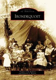
Search results from Open Library.
Recent natural events nearby
Ground air-quality sensors
Recently spotted species
Nearest stream gauge
Events
Gallery
Sources
- • Wikipedia
- • US Census Bureau (ACS 5-year estimates)
- • NOAA National Weather Service
- • Wikidata
- • USGS Earthquake Catalog (global feed)
- • NCES via Urban Institute Education Data Portal
- • GBIF (Global Biodiversity Information Facility)
- • CDC PLACES
- • Open-Meteo / sunrise-sunset.org
- • Wikipedia Pageviews API
- • Open Library