Browse / United States / New York / Utica
Utica
New Yorkcity

Utica
Total population
64,217
Median home value
$151,300
Bachelor's+
Median income
$52,484
Founded
1734
Demographic figures from US Census Bureau · ACS 5-year estimates. Overview below cites Wikipedia and may reference a different year.
City facts
Facts from Wikidata (CC0).
Overview
Utica is a city in the state of New York, and the county seat of Oneida County. The tenth-most populous city in New York, its population was 65,283 in the 2020 census. It is located on the Mohawk River in the Mohawk Valley at the foot of the Adirondack Mountains, approximately 95 mi (153 km) west-northwest of Albany, 55 mi (89 km) east of Syracuse and 240 mi (386 km) northwest of New York City. Utica and the nearby city of Rome anchor the Utica–Rome metropolitan area comprising all of Oneida and Herkimer counties.
Read more on WikipediaHistory & geography
History
Utica was established on the site of Old Fort Schuyler, built by American colonists for defense in 1758 during the French and Indian War, the North American front of the Seven Years' War against France. Prior to construction of the fort, the Mohawk, Onondaga and Oneida nations of the Iroquois (Haudenosaunee) Confederacy had controlled this area southeast of the Great Lakes region as early as 4000 BC. The Mohawk were the largest and most powerful nation in the eastern and lower Mohawk Valley. Colonists had a long-standing fur trade with the Mohawk, in exchange for firearms and rum. The Iroquois nations' dominating presence in the region prevented the Province of New York from expanding past the middle of the Mohawk Valley until after the American victory over the British and British-allied Iroquois in the Revolutionary War. Following the war several Iroquois nations were forced to cede lands to the new State Of New York. The land housing Old Fort Schuyler was part of a portion of marshland granted by King George II to New York governor William Cosby on January 2, 1734. Since the fort was located near several trails (including the Great Indian Warpath), its position—on a bend at a shallow portion of the Mohawk River—made it an important fording point. The Mohawk call the bend Unundadages ("around the hill"), a name that now appears on the city's seal. During the American Revolutionary War, border raids from British-allied Iroquois tribes harried the settlers on the frontier. George Washington ordered America’s first Rangers to enter Central New York and suppress the Iroquois threat. Sullivan's Expedition destroyed more than 40 Iroquois villages and their winter stores, causing starvation. In the aftermath of the war, numerous colonial settlers migrated into the region…
Geography
According to the United States Census Bureau, Utica has a total area of — of land and (1.52 percent) of water. Utica and its suburbs are bound by the Allegheny Plateau in the south and the Adirondack Mountains in the north, and the city is above sea level; this region is known as the Mohawk Valley. The city is west-northwest of Albany and east of Syracuse. The city's Mohawk name, Unundadages ("around the hill"), refers to a bend in the Mohawk River that flows around the city's elevated position as seen from the Deerfield Hills in the north. The Erie Canal and Mohawk River pass through northern Utica; northwest of downtown is the Utica Marsh, a group of cattail wetlands between the Erie Canal and Mohawk River (partially in the town of Marcy) with a variety of animals, plants and birds. During the 1850s, plank roads were built through the marshland surrounding the city. Utica's suburbs have more hills and cliffs than the city. Located where the Mohawk Valley forms a wide floodplain, the city has a generally sloping, flat topography. Streets laid out when Utica was a village had more irregularities than those built later in the 19th and 20th centuries. As a result of the city's location (adjacent to the Mohawk River), many streets parallel the river, so they do not run strictly east–west or north–south. Remnants of Utica's early electric-rail systems can be seen in the West and South neighborhoods, where the rails were set into the streets. Utica's neighborhoods have historically been defined by their residents, allowing them to develop their own individuality. Racial and ethnic groups, social and economic separation and the development of infrastructure and new means of transportation have shaped neighborhoods, with groups shifting between them as a result.…
Excerpted from the corresponding Wikipedia article (CC BY-SA).
Demographics & economy
Race & ethnicity
Source: US Census Bureau — American Community Survey, 5-year estimates.
Geography
Coordinates & boundaries from the US Census TIGER/Line shapefiles.
Climate
Current forecast
Forecast for Utica, NY from NOAA NWS API.
Air quality
Industrial & pollution facilities
Natural hazard risk
Health (adults)
Age-adjusted prevalence estimates from CDC PLACES (latest release).
Walkability
Amenities nearby
Wildlife & biodiversity
Most-observed species
- Northern CardinalCardinalis cardinalis (Linnaeus, 1758) · Aves6,074
- American CrowCorvus brachyrhynchos C.L.Brehm, 1822 · Aves6,041
- Black-capped ChickadeePoecile atricapillus (Linnaeus, 1766) · Aves5,600
- American GoldfinchSpinus tristis (Linnaeus, 1758) · Aves4,860
- American RobinTurdus migratorius Linnaeus, 1766 · Aves4,708
- Blue JayCyanocitta cristata (Linnaeus, 1758) · Aves4,619
- Mourning DoveZenaida macroura (Linnaeus, 1758) · Aves4,263
- European StarlingSturnus vulgaris Linnaeus, 1758 · Aves4,021
Citizen-science & research observations from the Global Biodiversity Information Facility (GBIF).
Schools
Largest nearby schools
- THOMAS R PROCTOR HIGH SCHOOLHigh · UTICA · 2,675 students · 16.8:1 ratio
- WHITESBORO HIGH SCHOOLHigh · MARCY · 938 students · 14.2:1 ratio
- ONEIDA-HERKIMER-MADISON BOCESOther · NEW HARTFORD · 733 students · 5.9:1 ratio
- SENATOR JAMES H DONOVAN MIDDLE SCHOOLMiddle · UTICA · 730 students · 11.4:1 ratio
- JOHN F KENNEDY MIDDLE SCHOOLMiddle · UTICA · 695 students · 12.2:1 ratio
- NEW HARTFORD SENIOR HIGH SCHOOLHigh · NEW HARTFORD · 645 students · 13.4:1 ratio
- CHRISTOPHER COLUMBUS ELEMENTARY SCHOOLElementary · UTICA · 639 students · 14.5:1 ratio
- WATSON WILLIAMS ELEMENTARY SCHOOLElementary · UTICA · 630 students · 13.7:1 ratio
Public K–12 schools within ~10 mi from Urban Institute Education Data Portal (NCES Common Core of Data, 2022).
Earthquake history
Most recent
- M 2.5 — 2026-04-266 km SE of Lowville, New York
- M 2.79 — 2015-09-27New York
- M 2.66 — 2008-02-272 km SW of Central Bridge, New York
Events from the USGS Earthquake Catalog (global) (FDSN Event Web Service).
Photos
Sights & places nearby
Notable people from here


People born within ~10 km, from Wikidata (CC0). Click any name for their Wikipedia article.
Nearby places in New York
- Oriskany6.8 mi away · pop. 1,238
- Poland12.1 mi away
- Newport12.3 mi away
- Herkimer12.7 mi away · pop. 7,566
- East Herkimer14 mi away · pop. 659
- Prospect14.7 mi away
- Rome16 mi away · pop. 31,795
- Oriskany Falls16.2 mi away
- Little Falls19 mi away
- Munnsville20 mi away
- Oneida Castle20.6 mi away
- Richfield Springs20.7 mi away
Geography & sun
Elevation, sunrise/sunset and daylight from Open-Meteo. Solar climatology from NASA POWER.
Nearby airports
Public attention
Pageview totals from the Wikimedia Pageviews API.
Books about Utica
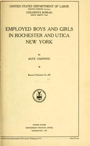


Search results from Open Library.
Recent natural events nearby
Ground air-quality sensors
Recently spotted species
Nearest stream gauge
Live readings from USGS NWIS · measured 2026-06-13 14:30 UTC.
Events
Notable, recurring, and historical events associated with Utica, sourced from Wikidata.
- Sep 20, 2024
Source: Wikidata (CC0).
Gallery
Geotagged photos within ~6 miles of Utica, from Wikimedia Commons contributors.
 0.2 mi
 0.3 mi
 0.3 mi
 0.3 mi
 0.3 mi
 0.3 mi
 0.3 mi
 0.3 mi
 0.3 mi
 0.3 mi
 0.3 mi
 0.3 mi
 0.3 mi
 0.3 mi
 0.3 mi
 0.3 mi
 0.3 mi
 0.3 mi
 0.4 mi
 0.4 mi
 0.4 mi
 0.4 mi
 0.4 mi
 0.4 mi
Photos via Wikimedia Commons — see each image page for license & attribution.
Sources
- • Wikipedia
- • US Census Bureau (ACS 5-year estimates)
- • NOAA National Weather Service
- • Wikimedia Commons
- • Wikidata
- • USGS Earthquake Catalog (global feed)
- • USGS NWIS (water data)
- • NCES via Urban Institute Education Data Portal
- • GBIF (Global Biodiversity Information Facility)
- • CDC PLACES
- • Open-Meteo / sunrise-sunset.org
- • Wikipedia Pageviews API
- • Open Library