Browse / United States / Ohio / Cuyahoga Falls
Cuyahoga Falls
Ohiocity

Cuyahoga Falls
Total population
50,909
Median home value
$183,300
Bachelor's+
Median income
$72,705
Demographic figures from US Census Bureau · ACS 5-year estimates. Overview below cites Wikipedia and may reference a different year.
- Freeze Watch · SevereFreeze Watch issued October 16 at 12:36PM EDT until October 18 at 9:00AM EDT by NWS Cleveland OH
Source: NOAA National Weather Service.
City facts
Overview
Cuyahoga Falls is a city in Summit County, Ohio, United States. The population was 51,114 at the 2020 census. The second-largest city in Summit County, it is located directly north of Akron and is a suburb in the Akron metropolitan area. The city was founded in 1812 by William Wetmore and was originally named Manchester, but renamed for the Cuyahoga River and the series of waterfalls that run along the southern boundary of the city.
Read more on WikipediaHistory & geography
History
Cuyahoga Falls was formed in 1812 near the junction of what was then Northampton, Stow, Tallmadge, and Portage townships. The focus was the series of Cuyahoga River waterfalls that provided power for manufacturing. In 1812, Kelsey and Wilcox built a dam on the Cuyahoga River at a place where a railroad bridge crossed it in 1876. They then built a flour mill, an oil mill, and a saw mill. This led to the construction of a number of houses. This area was known as the old village. Development moved downstream, though, when the power was discovered to be better there. The old village was eventually destroyed in 1826, when a dam built by William Wetmore flooded the dam at the old village and its mills were torn down. The earliest settlers of Cuyahoga Falls included Joshua Stow and William Wetmore. In 1815, a saw mill was operating near Gaylord's Grove, using power generated by a dam on the Cuyahoga River there. The town was initially called Manchester, but was renamed Cuyahoga Falls at the request of the Post Office since several other Manchesters were already in Ohio. The village proper was first laid out in 1826 by Judge Richardson. On July 31, 1940, the Doodlebug Disaster train wreck killed 43 people, the worst disaster in the history of the city. In 1985, a referendum of merger between the city and neighboring Northampton Township was approved by local voters. In 1986, Cuyahoga Falls merged with Northampton Township, the first merger of a city and township in Ohio. Cuyahoga Falls had been founded as an industrial city, taking advantage of the river power. By the middle of the twentieth century, it had become largely residential. Don Robart, mayor from 1986 to 2013, promoted the merger with Northampton Township because of the additional land that could be used for…
Geography
According to the United States Census Bureau, the city has an area of , of which is land and is water. Cuyahoga Falls is bordered by Akron to the south and the Cuyahoga Valley National Park to the northwest.
Excerpted from the corresponding Wikipedia article (CC BY-SA).
Demographics & economy
Race & ethnicity
Source: US Census Bureau — American Community Survey, 5-year estimates.
Geography
Coordinates & boundaries from the US Census TIGER/Line shapefiles.
Climate
Current forecast
Forecast for Cuyahoga Falls, OH from NOAA NWS API.
Air quality
Industrial & pollution facilities
Natural hazard risk
Health (adults)
Walkability
Amenities nearby
Wildlife & biodiversity
Most-observed species
- Northern CardinalCardinalis cardinalis (Linnaeus, 1758) · Aves40,579
- Blue JayCyanocitta cristata (Linnaeus, 1758) · Aves36,160
- American RobinTurdus migratorius Linnaeus, 1766 · Aves34,044
- Black-capped ChickadeePoecile atricapillus (Linnaeus, 1766) · Aves31,214
- Red-bellied WoodpeckerMelanerpes carolinus (Linnaeus, 1758) · Aves27,602
- Tufted TitmouseBaeolophus bicolor (Linnaeus, 1766) · Aves26,979
- American GoldfinchSpinus tristis (Linnaeus, 1758) · Aves26,114
- American CrowCorvus brachyrhynchos C.L.Brehm, 1822 · Aves25,602
Citizen-science & research observations from the Global Biodiversity Information Facility (GBIF).
Schools
Earthquake history
Most recent
- M 2.9 — 2026-03-053 km SW of Madison, Ohio
- M 2.7 — 2026-01-064 km ENE of North Madison, Ohio
- M 2.5 — 2025-05-124 km ESE of Madison, Ohio
- M 2.6 — 2024-06-011 km E of Madison, Ohio
- M 3 — 2024-03-302 km SSW of Maple Ridge, Ohio
- M 2.6 — 2024-01-053 km SE of Madison, Ohio
Events from the USGS Earthquake Catalog (global) (FDSN Event Web Service).
Photos
Sights & places nearby
Notable people from here


People born within ~10 km, from Wikidata (CC0). Click any name for their Wikipedia article.
Geography & sun
Elevation, sunrise/sunset and daylight from Open-Meteo. Solar climatology from NASA POWER.
Nearby airports
Public attention
Pageview totals from the Wikimedia Pageviews API.
Books about Cuyahoga Falls



Search results from Open Library.
Recent natural events nearby
Ground air-quality sensors
Recently spotted species







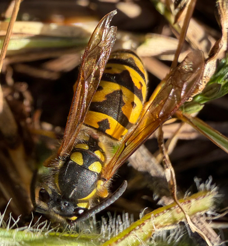

Research-grade observations from iNaturalist (within ~15 mi).
Nearest stream gauge
Live readings from USGS NWIS · measured 2026-10-16 17:15 UTC.
Events
Gallery
Sources
- • Wikipedia
- • US Census Bureau (ACS 5-year estimates)
- • NOAA National Weather Service
- • Wikidata
- • USGS Earthquake Catalog (global feed)
- • USGS NWIS (water data)
- • GBIF (Global Biodiversity Information Facility)
- • iNaturalist
- • Open-Meteo / sunrise-sunset.org
- • Wikipedia Pageviews API
- • Open Library