Browse / United States / Ohio / Elyria
Elyria
Ohiocity

Elyria
Total population
53,035
Median home value
$156,100
Bachelor's+
Median income
$54,945
Founded
1817
Demographic figures from US Census Bureau · ACS 5-year estimates. Overview below cites Wikipedia and may reference a different year.
- Freeze Watch · SevereFreeze Watch issued October 16 at 12:36PM EDT until October 18 at 9:00AM EDT by NWS Cleveland OH
Source: NOAA National Weather Service.
City facts
Facts from Wikidata (CC0).
Overview
Elyria is a city in Lorain County, Ohio, United States, and its county seat. The city is at the forks of the Black River in Northeast Ohio. The population was 52,656 at the 2020 census. Located 23 miles (37 km) southwest of Cleveland, it is part of the Cleveland metropolitan area and home to Lorain County Community College.
Read more on WikipediaHistory & geography
History
The village of Elyria was founded in 1817 by Heman Ely, who built a log house, dam, gristmill, and sawmill on the village's site along the Black River. Ely began to build more houses to accommodate European-American settlers migrating to what was, at that time, within Huron County, Ohio. By the turn of the 20th century, Elyria was a town of about 8,000. In 1908, Elyria Memorial Hospital was built. In the first half of the 20th century, the town developed some manufacturing, as well as a range of retail businesses. In August 1967, Midway Mall was opened. It changed the local economy by attracting local businesses from the town center or causing so much competition they went out of business. Industrial restructuring meant that good jobs left the area, and poverty increased. Three major car plant closings in the area led to economic stagnation and joblessness in the 1970s and 1980s that affected numerous communities. The region was nicknamed "the Rustbelt", suggesting the decline of its former industries. In the 1990s, Elyria experienced a minor revival with construction of some new roads and housing. It serves as a residential, suburban "bedroom community" for Cleveland, where new businesses and industries are developing with an increase in new jobs. In the 2000s and 2010s, companies like Bendix and 3M moved their operations elsewhere. To prepare for this, voters passed Issue 6 in March 2016. Issue 6 increased the city's income tax by 0.5%. It was used to pay for police, parks, and fiber-optic Internet in the city. With the reconstruction of State Route 57 on the city's northwest side by Midway Mall, traffic flow was improved.
Geography
Elyria is part of the Cleveland metropolitan area. According to the United States Census Bureau, the city has a total area of , of which is land and is water. The Black River flows through Elyria.
Excerpted from the corresponding Wikipedia article (CC BY-SA).
Demographics & economy
Race & ethnicity
Source: US Census Bureau — American Community Survey, 5-year estimates.
Geography
Coordinates & boundaries from the US Census TIGER/Line shapefiles.
Climate
Current forecast
Forecast for Elyria, OH from NOAA NWS API.
Air quality
Industrial & pollution facilities
Natural hazard risk
Health (adults)
Age-adjusted prevalence estimates from CDC PLACES (latest release).
Walkability
Amenities nearby
Wildlife & biodiversity
Most-observed species
- Northern CardinalCardinalis cardinalis (Linnaeus, 1758) · Aves29,137
- American RobinTurdus migratorius Linnaeus, 1766 · Aves27,739
- Blue JayCyanocitta cristata (Linnaeus, 1758) · Aves26,904
- Canada Goose (canadensis Group)Branta canadensis (Linnaeus, 1758) · Aves25,238
- American GoldfinchSpinus tristis (Linnaeus, 1758) · Aves22,498
- Red-winged BlackbirdAgelaius phoeniceus (Linnaeus, 1766) · Aves22,303
- MallardAnas platyrhynchos Linnaeus, 1758 · Aves21,542
- House SparrowPasser domesticus (Linnaeus, 1758) · Aves21,326
Citizen-science & research observations from the Global Biodiversity Information Facility (GBIF).
Schools
Largest nearby schools
- North Ridgeville Academic CenterMiddle · North Ridgeville · 1,878 students · 20.9:1 ratio
- Lorain High SchoolHigh · Lorain · 1,722 students · 18.1:1 ratio
- Elyria High SchoolHigh · Elyria · 1,639 students · 17.3:1 ratio
- Avon High SchoolHigh · Avon · 1,456 students · 23.9:1 ratio
- North Ridgeville High SchoolHigh · North Ridgeville · 1,268 students · 20.5:1 ratio
- William R BurtonHigh · Oberlin · 1,239 students · 8.5:1 ratio
- Powers Elementary SchoolElementary · Amherst · 1,123 students · 21.2:1 ratio
- Avon Middle SchoolMiddle · Avon · 1,084 students · 21.3:1 ratio
Public K–12 schools within ~10 mi from Urban Institute Education Data Portal (NCES Common Core of Data, 2022).
Earthquake history
Most recent
- M 2.9 — 2026-03-053 km SW of Madison, Ohio
- M 2.6 — 2024-01-053 km SE of Madison, Ohio
- M 2.5 — 2022-01-272 km NW of Lakeline, Ohio
- M 2.8 — 2022-01-043 km NW of Timberlake, Ohio
- M 2.6 — 2019-12-071 km N of Willowick, Ohio
- M 2.6 — 2019-10-154 km S of Madison, Ohio
Events from the USGS Earthquake Catalog (global) (FDSN Event Web Service).
Photos
Sights & places nearby
Notable people from here


People born within ~10 km, from Wikidata (CC0). Click any name for their Wikipedia article.
Nearby places in Ohio
Geography & sun
Elevation, sunrise/sunset and daylight from Open-Meteo. Solar climatology from NASA POWER.
Nearby airports
Public attention
Pageview totals from the Wikimedia Pageviews API.
Books about Elyria
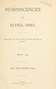
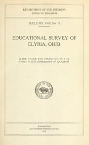
Search results from Open Library.
Recent natural events nearby
Ground air-quality sensors
Recently spotted species
Nearest stream gauge
Events
Gallery
Sources
- • Wikipedia
- • US Census Bureau (ACS 5-year estimates)
- • NOAA National Weather Service
- • Wikidata
- • USGS Earthquake Catalog (global feed)
- • NCES via Urban Institute Education Data Portal
- • GBIF (Global Biodiversity Information Facility)
- • CDC PLACES
- • Open-Meteo / sunrise-sunset.org
- • Wikipedia Pageviews API
- • Open Library