Browse / United States / Ohio / Englewood
Englewood
Ohiocity

Englewood
Total population
13,356
Median home value
$182,800
Bachelor's+
Median income
$80,030
Founded
1841
Demographic figures from US Census Bureau · ACS 5-year estimates. Overview below cites Wikipedia and may reference a different year.
- Freeze Watch · SevereFreeze Watch issued October 16 at 1:30PM EDT until October 18 at 9:00AM EDT by NWS Wilmington OH
Source: NOAA National Weather Service.
City facts
Sister cities
Facts from Wikidata (CC0).
Overview
Englewood is a city in Montgomery County, Ohio, United States. The population was 13,463 at the 2020 census. A northern suburb of Dayton, it is part of the Dayton metropolitan area.
Read more on WikipediaHistory & geography
History
Although Englewood was not actually founded until 1841, many early settlers began to come to the area known as Randolph Township around 1800. Earliest settlers were the families of David Hoover, David Mast, Daniel Hoover, Robert Ewing, John and Abraham McClintock, John Rench, Martin Sheets, Jacob Smith, Daniel and Peter Fetters. Also among the early settlers were the families of the Ellers, Fouts, Frantzs, Wertzs and the Brumbaughs. The early settlers made their living basically from agriculture. They shipped grain and bacon down the Stillwater River on flat bottom boats to Dayton and as far south as New Orleans. There was also a considerable amount of industry, including saw mills, gun smithing, wine distilling and pottery manufacturing. There were many Native Americans in the area in the early days that traded with the settlers. There was also an abundance of wildlife which afforded good hunting for the settlers’ food requirements. Following primarily the path traced through this area by the Stillwater River, a group of settlers founded what is now the City of Englewood on May 6, 1841. These pioneers included Mathias Gish, Daniel Rasor and Samuel Herr. Some of these settlers came from the area around Harrisburg, Pennsylvania, and thus named the community Harrisburg. Other residents came from Randolph County, North Carolina, and named this township accordingly. Harrisburg's first post office was opened on February 8, 1870, and discontinued on February 6, 1871. The post office was re-established on May 8, 1874, and the first postmaster was Harvey Iams. The town was then renamed Iamton. However, at that time the capital letters I and J were the same in the alphabet and the town became known as Jamton. In 1898, the local businessmen conducted a contest to choose a…
Geography
The city is situated along the Stillwater River, bordering the cities of Clayton, Union, and Butler Township. Interstate 70 and the National Road (U.S. Route 40) intersect Ohio State Route 48 within Englewood's boundaries. According to the United States Census Bureau, the city has a total area of , of which is land and is water.
Excerpted from the corresponding Wikipedia article (CC BY-SA).
Demographics & economy
Race & ethnicity
Source: US Census Bureau — American Community Survey, 5-year estimates.
Geography
Coordinates & boundaries from the US Census TIGER/Line shapefiles.
Climate
Current forecast
Forecast for Englewood, OH from NOAA NWS API.
Air quality
Industrial & pollution facilities
Natural hazard risk
Health (adults)
Age-adjusted prevalence estimates from CDC PLACES (latest release).
Walkability
Amenities nearby
Wildlife & biodiversity
Most-observed species
- Northern CardinalCardinalis cardinalis (Linnaeus, 1758) · Aves14,765
- American RobinTurdus migratorius Linnaeus, 1766 · Aves14,197
- Carolina ChickadeePoecile carolinensis (Audubon, 1834) · Aves10,402
- Mourning DoveZenaida macroura (Linnaeus, 1758) · Aves9,869
- MallardAnas platyrhynchos Linnaeus, 1758 · Aves9,159
- Red-bellied WoodpeckerMelanerpes carolinus (Linnaeus, 1758) · Aves8,921
- Song SparrowMelospiza melodia (A.Wilson, 1810) · Aves8,867
- European StarlingSturnus vulgaris Linnaeus, 1758 · Aves8,693
Citizen-science & research observations from the Global Biodiversity Information Facility (GBIF).
Schools
Largest nearby schools
- Wayne High SchoolHigh · Huber Heights · 1,743 students · 19.8:1 ratio
- Miami Valley CtcHigh · Englewood · 1,647 students
- Northmont High SchoolHigh · Clayton · 1,392 students · 16.6:1 ratio
- Weisenborn Junior HighMiddle · Huber Heights · 937 students · 20.4:1 ratio
- DECA PREPElementary · Dayton · 928 students · 14.5:1 ratio
- Butler High SchoolHigh · Vandalia · 860 students · 21.5:1 ratio
- Kleptz Early Childhood Learning CenterElementary · Clayton · 833 students · 20.8:1 ratio
- Pathway School of DiscoveryElementary · Dayton · 784 students
Public K–12 schools within ~10 mi from Urban Institute Education Data Portal (NCES Common Core of Data, 2022).
Earthquake history
Most recent
- M 2.5 — 2026-02-222 km NE of Hillsboro, Ohio
- M 2.9 — 2023-12-095 km W of Jackson Center, Ohio
- M 2.8 — 2008-09-305 km SW of Kettlersville, Ohio
- M 2.5 — 2006-08-153 km NE of Fort Shawnee, Ohio
- M 2.8 — 2006-05-122 km E of Lima, Ohio
- M 2.5 — 2004-01-302 km S of Rockford, Ohio
Events from the USGS Earthquake Catalog (global) (FDSN Event Web Service).
Photos
Sights & places nearby
Notable people from here


People born within ~10 km, from Wikidata (CC0). Click any name for their Wikipedia article.
Nearby places in Ohio
Geography & sun
Elevation, sunrise/sunset and daylight from Open-Meteo. Solar climatology from NASA POWER.
Nearby airports
Public attention
Pageview totals from the Wikimedia Pageviews API.
Books about Englewood
Search results from Open Library.
Recent natural events nearby
Ground air-quality sensors
Recently spotted species


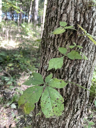
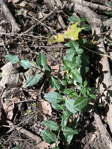





Research-grade observations from iNaturalist (within ~15 mi).
Nearest stream gauge
Events
Gallery
Sources
- • Wikipedia
- • US Census Bureau (ACS 5-year estimates)
- • NOAA National Weather Service
- • Wikidata
- • USGS Earthquake Catalog (global feed)
- • NCES via Urban Institute Education Data Portal
- • GBIF (Global Biodiversity Information Facility)
- • iNaturalist
- • CDC PLACES
- • Open-Meteo / sunrise-sunset.org
- • Wikipedia Pageviews API
- • Open Library