Browse / United States / Oklahoma / Colony
Colony
Oklahomatown

Colony
Total population
104
Demographic figures from US Census Bureau · ACS 5-year estimates. Overview below cites Wikipedia and may reference a different year.
City facts
Facts from Wikidata (CC0).
Overview
Colony is a town in northeastern Washita County, Oklahoma, United States. As of the 2020 census, Colony had a population of 112. It was named for the Seger Colony, founded in 1886, which taught modern agricultural techniques to the Arapaho and Cheyenne tribes that would be resettled in the vicinity. Colony is 16 miles (26 km) east and 4 miles (6.4 km) north of Cordell.
Read more on WikipediaHistory & geography
History
John Seger, a native of Ohio and a Union veteran of the Civil War, was hired in 1872 to work as a mason/carpenter to build housing and other structures for a school for Native American children at the Darlington Agency. Later, he began a colony for Native Americans with Arapaho Indians, who were joined later by several Cheyennes. By the following year, Seger's colony had over 500 inhabitants. Seger began teaching modern agricultural methods as well as brick-making. By 1892, the colony had also built an industrial arts school, with the Native Americans providing the bricks and cutting stone for all the buildings. William De Lestinier opened a store near the school with government permission, even before the Land Run of 1892. After the opening, a group of settlers, led by Zack King, created a townsite west of the school and obtained a post office named Seger. De Lestinier moved his store to the new site. In 1895, the Dutch Reformed Church founded a mission at the colony. In 1896, a new post office named Colony opened, and the town took that name. The colony continued to grow and had an estimated population of 300 by 1911. The Dutch Reformed mission closed in 1912 and the Seger Indian school closed in 1932.
Geography
Colony is located in Seger Township (T10N R14W), Washita County, Oklahoma. According to the United States Census Bureau, the town has a total area of , all land.
Excerpted from the corresponding Wikipedia article (CC BY-SA).
Demographics & economy
Geography
Coordinates & boundaries from the US Census TIGER/Line shapefiles.
Climate
Current forecast
Forecast for Colony, OK from NOAA NWS API.
Air quality
Industrial & pollution facilities
Natural hazard risk
Health (adults)
Walkability
Amenities nearby
Wildlife & biodiversity
Schools
Earthquake history
Photos
Sights & places nearby
Notable people from here

People born within ~10 km, from Wikidata (CC0). Click any name for their Wikipedia article.
Nearby places in Oklahoma
Geography & sun
Elevation, sunrise/sunset and daylight from Open-Meteo. Solar climatology from NASA POWER.
Nearby airports
Public attention
Pageview totals from the Wikimedia Pageviews API.
Books about Colony

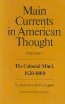
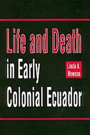
Search results from Open Library.
Recent natural events nearby
Ground air-quality sensors
Recently spotted species
Nearest stream gauge
Events
Gallery
Sources
- • Wikipedia
- • NOAA National Weather Service
- • Wikidata
- • Open-Meteo / sunrise-sunset.org
- • Wikipedia Pageviews API
- • Open Library