Browse / United States / Oklahoma / Oaks
Oaks
Oklahomatown
Total population
295
Median home value
$59,700
Bachelor's+
Median income
$46,875
Founded
1881
Demographic figures from US Census Bureau · ACS 5-year estimates. Overview below cites Wikipedia and may reference a different year.
City facts
Facts from Wikidata (CC0).
Overview
Oaks is a town in Cherokee and Delaware counties in the U.S. state of Oklahoma. As of the 2020 census, Oaks had a population of 267.
Read more on WikipediaHistory & geography
History
In 1842, the Moravian Brethren began a new mission which they named New Springplace. It was intended to replace their former mission in Georgia, which they had abandoned after the Cherokees had been forced to emigrate to Indian Territory. The mission operated in its new location until after the outbreak of the American Civil War. In 1862, a group of Union troops and Pin Indians killed James Ward, a Cherokee missionary. They abducted Ward's wife and twin infant sons, though they released them about from the mission. The mission was abandoned for the remainder of the war. The Moravians resumed their mission work in October 1866. After reassessing their activities, the church abandoned its work among the Cherokees, asking Niels Nielsen, a minister of the Evangelical Danish Lutheran Church, to help the New Springplace congregation. Nielsen took over the facilities in 1902 and dropped the Springplace name. George Miller opened a post office named Oaks on July 18, 1881. A plat for the town was filed on December 10, 1906. All of the land was owned by William Israel, subject to allotment by the Cherokees. Rev. Christian Adolphus Vammen, with his family, succeeded Nielsen in 1924 and two years later began a children's home, Oaks Indian Mission. The mission still operates at present.
Geography
Oaks is located in southern Delaware County. A small portion of the town extends south into Cherokee County. It is southwest of the town of Kansas and north of Tahlequah, the Cherokee County seat. According to the United States Census Bureau, the town of Oaks has a total area of , all land. Spring Creek passes through the community.
Excerpted from the corresponding Wikipedia article (CC BY-SA).
Demographics & economy
Race & ethnicity
Source: US Census Bureau — American Community Survey, 5-year estimates.
Geography
Coordinates & boundaries from the US Census TIGER/Line shapefiles.
Climate
Air quality
Industrial & pollution facilities
Natural hazard risk
Health (adults)
Age-adjusted prevalence estimates from CDC PLACES (latest release).
Walkability
Amenities nearby
Wildlife & biodiversity
Schools
Largest nearby schools
- KANSAS ESElementary · Kansas · 345 students · 13.8:1 ratio
- KANSAS HSHigh · Kansas · 273 students · 13:1 ratio
- KANSAS MSMiddle · Kansas · 173 students · 14.4:1 ratio
- LEACH PUBLIC SCHOOLElementary · Rose · 173 students · 19.2:1 ratio
- OAKS-MISSION HSHigh · Oaks · 81 students · 81:1 ratio
- OAKS-MISSION ESElementary · Oaks · 79 students · 11.3:1 ratio
Public K–12 schools within ~10 mi from Urban Institute Education Data Portal (NCES Common Core of Data, 2022).
Earthquake history
Photos
Sights & places nearby
Notable people from here
Nearby places in Oklahoma
Geography & sun
Elevation, sunrise/sunset and daylight from Open-Meteo. Solar climatology from NASA POWER.
Nearby airports
Public attention
Pageview totals from the Wikimedia Pageviews API.
Books about Oaks


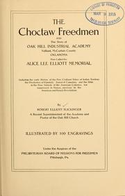
Search results from Open Library.
Recent natural events nearby
Ground air-quality sensors
Recently spotted species
Nearest stream gauge
Events
Gallery
Sources
- • Wikipedia
- • US Census Bureau (ACS 5-year estimates)
- • Wikidata
- • NCES via Urban Institute Education Data Portal
- • CDC PLACES
- • Open-Meteo / sunrise-sunset.org
- • Wikipedia Pageviews API
- • Open Library