Browse / United States / Oregon / Eugene
Eugene
Oregoncity

Eugene
Total population
178,789
Median home value
$471,000
Bachelor's+
Median income
$70,781
Founded
1846
Air quality index
Demographic figures from US Census Bureau · ACS 5-year estimates. Overview below cites Wikipedia and may reference a different year.
City facts
Facts from Wikidata (CC0).
Overview
Eugene is a city in and the county seat of Lane County, Oregon, United States. It is located at the southern end of the Willamette Valley, near the confluence of the McKenzie and Willamette rivers, about 50 miles (80 km) east of the Oregon Coast and approximately 110 miles south of Portland.
Read more on WikipediaHistory & geography
History
The first people to settle in the Eugene area were the Chifin band of the Kalapuyans, also written Calapooia or Calapooya. They made "seasonal rounds", moving around the countryside to collect and preserve local foods, including acorns, the bulbs of the wapato and camas plants, and berries. They stored these foods in their permanent winter village. When crop activities waned, they returned to their winter villages and took up hunting, fishing, and trading. They were known as the Chifin Kalapuyans and called the Eugene area where they lived "Chifin", sometimes recorded as "Chafin" or "Chiffin". Other Kalapuyan tribes occupied villages that are also now within Eugene city limits. Pee-you or Mohawk Calapooians, Winefelly or Pleasant Hill Calapooians, and the Lungtum or Long Tom. They were close-neighbors to the Chifin, intermarried, and were political allies. Some authorities suggest the Brownsville Kalapuyans (Calapooia Kalapuyans) were related to the Pee-you. It is likely that since the Santiam had an alliance with the Brownsville Kalapuyans that the Santiam influence also went as far at Eugene. According to archeological evidence, the ancestors of the Kalapuyans may have been in Eugene for as long as 10,000 years. In the 1800s their traditional way of life faced significant changes due to devastating epidemics and settlement, first by French fur traders and later by an overwhelming number of European settlers. Some sources also stated that their number started to decline in the nineteenth century due to diseases such as Small pox and Malaria. In July 1830, "intermittent fever" struck the lower Columbia region and a year later, the Willamette Valley. Natives traced the arrival of the disease, then new to the Pacific Northwest, to the USS Owyhee, captained by John…
Geography
According to the United States Census Bureau, the city has a total area of , of which is land and is water. Eugene is at an elevation of . To the north of downtown are Gillespie Butte and Skinner Butte. Northeast of the city are the Coburg Hills. Spencer Butte is a prominent landmark south of the city. Mount Pisgah is southeast of Eugene and includes the Mount Pisgah Arboretum and the Howard Buford Recreation Area, a Lane County Park. Eugene is surrounded by foothills and forests to the south, east, and west, while to the north the land levels out into the Willamette Valley and consists of mostly farmland. The Willamette and McKenzie Rivers run through Eugene and its neighboring city, Springfield. Another important stream is Amazon Creek, whose headwaters are near Spencer Butte. The creek discharges into the Long Tom River north Fern Ridge Reservoir, maintained for winter flood control by the Army Corps of Engineers. The Eugene Yacht Club hosts a sailing school and sailing regattas at Fern Ridge during summer months. Eugene has 23 neighborhoods: * Bethel * Amazon * Cal Young * Churchill * Downtown * Fairmount * Far West * Friendly * Goodpasture Island * Harlow * Industrial Corridor * Jefferson Westside * Laurel Hill * Northeast * River Road * Santa Clara * Southeast * South University * Southwest Hills * Trainsong * West Eugene * West University * Whiteaker The River Road and Santa Clara communities, which make up the northwestern part of the city, are neighborhoods within the urban growth boundary of Eugene. However, they are mostly outside of the city limits. Like the rest of the Willamette Valley, Eugene lies in the Marine West Coast climate zone, with Mediterranean characteristics. Under the Köppen climate classification scheme, Eugene has a warm-summer…
Excerpted from the corresponding Wikipedia article (CC BY-SA).
Demographics & economy
Race & ethnicity
Source: US Census Bureau — American Community Survey, 5-year estimates.
Geography
Coordinates & boundaries from the US Census TIGER/Line shapefiles.
Climate
Current forecast
Forecast for Eugene, OR from NOAA NWS API.
Air quality
Current readings from Open-Meteo Air Quality API (Copernicus CAMS European reanalysis).
Industrial & pollution facilities
Natural hazard risk
Health (adults)
Age-adjusted prevalence estimates from CDC PLACES (latest release).
Walkability
Amenities nearby
Wildlife & biodiversity
Most-observed species
- American CrowCorvus brachyrhynchos C.L.Brehm, 1822 · Aves37,981
- Black-capped ChickadeePoecile atricapillus (Linnaeus, 1766) · Aves35,147
- California/Woodhouse's Scrub-JayAphelocoma californica (Vigors, 1839) · Aves34,633
- Spotted TowheePipilo maculatus Swainson, 1827 · Aves30,462
- Song SparrowMelospiza melodia (A.Wilson, 1810) · Aves30,223
- Anna's HummingbirdCalypte anna (R.Lesson, 1829) · Aves30,019
- American RobinTurdus migratorius Linnaeus, 1766 · Aves29,955
- Dark-eyed JuncoJunco hyemalis (Linnaeus, 1758) · Aves27,273
Citizen-science & research observations from the Global Biodiversity Information Facility (GBIF).
Schools
Largest nearby schools
- Sheldon High SchoolHigh · Eugene · 1,525 students
- Willamette High SchoolHigh · Eugene · 1,516 students · 20.5:1 ratio
- South Eugene High SchoolHigh · Eugene · 1,505 students
- Springfield High SchoolHigh · Springfield · 1,317 students · 21.6:1 ratio
- Thurston High SchoolHigh · Springfield · 1,277 students · 23.2:1 ratio
- Churchill High SchoolHigh · Eugene · 1,082 students
- North Eugene High SchoolHigh · Eugene · 1,071 students
- Meadow View SchoolElementary · Eugene · 657 students · 18.3:1 ratio
Public K–12 schools within ~10 mi from Urban Institute Education Data Portal (NCES Common Core of Data, 2022).
Earthquake history
Most recent
- M 4.39 — 2022-10-0716 km ESE of Lacomb, Oregon
- M 2.61 — 2022-03-1816 km ESE of Lacomb, Oregon
- M 2.82 — 2021-07-232 km W of Mehama, Oregon
- M 2.77 — 2017-09-2613 km ESE of Yachats, Oregon
- M 2.52 — 2017-07-114 km ESE of Cascadia, Oregon
- M 4.14 — 2015-07-0416 km ENE of Springfield, Oregon
Events from the USGS Earthquake Catalog (global) (FDSN Event Web Service).
Photos
Sights & places nearby
Notable people from here


People born within ~10 km, from Wikidata (CC0). Click any name for their Wikipedia article.
Nearby places in Oregon
Geography & sun
Elevation, sunrise/sunset and daylight from Open-Meteo. Solar climatology from NASA POWER.
Nearby airports
Public attention
Pageview totals from the Wikimedia Pageviews API.
Books about Eugene




Search results from Open Library.
Recent natural events nearby
- Wildfire Austin Non-Stat, Clackamas, OregonWildfires · 2026-08-12 · 88 mi
- Wildfire AUSTIN, Clackamas, OregonWildfires · 2026-08-09 · 88 mi
- Wildfire Fielder Mtn, Jackson, OregonWildfires · 2026-08-13 · 113 mi
- Wildfire Wrights Spring, Klamath, OregonWildfires · 2026-08-05 · 130 mi
- Wildfire Picture Rock, Lake, OregonWildfires · 2026-08-16 · 138 mi
- Wildfire Ruggs, Morrow, OregonWildfires · 2026-08-31 · 188 mi
- Wildfire COTTONWOOD, Grant, OregonWildfires · 2026-08-06 · 189 mi
- Prescribed Fire SRF 2026 Rx Implementation, Humboldt, CaliforniaWildfires · 2026-10-12 · 192 mi
Wildfires, storms and other events from NASA EONET (last 12 months, within 250 mi).
Ground air-quality sensors
Recently spotted species
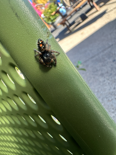
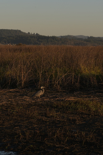
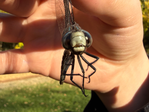
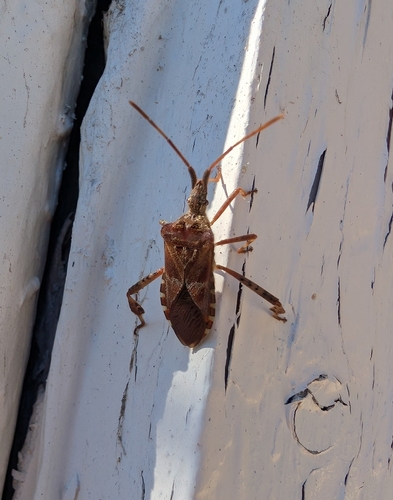
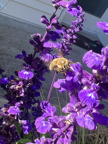
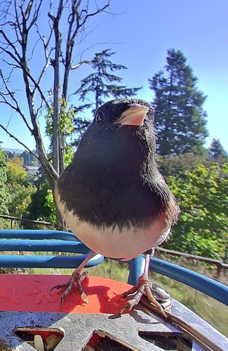
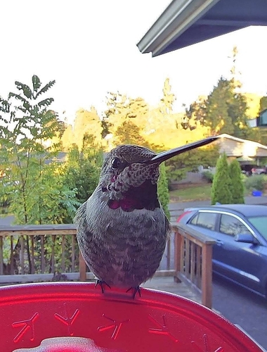
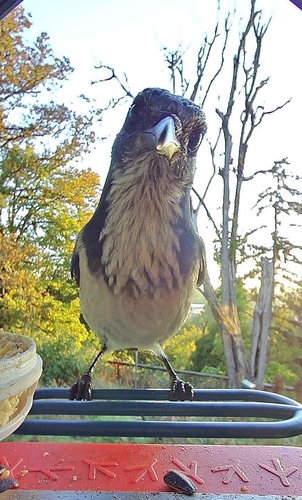
Research-grade observations from iNaturalist (within ~15 mi).
Nearest stream gauge
Events
Notable, recurring, and historical events associated with Eugene, sourced from Wikidata.
- 2022 World Athletics Championships – Women's 800 metresJul 24, 2022sporting event
- 2022 World Athletics Championships – Men's 5000 metresJul 24, 2022sporting event
- 2022 World Athletics Championships – Women's 4 × 400 metres relayJul 24, 2022sporting event
women's athletic competition
- 2022 World Athletics Championships – men's decathlonJul 23, 2022sporting event
- Jul 22, 2022
- Jul 22, 2022
- 2022 World Athletics Championships – Women's marathonJul 18, 2022sporting event
- Jul 1, 2022
- 2022 World Athletics Championships – women's heptathlonJul 1, 2022sporting event
- 2022 World Athletics Championships – Men's 400 metresJul 1, 2022sporting event
- 2022 World Athletics Championships – men's 200 metresJul 1, 2022sporting event
- 2022 World Athletics Championships – Men's 1500 metresJul 1, 2022sporting event
- 2022 World Athletics Championships – women's 1500 metresJul 1, 2022sporting event
- 2022 World Athletics Championships – Men's 800 metresJul 1, 2022sporting event
- 2022 World Athletics Championships – Men's 10,000 metresJul 1, 2022sporting event
- Jul 1, 2022
- Jul 1, 2022
- 2022 World Athletics Championships – Men's pole vaultJul 1, 2022sporting event
- 2022 World Athletics Championships – Men's long jumpJul 1, 2022sporting event
- 2022 World Athletics Championships – Men's triple jumpJul 1, 2022sporting event
Source: Wikidata (CC0).
Gallery
Sources
- • Wikipedia
- • US Census Bureau (ACS 5-year estimates)
- • NOAA National Weather Service
- • Wikidata
- • Open-Meteo Air Quality (CAMS)
- • USGS Earthquake Catalog (global feed)
- • NCES via Urban Institute Education Data Portal
- • GBIF (Global Biodiversity Information Facility)
- • iNaturalist
- • CDC PLACES
- • Open-Meteo / sunrise-sunset.org
- • Wikipedia Pageviews API
- • Open Library
- • NASA EONET