Browse / United States / Oregon / Lincoln City
Lincoln City
Oregoncity

Lincoln City
Total population
9,968
Median home value
$412,700
Bachelor's+
Median income
$56,635
Founded
1965
Demographic figures from US Census Bureau · ACS 5-year estimates. Overview below cites Wikipedia and may reference a different year.
City facts
Facts from Wikidata (CC0).
Overview
Lincoln City is a city in Lincoln County on the Oregon Coast of the United States, between Tillamook to the north and Newport to the south. It is named after the county, which was named in honor of former U.S. President Abraham Lincoln. The population was at 9,815 in the 2020 Census.
Read more on WikipediaHistory & geography
History
Lincoln City was incorporated on March 3, 1965, uniting the cities of Oceanlake and Taft, and the unincorporated communities of Cutler City and Nelscott. These were adjacent communities along U.S. Route 101, which serves as Lincoln City's main street. The name "Lincoln City" was chosen from contest entries submitted by local school children. The contest was held when it was determined that using one of the five communities' names would be too controversial. Cutler City is located on the east shore of Siletz Bay. The community was started by Mr. and Mrs. George Cutler. It is claimed they received the property from Chief Charles "Charley" DePoe of the Siletz tribe (part of the present-day Confederated Tribes of the Siletz). Cutler City post office ran from 1930 until the formation of Lincoln City. Delake is near Devils Lake, and was named for the way the local Finnish people pronounced the name of the lake. Delake post office was established in 1924, and reestablished as Oceanlake (see below) in 1927. Oceanlake was named for its position between Devils Lake and the Pacific Ocean. Its post office ran from 1927 until incorporation as Lincoln City. The neighborhood is home to Oceanlake Elementary School. Taft was named for the 27th U.S. president William Howard Taft. Taft post office was established in 1906, and was named when Taft was Secretary of War. The post office ran until incorporation as Lincoln City. to the north, and was incorporated on November 3, 1945. Wecoma is a Chinook jargon word meaning "sea". The post office at this locale was originally named Wecoma. On July 1, 2013, Lincoln City forcibly annexed the Roads End community to its north, by informing homeowners they would not receive water service, unless the owner consented to the annexation. The…
Geography
According to the United States Census Bureau, the city has a total area of , of which, is land and is water. Lincoln City is home to one of the world's shortest rivers, the D River, connecting Devil's Lake with the Pacific Ocean. The average low temperature in December, the coldest month, is , and in August, the warmest month, the average high is . The driest month on average is July, with December the wettest. The average annual precipitation is . The average July afternoon humidity is 75%, and the average January afternoon humidity is 84%. The record high in Lincoln City is , observed on August 2, 2017, while the record low of was observed on January 31, 1950 and December 8, 1972.
Excerpted from the corresponding Wikipedia article (CC BY-SA).
Demographics & economy
Race & ethnicity
Source: US Census Bureau — American Community Survey, 5-year estimates.
Geography
Coordinates & boundaries from the US Census TIGER/Line shapefiles.
Climate
Current forecast
Forecast for Lincoln City, OR from NOAA NWS API.
Air quality
Industrial & pollution facilities
Natural hazard risk
Health (adults)
Age-adjusted prevalence estimates from CDC PLACES (latest release).
Walkability
Amenities nearby
Wildlife & biodiversity
Schools
Largest nearby schools
- Taft High SchoolHigh · Lincoln City · 464 students · 21.1:1 ratio
- Taft Elementary SchoolElementary · Lincoln City · 453 students · 16.8:1 ratio
- Oceanlake Elementary SchoolElementary · Lincoln City · 290 students · 15.3:1 ratio
- Taft Middle SchoolMiddle · Lincoln City · 259 students · 16.2:1 ratio
- Lincoln City Career Technical High SchoolHigh · Lincoln City · 30 students · 7.5:1 ratio
Public K–12 schools within ~10 mi from Urban Institute Education Data Portal (NCES Common Core of Data, 2022).
Earthquake history
Photos
Sights & places nearby
Notable people from here
People born within ~10 km, from Wikidata (CC0). Click any name for their Wikipedia article.
Nearby places in Oregon
Geography & sun
Elevation, sunrise/sunset and daylight from Open-Meteo. Solar climatology from NASA POWER.
Nearby airports
Public attention
Pageview totals from the Wikimedia Pageviews API.
Books about Lincoln City

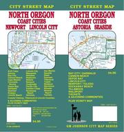

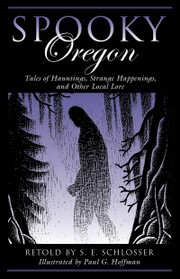
Search results from Open Library.
Recent natural events nearby
- Wildfire Austin Non-Stat, Clackamas, OregonWildfires · 2026-08-12 · 100 mi
- Wildfire AUSTIN, Clackamas, OregonWildfires · 2026-08-09 · 101 mi
- Wildfire HIGH LAVA, Skamania, WashingtonWildfires · 2026-07-23 · 111 mi
- Wildfire GRASSHOPPER, Wasco, OregonWildfires · 2026-07-23 · 123 mi
- Wildfire Beachcomb, Jefferson, OregonWildfires · 2026-07-23 · 129 mi
- Wildfire Bench, Jefferson, OregonWildfires · 2026-07-23 · 132 mi
- Wildfire 8 MILE, Wasco, OregonWildfires · 2026-07-24 · 138 mi
- Wildfire 0658 ROUND BUTTE, Jefferson, OregonWildfires · 2026-08-01 · 139 mi
Wildfires, storms and other events from NASA EONET (last 12 months, within 250 mi).
Ground air-quality sensors
Recently spotted species
Nearest stream gauge
Events
Gallery
Sources
- • Wikipedia
- • US Census Bureau (ACS 5-year estimates)
- • NOAA National Weather Service
- • Wikidata
- • NCES via Urban Institute Education Data Portal
- • CDC PLACES
- • Open-Meteo / sunrise-sunset.org
- • Wikipedia Pageviews API
- • Open Library
- • NASA EONET