Browse / United States / Pennsylvania / Catasauqua
Catasauqua
Pennsylvaniaborough

Catasauqua
Total population
6,541
Median home value
$209,900
Bachelor's+
Median income
$85,049
Founded
1768
Demographic figures from US Census Bureau · ACS 5-year estimates. Overview below cites Wikipedia and may reference a different year.
City facts
Facts from Wikidata (CC0).
Overview
Catasauqua, referred to colloquially as Catty, is a borough in Lehigh County, Pennsylvania, United States. Catasauqua's population was 6,518 at the 2020 census. It is a suburb of Allentown in the Lehigh Valley, which had a population of 861,899 and was the 68th-most populous metropolitan area in the U.S. as of the 2020 census.
Read more on WikipediaHistory & geography
History
George Taylor, signer of the Declaration of Independence, built a Georgian stone house in 1768 in what is now Catasauqua. The George Taylor House has been named a National Historic Landmark, a showpiece of the community's rich historical heritage. At the time, the area of present-day Catasaqua was referred to as Biery's Port. In 1840, the anthracite iron industry was found in Biery's Port in present-day Catasaqua, making Catasaqua a birthplace of the American Industrial Revolution. Welsh immigrant David Thomas relocated to the area and opened the Crane Iron Works. The Catasauqua and Fogelsville Railroad existed to transport ore from limonite deposits to the plant. Remembered as "the father of Catasauqua," Thomas initially named the community Craneville after his former employer in Wales. The wealthy, generous Thomases were responsible for many sweeping changes to the prosperity of the community. David Thomas founded the Presbyterian Church of Catasauqua, in which residents still worship today, and his wife Elizabeth donated money and land to found the Welsh Congregational Church, which no longer exists. Thomas organized Catasauqua's first fire company, installed its first public water system, and served as its first burgess. In 1854, the town was formally titled Catasauqua (pronounced "Cat-uh-SAW-kwuh"), derived from the Lenape language, and meaning "dry ground" or "thirsty ground." By 1900, Catasauqua boasted 5,000 residents, and had the highest percentage of self-made millionaires of any town in the United States. In 1917, while many of the young men of the town served in World War I, Catasauqua became the first community in the United States to raise $1 million in war bonds, earning it the nickname "The Million Dollar Town". Catasauqua observed its 150th…
Geography
Catasauqua is located at (40.652995, -75.467627). Nearby large communities include Allentown to the south and Bethlehem to the east. According to the U.S. Census Bureau, the borough has a total area of , of which is land and or 2.31%) is water. Catasauqua Creek flows through the town. Lehigh River runs along the southwestern edge of Catasauqua. *Hanover Township *North Catasauqua *Whitehall Township *Northampton *Allentown *Allen Township *Bethlehem *Coplay *Hokendauqua
Excerpted from the corresponding Wikipedia article (CC BY-SA).
Demographics & economy
Race & ethnicity
Source: US Census Bureau — American Community Survey, 5-year estimates.
Geography
Coordinates & boundaries from the US Census TIGER/Line shapefiles.
Climate
Current forecast
Forecast for Catasauqua, PA from NOAA NWS API.
Air quality
Industrial & pollution facilities
Natural hazard risk
Health (adults)
Walkability
Amenities nearby
Wildlife & biodiversity
Schools
Largest nearby schools
- Parkland HSHigh · Allentown · 3,220 students · 14.9:1 ratio
- William Allen HSHigh · Allentown · 2,852 students · 20.2:1 ratio
- Emmaus HSHigh · Emmaus · 2,846 students · 17.4:1 ratio
- Louis E Dieruff HSHigh · Allentown · 1,915 students · 18.1:1 ratio
- Whitehall HSHigh · Whitehall · 1,459 students · 16:1 ratio
- Executive Education Academy CSOther · Allentown · 1,368 students · 14.4:1 ratio
- Springhouse MSMiddle · Allentown · 1,344 students · 15.6:1 ratio
- Southern Lehigh SHSHigh · Center Valley · 1,056 students · 18.2:1 ratio
Public K–12 schools within ~10 mi from Urban Institute Education Data Portal (NCES Common Core of Data, 2022).
Earthquake history
Photos
Sights & places nearby
Notable people from here


People born within ~10 km, from Wikidata (CC0). Click any name for their Wikipedia article.
Nearby places in Pennsylvania
Geography & sun
Elevation, sunrise/sunset and daylight from Open-Meteo. Solar climatology from NASA POWER.
Nearby airports
Public attention
Pageview totals from the Wikimedia Pageviews API.
Books about Catasauqua


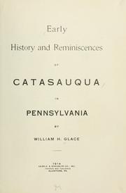
Search results from Open Library.
Recent natural events nearby
Ground air-quality sensors
Recently spotted species
Nearest stream gauge
Events
Gallery
Sources
- • Wikipedia
- • US Census Bureau (ACS 5-year estimates)
- • NOAA National Weather Service
- • Wikidata
- • NCES via Urban Institute Education Data Portal
- • Open-Meteo / sunrise-sunset.org
- • Wikipedia Pageviews API
- • Open Library