Browse / United States / Pennsylvania / Chester
Chester
Pennsylvaniacity

Chester
Total population
33,619
Median home value
$83,100
Bachelor's+
Median income
$41,342
Demographic figures from US Census Bureau · ACS 5-year estimates. Overview below cites Wikipedia and may reference a different year.
City facts
Overview
Chester is a city in Delaware County, Pennsylvania, United States. It is part of the Philadelphia metropolitan area and located on the western bank of the Delaware River between Philadelphia and Wilmington, Delaware. The population of Chester was 32,605 at the 2020 census.
Read more on WikipediaHistory & geography
History
The indigenous tribe that owned the land where Chester now stands were the Okehockings, removed by order of William Penn in 1702 to other lands in Chester County. The original indigenous name of Chester was Mecoponaca, which means "the stream along which large potatoes grow". The first European settlers in the area were members of the New Sweden colony. The settlement that became Chester was first called "Finlandia" (the Latin name for Finland) and then "Upland" after the Swedish province of Uppland. The New Sweden settlers built Fort Mecoponacka in 1641 to defend the settlement. In 1644, the present site of Chester was a tobacco plantation operated by the New Sweden colonists. By 1682, Upland was the most populous town of the new Province of Pennsylvania. On October 27, the ship Welcome arrived bearing William Penn on his first visit to the province. Penn renamed the settlement after the English city of Chester. Chester County originally stretched from the Delaware River to the Susquehanna River from its founding in 1682 until 1729 when Lancaster County was formed from the western part. Chester served as the county seat for Chester County from 1682 to 1788. In 1789, Delaware County was formed from the eastern part of Chester County, and Chester became the new county seat. The borough of Chester was governed under the charter granted by Penn in 1701 until March 5, 1795, when it was incorporated by the Pennsylvania Assembly. In the 1700s and 1800s, Chester was a hub for business due to easy access to the Delaware River for the transport of raw materials and finished goods by ship. By the mid-1800s, many textile mills and factories were built along Chester Creek including the Upland Mills by John Price Crozer and the Powhattan Mills by David Reese Esrey and Hugh…
Geography
Chester borders on (clockwise from southwest to northeast) Trainer Borough, Upper Chichester Township, Chester Township, Upland Borough, Parkside Borough, Brookhaven Borough, Nether Providence Township, Ridley Township, and Eddystone Borough in Pennsylvania. Chester is bordered to the south by the Delaware River. The city has a total area of , of which is land and of which (19.42%) is water, according to the U.S. Census Bureau.}}
Excerpted from the corresponding Wikipedia article (CC BY-SA).
Demographics & economy
Race & ethnicity
Source: US Census Bureau — American Community Survey, 5-year estimates.
Geography
Coordinates & boundaries from the US Census TIGER/Line shapefiles.
Climate
Current forecast
Forecast for Chester, PA from NOAA NWS API.
Air quality
Industrial & pollution facilities
Natural hazard risk
Health (adults)
Walkability
Amenities nearby
Wildlife & biodiversity
Schools
Largest nearby schools
- Chester Community CSElementary · Chester · 4,276 students · 18.3:1 ratio
- Upper Darby SHSHigh · Drexel Hill · 4,191 students · 18.9:1 ratio
- Ridley HSHigh · Folsom · 1,869 students · 14.5:1 ratio
- Garnet Valley HSHigh · Glen Mills · 1,546 students · 13.2:1 ratio
- Beverly Hills MSMiddle · Upper Darby · 1,523 students · 15.9:1 ratio
- Springfield HSHigh · Springfield · 1,375 students · 16.8:1 ratio
- Academy Park HSHigh · Sharon Hill · 1,355 students · 18.6:1 ratio
- Drexel Hill MSMiddle · Drexel Hill · 1,318 students · 15.5:1 ratio
Public K–12 schools within ~10 mi from Urban Institute Education Data Portal (NCES Common Core of Data, 2022).
Earthquake history
Photos
Sights & places nearby
Notable people from here


People born within ~10 km, from Wikidata (CC0). Click any name for their Wikipedia article.
Nearby places in Pennsylvania
Geography & sun
Elevation, sunrise/sunset and daylight from Open-Meteo. Solar climatology from NASA POWER.
Nearby airports
Public attention
Pageview totals from the Wikimedia Pageviews API.
Books about Chester
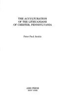

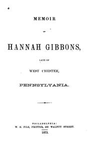
Search results from Open Library.
Recent natural events nearby
Ground air-quality sensors
Recently spotted species
Nearest stream gauge
Events
Gallery
Sources
- • Wikipedia
- • US Census Bureau (ACS 5-year estimates)
- • NOAA National Weather Service
- • Wikidata
- • NCES via Urban Institute Education Data Portal
- • Open-Meteo / sunrise-sunset.org
- • Wikipedia Pageviews API
- • Open Library