Browse / United States / Pennsylvania / Dauphin
Dauphin
Pennsylvaniaborough

Dauphin
Total population
1,075
Median home value
$198,800
Bachelor's+
Median income
$45,625
Founded
1765
Demographic figures from US Census Bureau · ACS 5-year estimates. Overview below cites Wikipedia and may reference a different year.
City facts
Facts from Wikidata (CC0).
Overview
Dauphin is a borough in Dauphin County, Pennsylvania, United States. The population was 796 at the 2020 census. Dauphin's ZIP code is 17018. It is part of the Harrisburg metropolitan area.
Read more on WikipediaHistory & geography
History
Dauphin borough began as a settlement at the mouth of Stony Creek, the head of a valley between Second and Third Mountains. It was established by Samuel Sturgeon in 1765. By the end of the eighteenth century, the Sturgeon property was owned by Revolutionary War soldier Timothy Green. The locality became known as Green's Mill, after the grist mill Colonel Green built at the mouth of the creek. According to local history, the area was also known for its colonial-period fort, alternately called Fort Lyon or Fort McKee. Colonel Green continued to hold highly valued real estate until his death in 1812. By 1814, his plantation property with its mills became part of his son Judge Innis Green's holdings. Judge Green continued to add to his real estate holdings throughout the early nineteenth century. The borough also took the name, Greensburg, after a post office. The surrounding township is called Middle Paxton, part of the former Paxton Township of Lancaster County prior to the creation of Dauphin County in 1785. Middle Paxton Township was incorporated in 1787. The main geographic feature of this area are ancient hills or mountains and narrow valleys that generally run east to west with streams emptying into the Susquehanna River. The township remained rural until the twentieth century. Judge Green laid out Dauphin as Port Lyon in recognition of the former fort in 1826. Green named the Port Lyon streets after Pennsylvania rivers and creeks. Charles Bird had earlier that year purchased four tracts of land in Middle Paxton Township from Judge Green. Bird's interest was purchased by a group of businessmen who then sold to the D & S Coal Company. Green received the last payment on the agreement price of US $10,000.00 in 1835. Dauphin was incorporated into a borough by an act…
Geography
Dauphin is located on the western edge of Dauphin County at , on the east bank of the Susquehanna River. The land at the river's edge is alluvial floodplain, but Dauphin sits at the head of a narrow valley between two mountains, at the mouth of Stony Creek. The valley between the two mountains is called Stony Valley, which contains the villages of Singersville and Ellendale Forge. This section along the Susquehanna River is a gateway from the southeastern plains into the Appalachian Mountains and the north-central part of the state. Berrier Island is also located at Dauphin. Dauphin is surrounded by Middle Paxton Township, which comprises mountains and valleys south of the confluence of the Susquehanna and Juniata rivers. From south to north, the mountains in the township are Blue Mountain, Second Mountain, Third or Stony Mountain, and Peters Mountain. The eastern ends of these valleys are generally undeveloped state game lands and protected watershed. U.S. Routes 22 and 322 pass through the borough as a four-lane expressway, close to the Susquehanna River, with full access from Pennsylvania Route 225 at the west end of town and with westbound access from the east end of town. US 22/322 leads south to the center of Harrisburg and northwest to Duncannon. PA 225 leads north over Peters Mountain to Halifax. According to the U.S. Census Bureau, the borough has a total area of , of which , or 1.16%, is water.
Excerpted from the corresponding Wikipedia article (CC BY-SA).
Demographics & economy
Race & ethnicity
Source: US Census Bureau — American Community Survey, 5-year estimates.
Geography
Coordinates & boundaries from the US Census TIGER/Line shapefiles.
Climate
10-year averages from ERA5 reanalysis (Open-Meteo).
Current forecast
Forecast for Dauphin, PA from NOAA NWS API.
Air quality
Industrial & pollution facilities
Natural hazard risk
Health (adults)
Walkability
Amenities nearby
Wildlife & biodiversity
Schools
Largest nearby schools
- Commonwealth Charter Academy CSOther · Harrisburg · 20,355 students · 17.4:1 ratio
- Reach Cyber CSOther · Harrisburg · 6,918 students · 14.3:1 ratio
- Central Dauphin SHSHigh · Harrisburg · 1,975 students · 16.2:1 ratio
- Central Dauphin East SHSHigh · Harrisburg · 1,590 students · 15.9:1 ratio
- Harrisburg HSHigh · Harrisburg · 1,230 students · 16.2:1 ratio
- Dauphin County Technical SchoolHigh · Harrisburg · 1,125 students · 14.1:1 ratio
- Central Dauphin MSMiddle · Harrisburg · 848 students · 16:1 ratio
- Thomas W Holtzman Jr El SchElementary · Harrisburg · 820 students · 19.1:1 ratio
Public K–12 schools within ~10 mi from Urban Institute Education Data Portal (NCES Common Core of Data, 2022).
Earthquake history
Photos
Sights & places nearby
Notable people from here


People born within ~10 km, from Wikidata (CC0). Click any name for their Wikipedia article.
Nearby places in Pennsylvania
- Marysville2.1 mi away
- Colonial Park8.1 mi away
- Lenkerville11.5 mi away · pop. 775
- Mechanicsburg11.6 mi away
- Millersburg12.1 mi away
- Hummelstown13.5 mi away · pop. 4,527
- Elizabethville13.7 mi away
- Bloomfield14.1 mi away · pop. 1,090
- Liverpool14.6 mi away
- Messiah College14.8 mi away
- Carlisle Barracks16.8 mi away
- Berrysburg17.4 mi away
Geography & sun
Elevation, sunrise/sunset and daylight from Open-Meteo. Solar climatology from NASA POWER.
Nearby airports
Public attention
Pageview totals from the Wikimedia Pageviews API.
Books about Dauphin


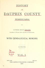
Search results from Open Library.
Recent natural events nearby
Ground air-quality sensors
Recently spotted species



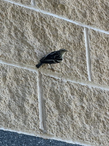


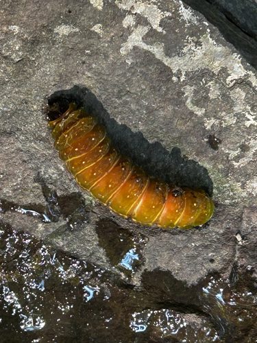
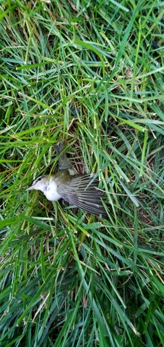

Research-grade observations from iNaturalist (within ~15 mi).
Nearest stream gauge
Events
Gallery
Sources
- • Wikipedia
- • US Census Bureau (ACS 5-year estimates)
- • Open-Meteo (ERA5 reanalysis)
- • NOAA National Weather Service
- • Wikidata
- • NCES via Urban Institute Education Data Portal
- • iNaturalist
- • Open-Meteo / sunrise-sunset.org
- • Wikipedia Pageviews API
- • Open Library