Browse / United States / Pennsylvania / Farrell
Farrell
Pennsylvaniacity

Farrell
Total population
4,199
Median home value
$87,800
Bachelor's+
Median income
$42,595
Founded
1899
Demographic figures from US Census Bureau · ACS 5-year estimates. Overview below cites Wikipedia and may reference a different year.
City facts
Facts from Wikidata (CC0).
Overview
Farrell is a city in western Mercer County, Pennsylvania, United States, along the Shenango River. As of the 2020 census, it had a population of 4,258. The city is part of the Hermitage micropolitan area.
Read more on WikipediaHistory & geography
History
Once dubbed "The Magic City," Farrell sprang up practically overnight when a steel mill was constructed in 1901 on a plain bordering the Shenango River, near Sharon, in what was then part of Hickory Township (now Hermitage). The community name was at the beginning South Sharon. In 1912, the population reached 10,000. At that time, the residents of the new city elected to take the name of Farrell, after industrialist James A. Farrell. The community was incorporated as the Borough of South Sharon in 1916; its population peaked at over 15,000 in 1920 and its status was elevated to a third-class city in 1932. The mill, which eventually became known as the Roemer Works of Sharon Steel Corporation, would serve as the community's lifeblood until 1992, when it was liquidated after filing bankruptcy. Many of the assets were sold at auction to Britain-based Caparo Corporation and later to Swiss steelmaker Duferco, which operates the plant today. Farrell was designated a financially distressed municipality in 1987 by the state of Pennsylvania. In 2004 local politicians proposed the creation of Shenango Valley City, consisting of Farrell as well as Hermitage, Sharpsville, Sharon, and Wheatland with the issue being put on the ballot in the form of a referendum. Then Governor of Pennsylvania, Ed Rendell voiced support for the measure and would be joined by Kathleen McGinty, Secretary of the Department of Environmental Protection, and Dennis Yablonsky, Secretary of the Department of Community and Economic Development with the trio touring the region to urge for voters to pass the motion. Despite years of population and industrial decline, Farrell has made progress in rebuilding itself due to new industrial investments on tax abated land and several new housing starts.
Excerpted from the corresponding Wikipedia article (CC BY-SA).
Demographics & economy
Race & ethnicity
Source: US Census Bureau — American Community Survey, 5-year estimates.
Geography
Coordinates & boundaries from the US Census TIGER/Line shapefiles.
Climate
Air quality
Industrial & pollution facilities
Natural hazard risk
Health (adults)
Walkability
Amenities nearby
Wildlife & biodiversity
Schools
Largest nearby schools
- Hickory HSHigh · Hermitage · 811 students · 13.5:1 ratio
- Artman El SchElementary · Hermitage · 609 students · 17.4:1 ratio
- Sharon HSHigh · Sharon · 523 students · 11.4:1 ratio
- Case Avenue El SchElementary · Sharon · 484 students · 11.3:1 ratio
- Sharpsville Area El SchElementary · Sharpsville · 424 students · 15.7:1 ratio
- Farrell Area ES/LMSElementary · Farrell · 378 students · 9.4:1 ratio
- Sharpsville Area SHSHigh · Sharpsville · 357 students · 9.2:1 ratio
- West Middlesex Area JSHSHigh · West Middlesex · 346 students · 11.5:1 ratio
Public K–12 schools within ~10 mi from Urban Institute Education Data Portal (NCES Common Core of Data, 2022).
Earthquake history
Photos
Sights & places nearby
Notable people from here
Nearby places in Pennsylvania
- Hermitage3.2 mi away
- Frizzleburg9.9 mi away
- Edinburg14.4 mi away
- Fredonia14.6 mi away · pop. 314
- Harlansburg21 mi away · pop. 269
- Lake Arthur Estates25.1 mi away
- Ellwood City26.6 mi away · pop. 7,532
- Barkeyville26.8 mi away
- Frisco27.6 mi away
- Homewood28.8 mi away · pop. 75
- Conneaut Lakeshore29.8 mi away · pop. 1,886
- Cochranton31.6 mi away · pop. 1,084
Geography & sun
Elevation, sunrise/sunset and daylight from Open-Meteo. Solar climatology from NASA POWER.
Nearby airports
Public attention
Pageview totals from the Wikimedia Pageviews API.
Books about Farrell
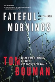


Search results from Open Library.
Recent natural events nearby
Ground air-quality sensors
Recently spotted species
Nearest stream gauge
Events
Gallery
Sources
- • Wikipedia
- • US Census Bureau (ACS 5-year estimates)
- • Wikidata
- • NCES via Urban Institute Education Data Portal
- • Open-Meteo / sunrise-sunset.org
- • Wikipedia Pageviews API
- • Open Library