Browse / United States / Pennsylvania / Spring Grove
Spring Grove
Pennsylvaniaborough

Spring Grove
Total population
2,433
Median home value
$204,000
Bachelor's+
Median income
$76,620
Founded
1747
Demographic figures from US Census Bureau · ACS 5-year estimates. Overview below cites Wikipedia and may reference a different year.
City facts
Facts from Wikidata (CC0).
Overview
Spring Grove is a borough in York County, Pennsylvania, United States. The population was 2,372 at the 2020 census. It is part of the York–Hanover metropolitan area.
Read more on WikipediaHistory & geography
History
The site of Spring Grove was laid out in 1747 on the banks of Codorus Creek, midway between York and Hanover, by a surveyor for the Penns. Its growth since that time falls into two periods, each lasting approximately 100 years. The first witnessed development of the borough as an iron-making center. The second, which extends to the present day, is as a papermaking center. The businesses of both periods have relied on certain natural resources of the area. Originally, Spring Grove was a part of Paradise Township and was contained within the boundaries of Lancaster County. York County was formed in 1749 and Jackson Township, including Spring Grove, in 1853. The residents of the community petitioned the County Court in 1882 for incorporation as a borough, and in August of that year their petition was granted. Since that time, the borough has grown in area as a result of annexation of the surrounding land, the largest annexation having taken place in 1953. In the 1770s, attracted by the presence of water, iron ore and wood for charcoal in the Pigeon Hills, an iron manufacturer established a forge at "Spring Forge". It is known as Spring Grove. The early German and English woodchoppers who flocked to this first Pennsylvania iron industry west of the Susquehanna River were the forebears of today's community. By the mid-19th century, the manufacturing of iron had grown to a point where almost of iron bar were produced locally each year. By 1851, however, the iron business had been suspended, and its buildings were converted to the manufacturing of paper. Once again local resources, wood and water, were largely responsible for the location of this industry in the Spring Grove area. Thirteen years later, the plant was purchased by P. H. Glatfelter for $14,000. Other basic…
Geography
Spring Grove is located at (39.876827, -76.865536). According to the United States Census Bureau, the borough has a total area of , all land.
Excerpted from the corresponding Wikipedia article (CC BY-SA).
Demographics & economy
Race & ethnicity
Source: US Census Bureau — American Community Survey, 5-year estimates.
Geography
Coordinates & boundaries from the US Census TIGER/Line shapefiles.
Climate
Current forecast
Forecast for Spring Grove, PA from NOAA NWS API.
Air quality
Industrial & pollution facilities
Natural hazard risk
Health (adults)
Walkability
Amenities nearby
Wildlife & biodiversity
Most-observed species
- Northern CardinalCardinalis cardinalis (Linnaeus, 1758) · Aves13,377
- American RobinTurdus migratorius Linnaeus, 1766 · Aves10,098
- Mourning DoveZenaida macroura (Linnaeus, 1758) · Aves9,678
- Carolina WrenThryothorus ludovicianus (Latham, 1790) · Aves9,078
- Blue JayCyanocitta cristata (Linnaeus, 1758) · Aves8,851
- Red-bellied WoodpeckerMelanerpes carolinus (Linnaeus, 1758) · Aves8,246
- Carolina ChickadeePoecile carolinensis (Audubon, 1834) · Aves7,837
- Tufted TitmouseBaeolophus bicolor (Linnaeus, 1766) · Aves7,456
Citizen-science & research observations from the Global Biodiversity Information Facility (GBIF).
Schools
Largest nearby schools
- William Penn SHSHigh · York · 1,534 students · 16:1 ratio
- Dallastown Area Intermediate SchMiddle · York · 1,484 students · 15.8:1 ratio
- South Western SHSHigh · Hanover · 1,299 students · 15.3:1 ratio
- Spring Grove Area HSHigh · Spring Grove · 1,166 students · 14.9:1 ratio
- Emory H Markle MSMiddle · Hanover · 1,028 students · 14.7:1 ratio
- Dover Area HSHigh · Dover · 1,016 students · 16.1:1 ratio
- York Academy Regional CSOther · York · 963 students · 16.9:1 ratio
- West York Area HSHigh · York · 869 students · 15:1 ratio
Public K–12 schools within ~10 mi from Urban Institute Education Data Portal (NCES Common Core of Data, 2022).
Earthquake history
Most recent
- M 2.5 — 2025-10-274 km E of Riverside, Maryland
- M 2.6 — 2021-06-252 km SE of Woodlawn, Maryland
- M 2.81 — 2019-09-155 km ESE of East Berlin, Pennsylvania
- M 3.44 — 2019-06-139 km N of Blain, Pennsylvania
- M 3.6 — 2010-07-165 km NNW of Barnesville, Maryland
- M 3.05 — 2010-06-034 km ENE of Franklintown, Pennsylvania
Events from the USGS Earthquake Catalog (global) (FDSN Event Web Service).
Photos
Sights & places nearby
Notable people from here
Geography & sun
Nearby airports
Public attention
Books about this place
Recent natural events nearby
Ground air-quality sensors
Recently spotted species

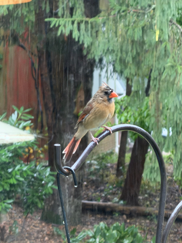


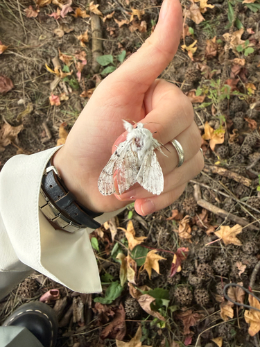


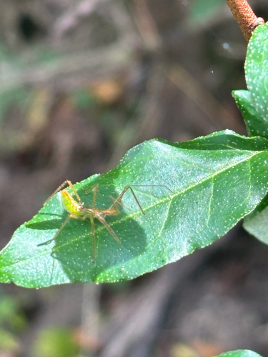
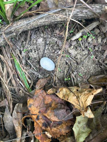
Research-grade observations from iNaturalist (within ~15 mi).
Nearest stream gauge
Events
Gallery
Sources
- • Wikipedia
- • US Census Bureau (ACS 5-year estimates)
- • NOAA National Weather Service
- • Wikidata
- • USGS Earthquake Catalog (global feed)
- • NCES via Urban Institute Education Data Portal
- • GBIF (Global Biodiversity Information Facility)
- • iNaturalist