Browse / Poland / Podlaskie / Białystok
Białystok
Podlaskiecity

Białystok
Total population
294,242
Founded
1691
Air quality index
Demographic figures from Statistics Poland (GUS). Overview below cites Wikipedia and may reference a different year.
City facts
Sister cities
Facts from Wikidata (CC0).
Overview
Białystok is the largest city in northeastern Poland and the capital of the Podlaskie Voivodeship. It is the tenth-largest city in Poland, second in terms of population density, and thirteenth in area.
Read more on WikipediaHistory & geography
History
Archaeological discoveries show that the first settlements in the area of present-day Białystok occurred during the Stone Age. Tombs of ancient settlers can be found in the district of Dojlidy. In the early Iron Age, people settled in the area producing kurgans, the tombs of the chiefs in the area located in the current village of Rostołty. Since then, the Białystok area has been at the crossroads of cultures. Trade routes linking the Baltic to the Black Sea favored the development of settlements with Yotvingia-Ruthenian-Polish cultural characteristics. Thereafter, Białystok was part of Lithuania for 132 years. The Union of Lublin in 1569 transferred the city to Poland, but it remained very close to its border with the Grand Duchy of Lithuania until the last partition of the Polish–Lithuanian Commonwealth in 1795. Białystok was administratively part of the Podlaskie Voivodeship, after 1569 also part of the Lesser Poland Province of the Kingdom of Poland. From 1547, the settlement was owned by the Wiesiołowski family, which founded the first school. The first brick church and a castle were built between 1617 and 1826. The two-floor castle, designed on a rectangular plan in the Gothic-Renaissance style, was the work of . Extension of the castle was continued by Krzysztof Wiesiołowski, starost of Tykocin, Grand Marshal of Lithuania since 1635, and husband of Aleksandra Marianna Sobieska. In 1661 it was given to Stefan Czarniecki as a reward for his service in the victory over the Swedes during the Deluge. Four years later, it was given as a dowry of his daughter Aleksandra, who married Marshal of the Crown Court Jan Klemens Branicki, thus passing into the hands of the Branicki family. In 1692, , the son of Jan Klemens Branicki, obtained city rights for Białystok from…
Geography
Białystok is situated in the Białystok Uplands () of the Podlaskie Plain (), part of what is known collectively as the Green Lungs of Poland. It is situated by road northeast of Warsaw. A characteristic element of the relief of the city area are clear depressions in the surface of the moraine plateau, which are used by the rivers Biała, Horodnianka, and Czaplinianka. Forests are an important part of the city character, they currently occupy approximately (18% of the administrative area of the city) which places it as the fifth most "wooded" city in Poland; behind Katowice (38%), Bydgoszcz (30%), Toruń (22.9%) and Gdańsk (17.6%). There are a total of 9 parks in the city (on municipal plots), of which 5 are historic parks with a total area of about 59.06 ha, entered into the municipal register of monuments, and 4 are city parks with an area of about 21.68 ha. Part of Knyszyn Forest is preserved within the city limits by two nature reserves—a total area of . The Zwierzyniecki Forest Nature Reserve, which is contained within the city limits, is a fragment, , of the riparian forest with a dominant assemblage of oak and hornbeam. The Antoniuk Nature Reserve () is a park in the city that preserves the natural state of a forest fragment characteristic of the Białystok Upland, with a dominant mixed forest of hazel and spruce. The of forests lying in the vicinity of the Dojlidy Ponds are administered by the Białystok Central Sports and Recreation Center ( – BOSiR). The Dojlidy Ponds recreation area includes a public beach, walking trails, birdwatching and fishing. The city has a warm-summer humid continental or hemiboreal climate (Dfb) according to the Köppen climate classification system under the isotherm for the average temperature of the coldest month, or an…
Excerpted from the corresponding Wikipedia article (CC BY-SA).
Geography
Coordinates & boundaries from the US Census TIGER/Line shapefiles.
Climate
Air quality
Current readings from Open-Meteo Air Quality API (Copernicus CAMS European reanalysis).
Walkability
Amenities nearby
Wildlife & biodiversity
Most-observed species
- Great TitParus major Linnaeus, 1758 · Aves506
- MallardAnas platyrhynchos Linnaeus, 1758 · Aves468
- Common Wood-PigeonColumba palumbus Linnaeus, 1758 · Aves443
- Eurasian MagpiePica pica (Linnaeus, 1758) · Aves438
- Eurasian Blue TitCyanistes caeruleus (Linnaeus, 1758) · Aves372
- Common CraneGrus grus (Linnaeus, 1758) · Aves365
- Eurasian BlackbirdTurdus merula Linnaeus, 1758 · Aves334
- Eurasian JayGarrulus glandarius (Linnaeus, 1758) · Aves332
Citizen-science & research observations from the Global Biodiversity Information Facility (GBIF).
Earthquake history
Events from the USGS Earthquake Catalog (global) (FDSN Event Web Service).
Photos
Sights & places nearby
Notable people from here


People born within ~10 km, from Wikidata (CC0). Click any name for their Wikipedia article.
Nearby places in Podlaskie
Geography & sun
Elevation, sunrise/sunset and daylight from Open-Meteo. Solar climatology from NASA POWER.
Nearby airports
Public attention
Pageview totals from the Wikimedia Pageviews API.
Books about Białystok
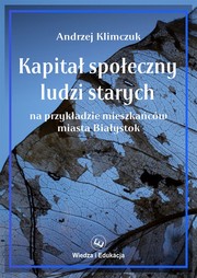
Search results from Open Library.
Recent natural events nearby
Ground air-quality sensors
Recently spotted species
Events
Notable, recurring, and historical events associated with Białystok, sourced from Wikidata.
- Q115670068Jan 1, 1988event
Source: Wikidata (CC0).
Gallery
Geotagged photos within ~6 miles of Białystok, from Wikimedia Commons contributors.


Photos via Wikimedia Commons — see each image page for license & attribution.
Official Identifiers
GUS — Statistics Poland
- SIMC code
- 0922410
- Population (Wikidata)
- 290,386
- Wikidata
- Q761
SIMC place ID via Wikidata P4046
Sources
- • Wikipedia
- • Wikimedia Commons
- • Wikidata
- • Open-Meteo Air Quality (CAMS)
- • USGS Earthquake Catalog (global feed)
- • GBIF (Global Biodiversity Information Facility)
- • Open-Meteo / sunrise-sunset.org
- • Wikipedia Pageviews API
- • Open Library
- • GUS — Statistics Poland — SIMC place ID via Wikidata P4046