Browse / Poland / Świętokrzyskie / Szydłów
Szydłów
Świętokrzyskietown

Szydłów
Total population
974
Founded
1191
Demographic figures from Statistics Poland (GUS). Overview below cites Wikipedia and may reference a different year.
City facts
Facts from Wikidata (CC0).
Overview
Szydłów is a fortified town in Staszów County, Świętokrzyskie Voivodeship, in southeastern Poland. It is the seat of the gmina called Gmina Szydłów. It lies approximately 13 km (8 mi) west of Staszów and 43 km (27 mi) south-east of the regional capital Kielce.
Read more on WikipediaHistory & geography
History
First mention of Szydłów comes from the year 1191, in documents of Sandomierz Collegiate church. At that time, the village was owned by Polish Kings, located along the Vistula merchant road, which was of major importance in the late Middle Ages. On July 1, 1329, Szydłów was incorporated as a town on Środa Śląska town law (see also: Magdeburg rights). In the mid-14th century, King Casimir III the Great founded here a fortified castle and the Church of Saint Ladislaus. The town was surrounded by a defensive wall, with three gates—Kraków Gate, Opatów Gate, and Water Gate. Soon afterwards, Szydłów became the seat of a starosta, and first artisans came here, as well as Jewish settlers. It was a royal town of the Kingdom of Poland, administratively located in the Wiślica County in the Sandomierz Voivodeship in the Lesser Poland Province. Its location helped wine, cattle and hops merchants, who would go with their goods to Sandomierz. In the 16th century, Szydłów emerged as a center of cloth-making. Also, tailors, bakers, shoemakers, iron smiths, saddle makers, sword makers and pot makers worked here, there also was a brewery. In 1528, waterworks and bath houses were opened, and in 1564, the town had 180 houses, of which 49 were located on the market square, but next year, large parts of Szydłów burned in a fire. At that time, a number Jews settled in the town, who in 1534–1564 built the first synagogue. Good times came to an end in the first half of the 17th century. In 1630 Szydłów was burned by rebellious soldiers of fortune, who were not paid their salaries. Unable to enter the fortified town, the mercenaries set the suburbs on fire, and the blaze reached Szydłów. Swedish invasion of Poland (1655–1660), and the invasion of troops of George II Rakoczi (see Treaty of…
Excerpted from the corresponding Wikipedia article (CC BY-SA).
Geography
Coordinates & boundaries from the US Census TIGER/Line shapefiles.
Climate
Air quality
Walkability
Amenities nearby
Wildlife & biodiversity
Earthquake history
Photos
Sights & places nearby
Notable people from here


People born within ~10 km, from Wikidata (CC0). Click any name for their Wikipedia article.
Nearby places in Świętokrzyskie
- Niemścice4.6 mi away · pop. 220
- Wola Osowa4.9 mi away · pop. 180
- Zagrody4.9 mi away · pop. 150
- Tuczępy5 mi away · pop. 635
- Wólka Bosowska5.3 mi away
- Płośnia5.8 mi away
- Pągowiec5.8 mi away · pop. 78
- Wólka Żabna6.2 mi away · pop. 122
- Nieciesławice6.3 mi away
- Sielec6.4 mi away · pop. 413
- Rakówka7.2 mi away · pop. 132
- Poddębowiec7.9 mi away · pop. 150
Geography & sun
Elevation, sunrise/sunset and daylight from Open-Meteo. Solar climatology from NASA POWER.
Nearby airports
Public attention
Pageview totals from the Wikimedia Pageviews API.
Books about Szydłów
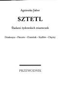
Search results from Open Library.
Recent natural events nearby
Ground air-quality sensors
Recently spotted species
Events
Gallery
Sources
- • Wikipedia
- • Wikidata
- • Open-Meteo / sunrise-sunset.org
- • Wikipedia Pageviews API
- • Open Library