Browse / Poland / Lublin / Tarnogród
Tarnogród
Lublintown

Tarnogród
Total population
3,207
Founded
1567
Demographic figures from Statistics Poland (GUS). Overview below cites Wikipedia and may reference a different year.
City facts
Facts from Wikidata (CC0).
Overview
Tarnogród is a town in Biłgoraj County, Lublin Voivodeship, Poland. It has a population of 3,399 (2006).
Read more on WikipediaHistory & geography
History
The history of the town dates back to a medieval settlement, then known as Cierniogród. The town had city rights from the 16th to 19th century, and regained them in 1987. There are various tourist attractions in the town, including a synagogue built in 1686 and a late baroque church built between 1750 and 1771. Outside the church there is a belfry from 1777. Tarnogród was founded in the mid-16th century in a location where a defensive gord called Cierniogród once had existed. It received Magdeburg rights in Piotrków Trybunalski, on 14 May 1567, from Polish King Sigismund II Augustus. The House of Zamoyski, which owned Tarnogród, built houses around a market square, together with a wooden town hall and prison tower. Later on, a hospital was added, together with two churches (1569, 1591) and a bathhouse. The town had three gates, its population in 1589 is estimated at app. 1,500. It was a Polish private town, administratively located in the Przemyśl Land in the Ruthenian Voivodeship in the Lesser Poland Province of the Polish Crown. In 1588, Tarnogród became part of Zamoyski Family Fee Tail. The town had a vogt, a mayor and a council. In the early 17th century, Tarnogród had two Roman Catholic churches, a synagogue and an Orthodox church. In the mid-17th century, numerous wars and plagues decimated Tarnogrod's population. In this period, during the cossack riots, the Jewish community of Tarnogród almost perished. On 26 November 1715, the Tarnogród Confederation was formed here. Following the First Partition of Poland (1772), the town was captured by Austrians, who brought here German settlers. Austrian rule ended in 1809 (see Polish–Austrian War), and for the next 6 years, Tarnogród belonged to the Polish Duchy of Warsaw, in which it became the seat of a county (until…
Excerpted from the corresponding Wikipedia article (CC BY-SA).
Geography
Coordinates & boundaries from the US Census TIGER/Line shapefiles.
Climate
Air quality
Walkability
Amenities nearby
Wildlife & biodiversity
Earthquake history
Photos
Sights & places nearby
Notable people from here


People born within ~10 km, from Wikidata (CC0). Click any name for their Wikipedia article.
Nearby places in Lublin
- Wola Różaniecka2.6 mi away · pop. 784
- Stare Króle5.2 mi away · pop. 180
- Wola Kulońska5.3 mi away · pop. 83
- Dereźnia Majdańska9.2 mi away · pop. 285
- Szyszków9.2 mi away · pop. 560
- Jasiennik Stary14.2 mi away · pop. 341
- Hedwiżyn15.7 mi away · pop. 687
- Tereszpol-Zaorenda15.9 mi away · pop. 1,171
- Kaczórki22.7 mi away
- Kocudza Druga22.8 mi away
- Niedzieliska28.1 mi away
- Rogóźno-Kolonia28.1 mi away
Geography & sun
Elevation, sunrise/sunset and daylight from Open-Meteo. Solar climatology from NASA POWER.
Nearby airports
Public attention
Pageview totals from the Wikimedia Pageviews API.
Books about Tarnogród
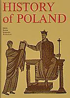
Search results from Open Library.
Recent natural events nearby
Ground air-quality sensors
Recently spotted species
Events
Gallery
Official Identifiers
GUS — Statistics Poland
- SIMC code
- 0988069
- Population (Wikidata)
- 3,207
- Wikidata
- Q777169
SIMC place ID via Wikidata P4046
Sources
- • Wikipedia
- • Wikidata
- • Open-Meteo / sunrise-sunset.org
- • Wikipedia Pageviews API
- • Open Library
- • GUS — Statistics Poland — SIMC place ID via Wikidata P4046