Browse / United States / Rhode Island / Newport
Newport
Rhode Islandcity

Newport
Total population
24,874
Median home value
$746,900
Bachelor's+
Median income
$86,313
Founded
1639
Demographic figures from US Census Bureau · ACS 5-year estimates. Overview below cites Wikipedia and may reference a different year.
City facts
Facts from Wikidata (CC0).
Overview
Newport is a seaside city on Aquidneck Island in Rhode Island, United States. It is located in Narragansett Bay, approximately 33 miles (53 km) southeast of Providence, 20 miles (32 km) south of Fall River, Massachusetts, 74 miles (119 km) south of Boston, and 180 miles (290 km) northeast of New York City. It is known as a New England summer resort and is famous for its historic mansions and its rich sailing history. As of the 2020 census, Newport had a population of 25,163.
Read more on WikipediaHistory & geography
History
Newport was founded in 1639 on Rhode Island, which is now called Aquidneck Island. Its eight founders and first officers were Nicholas Easton, William Coddington, John Clarke, John Coggeshall, William Brenton, Jeremy Clark, Thomas Hazard, and Henry Bull. Many of these people were part of the settlement at Portsmouth, along with Anne Hutchinson and her followers. They separated within a year of settling Portsmouth and began the settlement of Newport on the southern side of the island. Newport grew to be the largest of the four original settlements that became the Colony of Rhode Island and Providence Plantations, including Providence Plantations and Shawomett. Many of the first colonists in Newport became Baptists, and the second Baptist congregation in Rhode Island was formed in 1640 under the leadership of John Clarke. In 1658, a group of Jews was welcomed to settle in Newport, fleeing the Inquisition in Spain and Portugal. They were not allowed to settle elsewhere. This group eventually came to be known as Congregation Jeshuat Israel, and is the second-oldest Jewish congregation in the United States. They meet in Touro Synagogue, the oldest synagogue in America. The Colony of Rhode Island and Providence Plantations received its royal charter in 1663. Benedict Arnold was elected as the first governor. The Old Colony House at the head of Washington Square in Newport served as the seat of Rhode Island's government from 1741 until the current Rhode Island State House was completed in Providence in 1904. At that time, Providence became the state's sole capital city. Newport was the most important port in colonial Rhode Island, and a public school was established in 1640. The commercial activity that raised Newport to its fame as a rich port began with the immigration…
Geography
Newport is located on, and is the most populous municipality of, Aquidneck Island in Narragansett Bay. According to the United States Census Bureau, the city has a total area of , of which is land and , or 32.64%, is water. The Newport Bridge, the longest suspension bridge in New England, connects Newport to neighboring Conanicut Island across the East Passage of the Narragansett. Newport has a humid continental climate (Köppen Dfa/Dfb), bordering on a humid subtropical climate (Köppen Cfa) and oceanic climate (Köppen Cfb). Being surrounded by ocean water, Newport is often cooler in the summer than some coastal cities further north, such as Boston. According to the USDA, Newport is located in plant hardiness zone 7a.
Excerpted from the corresponding Wikipedia article (CC BY-SA).
Demographics & economy
Race & ethnicity
Source: US Census Bureau — American Community Survey, 5-year estimates.
Geography
Coordinates & boundaries from the US Census TIGER/Line shapefiles.
Climate
Air quality
Industrial & pollution facilities
Natural hazard risk
Health (adults)
Age-adjusted prevalence estimates from CDC PLACES (latest release).
Walkability
Amenities nearby
Wildlife & biodiversity
Schools
Largest nearby schools
- Claiborne Pell ElementaryElementary · Newport · 697 students · 10.6:1 ratio
- Rogers High SchoolHigh · Newport · 633 students · 9.9:1 ratio
- Portsmouth Middle SchoolMiddle · Portsmouth · 618 students · 11.2:1 ratio
- Middletown High SchoolHigh · Middletown · 567 students · 11.3:1 ratio
- Frank E. Thompson MiddleMiddle · Newport · 546 students · 9.1:1 ratio
- Gaudet Middle SchoolMiddle · Middletown · 465 students · 12.2:1 ratio
- Melville SchoolElementary · Portsmouth · 328 students · 12.1:1 ratio
- Aquidneck SchoolElementary · Middletown · 318 students · 13.8:1 ratio
Public K–12 schools within ~10 mi from Urban Institute Education Data Portal (NCES Common Core of Data, 2022).
Earthquake history
Photos
Sights & places nearby
Notable people from here


People born within ~10 km, from Wikidata (CC0). Click any name for their Wikipedia article.
Nearby places in Rhode Island
- Newport East3.2 mi away
- Melville5.8 mi away
- Narragansett Pier8.3 mi away · pop. 3,167
- Wakefield-Peace Dale9.6 mi away
- Kingston10.6 mi away
- Tiverton13.7 mi away
- Warwick16.5 mi away · pop. 83,554
- Charlestown17.3 mi away · pop. 1,499
- Carolina17.4 mi away
- Wyoming19.3 mi away · pop. 320
- Hope Valley20.9 mi away · pop. 2,297
- Quonochontaug21.9 mi away
Geography & sun
Elevation, sunrise/sunset and daylight from Open-Meteo. Solar climatology from NASA POWER.
Nearby airports
Public attention
Pageview totals from the Wikimedia Pageviews API.
Books about Newport


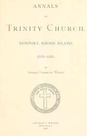


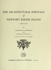
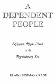
Search results from Open Library.
Recent natural events nearby
Ground air-quality sensors
Recently spotted species
Nearest stream gauge
Events
Gallery
Sources
- • Wikipedia
- • US Census Bureau (ACS 5-year estimates)
- • Wikidata
- • NCES via Urban Institute Education Data Portal
- • CDC PLACES
- • Open-Meteo / sunrise-sunset.org
- • Wikipedia Pageviews API
- • Open Library