Browse / United States / South Carolina / Beaufort
Beaufort
South Carolinacity

Beaufort
Total population
13,747
Founded
1711
Air quality index
Demographic figures from US Census Bureau · ACS 5-year estimates. Overview below cites Wikipedia and may reference a different year.
- Heat Advisory · ModerateHeat Advisory issued June 28 at 2:12AM EDT until June 28 at 6:00PM EDT by NWS Charleston SC
Source: NOAA National Weather Service.
City facts
Facts from Wikidata (CC0).
Overview
Beaufort is a city in Beaufort County, South Carolina, United States, and its county seat. Chartered in 1711, it is the second-oldest city in South Carolina, behind Charleston. The city's population was 13,607 at the 2020 census. It is part of the Hilton Head Island metropolitan area.
Read more on WikipediaHistory & geography
History
Written history began 500 years ago with the exploration of the area by Spanish Captain Pedro de Salazar between 1514 and 1516. Nearby, the colony of Santa Elena was having problems by 1566, when a group of potential settlers sailed from northwest Iberia and the Spanish governor of Floritda, Acinega, dispatched under Captain Pardo and 250 men to reinforce the colony. The Lowcountry region had been subject to numerous European explorations and failed attempts at colonization before British colonists founded Beaufort in 1711. Beaufort was named for Henry Somerset, 2nd Duke of Beaufort. The city grew slowly at first due to attacks from Native American tribes and threats from the Spanish Empire to the south. It flourished first as a center for shipbuilding and later, when the region was established as a slave society, as the elite center for the Lowcountry planters through the Civil War. Several months after hostilities began between the states, Beaufort was occupied by Union forces following the Battle of Port Royal. Due to its early occupation, the city attracted escaping slaves. The Union declared the slaves emancipated and initiated efforts at education and preparation for full independence. The Freedmen's Bureau worked with local blacks during Reconstruction. After the war, the city relied on phosphate mining before a devastating hurricane in 1893 and a fire in 1907 brought extensive destruction and economic turmoil. Their effects slowed growth of the city for nearly half a century. In the latter half of the 20th century, the community became a popular tourist destination. Beaufort also benefited from the growth of military installations in the area and related employment. Local groups have worked to preserve Beaufort's historic character and significant…
Geography
The majority of the city is situated upon Port Royal Island, an interior Sea Island that the city shares with neighboring Port Royal and unincorporated portions of Beaufort County. The city has also annexed lands across the Beaufort River on Lady's Island. The city is amid a marshy estuary, and according to the United States Census Bureau has a total area of , of which is land and , or 17.80%, is water.
Excerpted from the corresponding Wikipedia article (CC BY-SA).
Demographics & economy
Geography
Coordinates & boundaries from the US Census TIGER/Line shapefiles.
Climate
Current forecast
Forecast for Beaufort, SC from NOAA NWS API.
Air quality
Current readings from Open-Meteo Air Quality API (Copernicus CAMS European reanalysis).
Industrial & pollution facilities
Natural hazard risk
Health (adults)
Age-adjusted prevalence estimates from CDC PLACES (latest release).
Walkability
Amenities nearby
Wildlife & biodiversity
Most-observed species
- Northern CardinalCardinalis cardinalis (Linnaeus, 1758) · Aves12,792
- Carolina WrenThryothorus ludovicianus (Latham, 1790) · Aves10,721
- Carolina ChickadeePoecile carolinensis (Audubon, 1834) · Aves10,495
- Tufted TitmouseBaeolophus bicolor (Linnaeus, 1766) · Aves9,169
- Red-bellied WoodpeckerMelanerpes carolinus (Linnaeus, 1758) · Aves8,957
- American CrowCorvus brachyrhynchos C.L.Brehm, 1822 · Aves8,843
- Mourning DoveZenaida macroura (Linnaeus, 1758) · Aves7,550
- Downy WoodpeckerDryobates pubescens (Linnaeus, 1766) · Aves7,532
Citizen-science & research observations from the Global Biodiversity Information Facility (GBIF).
Schools
Largest nearby schools
- Bridges Preparatory SchoolOther · Beaufort · 1,271 students · 14.6:1 ratio
- Beaufort HighHigh · Beaufort · 1,191 students · 14.5:1 ratio
- Battery Creek HighHigh · Beaufort · 788 students · 12.1:1 ratio
- Riverview Charter SchoolElementary · Beaufort · 703 students · 13.5:1 ratio
- Robert Smalls International AcademyElementary · Beaufort · 685 students · 10.9:1 ratio
- Whale Branch Early College HighHigh · Seabrook · 476 students · 12.5:1 ratio
- Coosa ElementaryElementary · Beaufort · 461 students · 13.6:1 ratio
- Broad River ElementaryElementary · Beaufort · 455 students · 9.9:1 ratio
Public K–12 schools within ~10 mi from Urban Institute Education Data Portal (NCES Common Core of Data, 2022).
Earthquake history
Most recent
- M 2.91 — 2026-02-086 km SW of Ladson, South Carolina
- M 3.27 — 2021-09-27South Carolina
- M 2.82 — 2021-09-273 km NNE of Summerville, South Carolina
- M 3 — 2014-03-190 km WNW of Centerville, South Carolina
- M 2.5 — 2013-09-198 km WSW of Summerville, South Carolina
- M 2.8 — 2012-07-315 km S of Centerville, South Carolina
Events from the USGS Earthquake Catalog (global) (FDSN Event Web Service).
Photos
Sights & places nearby
Notable people from here


People born within ~10 km, from Wikidata (CC0). Click any name for their Wikipedia article.
Nearby places in South Carolina
Geography & sun
Elevation, sunrise/sunset and daylight from Open-Meteo. Solar climatology from NASA POWER.
Nearby airports
Public attention
Pageview totals from the Wikimedia Pageviews API.
Books about Beaufort

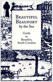

Search results from Open Library.
Recent natural events nearby
Ground air-quality sensors
Recently spotted species
Nearest stream gauge
Events
Gallery
Geotagged photos within ~6 miles of Beaufort, from Wikimedia Commons contributors.
 0.9 mi
.jpg) 1.6 mi
1.6 mi.jpg) 1.6 mi
1.6 mi.jpg) 1.6 mi
1.6 mi.jpg) 1.6 mi
1.6 mi.jpg) 1.6 mi
1.6 mi.jpg) 1.6 mi
1.6 mi.jpg) 1.6 mi
1.6 mi.jpg) 1.6 mi
1.6 mi.jpg) 1.6 mi
1.6 mi.jpg) 1.6 mi
1.6 mi.jpg) 1.6 mi
1.6 mi.jpg) 1.8 mi
1.8 mi.jpg) 1.8 mi
1.8 mi.jpg) 1.8 mi
1.8 mi.jpg) 1.8 mi
1.8 mi.jpg) 1.8 mi
1.8 mi.jpg) 1.8 mi
1.8 mi.jpg) 1.8 mi
1.8 mi.jpg) 1.8 mi
1.8 mi.jpg) 1.8 mi
1.8 mi.jpg) 1.8 mi
1.8 mi.jpg) 1.8 mi
1.8 mi.jpg) 1.8 mi
1.8 miPhotos via Wikimedia Commons — see each image page for license & attribution.
Sources
- • Wikipedia
- • NOAA National Weather Service
- • Wikimedia Commons
- • Wikidata
- • Open-Meteo Air Quality (CAMS)
- • USGS Earthquake Catalog (global feed)
- • NCES via Urban Institute Education Data Portal
- • GBIF (Global Biodiversity Information Facility)
- • CDC PLACES
- • Open-Meteo / sunrise-sunset.org
- • Wikipedia Pageviews API
- • Open Library