Browse / United States / South Carolina / Chapin
Chapin
South Carolinatown

Chapin
Total population
1,394
Median home value
$221,000
Bachelor's+
Median income
$79,922
Demographic figures from US Census Bureau · ACS 5-year estimates. Overview below cites Wikipedia and may reference a different year.
City facts
Facts from Wikidata (CC0).
Overview
Chapin, South Carolina is a town located in Lexington County, South Carolina, United States. Chapin had a population of 1,809 at the 2020 census.
Read more on WikipediaHistory & geography
History
Chapin was named after Martin Chapin in 1889. After he and Laura Anne Benjamin were married on June 16, 1850, the couple moved down South because of Martin's health (a lung condition). The Chapins were living in Columbia when Martin's doctor suggested he to move to the Piney Woods area. Over the years, Chapin bought of land in this area. He built a home in Piney Woods, and later a hotel in the 1880s along the new rail line that ran from Columbia to Laurens, the Columbia, Newberry and Laurens Railroad. The railroad provided a way to trade and transport goods to the capital city. Cotton and the lumber industry were flourishing with the railroad providing transportation. After Martin's death on August 31, 1894, Laura Chapin sold their home and moved into the Chapin hotel. On March 28, 1907, Job S. Wessinger, P.M. Frick, and J. S. Honeycut founded the Bank of Chapin. One year later, the building for the bank was built. The bank prospered with help from the railroad. During World War I, Chapin was doing well economically. The price of cotton had risen and the farmers were making plenty of money. As a result, the Bank of Chapin was also thriving during this time. The first high school was built in 1924. Slowly the businesses in Chapin were starting to experience hard times nearing the 1930s. On Thursday, October 15, 1931, the Bank of Chapin did not open, and like other banks around the world, the bank would not allow customers to withdraw their money. Anybody who had money saved in the bank lost that money due to the crash of the stock market, later known as the start of the Great Depression. Another disaster to hit Chapin was the building of the dam on the Saluda River that would result in the building of a lake. This lake would take over most of the Chapin families’…
Geography
Chapin is located in the northern corner of Lexington County. According to the United States Census Bureau, the town has a total area of , of which , or 0.53%, are water. While Chapin is a part of Lexington County, the creation of Lake Murray by the Dreher Shoals Dam cut Chapin off from the rest of the county by road, creating something of an exclave.
Excerpted from the corresponding Wikipedia article (CC BY-SA).
Demographics & economy
Race & ethnicity
Source: US Census Bureau — American Community Survey, 5-year estimates.
Geography
Coordinates & boundaries from the US Census TIGER/Line shapefiles.
Climate
Current forecast
Forecast for Chapin, SC from NOAA NWS API.
Air quality
Industrial & pollution facilities
Natural hazard risk
Health (adults)
Age-adjusted prevalence estimates from CDC PLACES (latest release).
Walkability
Amenities nearby
Wildlife & biodiversity
Most-observed species
- Northern CardinalCardinalis cardinalis (Linnaeus, 1758) · Aves8,239
- Carolina WrenThryothorus ludovicianus (Latham, 1790) · Aves7,347
- Carolina ChickadeePoecile carolinensis (Audubon, 1834) · Aves6,830
- Tufted TitmouseBaeolophus bicolor (Linnaeus, 1766) · Aves6,475
- House FinchHaemorhous mexicanus (P.L.Statius Müller, 1776) · Aves5,564
- Red-bellied WoodpeckerMelanerpes carolinus (Linnaeus, 1758) · Aves5,535
- Mourning DoveZenaida macroura (Linnaeus, 1758) · Aves5,405
- Downy WoodpeckerDryobates pubescens (Linnaeus, 1766) · Aves5,143
Citizen-science & research observations from the Global Biodiversity Information Facility (GBIF).
Schools
Largest nearby schools
- Chapin HighHigh · Chapin · 1,615 students · 15.5:1 ratio
- Chapin IntermediateMiddle · Chapin · 913 students · 16:1 ratio
- Chapin ElementaryElementary · Chapin · 790 students · 13.2:1 ratio
- Piney Woods ElementaryElementary · Chapin · 501 students · 12.8:1 ratio
- Odyssey Online LearningHigh · Chapin · 465 students · 58.1:1 ratio
Public K–12 schools within ~10 mi from Urban Institute Education Data Portal (NCES Common Core of Data, 2022).
Earthquake history
Most recent
- M 3 — 2026-02-265 km WSW of Irmo, South Carolina
- M 2.84 — 2026-02-134 km WSW of Irmo, South Carolina
- M 2.72 — 2026-01-205 km ESE of Elgin, South Carolina
- M 2.54 — 2025-08-234 km NNW of Coronaca, South Carolina
- M 3.04 — 2025-08-233 km N of Coronaca, South Carolina
- M 2.88 — 2025-08-233 km NNW of Coronaca, South Carolina
Events from the USGS Earthquake Catalog (global) (FDSN Event Web Service).
Photos
Sights & places nearby
Notable people from here


People born within ~10 km, from Wikidata (CC0). Click any name for their Wikipedia article.
Nearby places in South Carolina
Geography & sun
Elevation, sunrise/sunset and daylight from Open-Meteo. Solar climatology from NASA POWER.
Nearby airports
Public attention
Pageview totals from the Wikimedia Pageviews API.
Books about Chapin
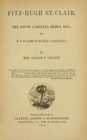

Search results from Open Library.
Recent natural events nearby
- Wildfire Main Trail, Chatham, GeorgiaWildfires · 2026-08-14 · 160 mi
- Wildfire Camden McCarthy Overpass Fire, Camden, GeorgiaWildfires · 2026-07-30 · 221 mi
- Wildfire Mitchell, Ware, GeorgiaWildfires · 2026-08-24 · 250 mi
Wildfires, storms and other events from NASA EONET (last 12 months, within 250 mi).
Ground air-quality sensors
Recently spotted species
Nearest stream gauge
Events
Gallery
Sources
- • Wikipedia
- • US Census Bureau (ACS 5-year estimates)
- • NOAA National Weather Service
- • Wikidata
- • USGS Earthquake Catalog (global feed)
- • NCES via Urban Institute Education Data Portal
- • GBIF (Global Biodiversity Information Facility)
- • CDC PLACES
- • Open-Meteo / sunrise-sunset.org
- • Wikipedia Pageviews API
- • Open Library
- • NASA EONET