Browse / United States / South Carolina / Greenville
Greenville
South Carolinacity

Greenville
Total population
74,386
Median home value
$553,700
Bachelor's+
Median income
$81,573
Demographic figures from US Census Bureau · ACS 5-year estimates. Overview below cites Wikipedia and may reference a different year.
City facts
Overview
Greenville is a city in Greenville County, South Carolina, United States, and its county seat. It is the sixth-most populous city in South Carolina with a population of 70,720 at the 2020 census, while the Greenville metropolitan area has an estimated 997,000 residents and is the largest metropolitan area in the state.
Read more on WikipediaHistory & geography
History
The land of present-day Greenville was once the hunting ground of the Cherokee, which was forbidden to colonists. A wealthy settler from Virginia named Richard Pearis arrived in South Carolina around 1754 and established relations with the Cherokee. Pearis had a child with a Cherokee woman and received about from the Cherokee around 1770. Pearis established a plantation on the Reedy River called the Great Plains in present-day Downtown Greenville. The American Revolution divided the South Carolina country between the Loyalists and Patriots. Pearis supported the Loyalists and together with their allies, the Cherokee, attacked the Patriots. The Patriots retaliated by burning down Pearis' plantation and jailing him in Charleston. Pearis never returned to his plantation but Paris Mountain is named after him. The Treaty of Dewitt's Corner in 1777 ceded almost all Cherokee land, including present-day Greenville, to South Carolina. Greenville County was created in 1786. Some sources state it was named for its physical appearance, while others say the county is named after General Nathanael Greene in honor of his service in the American Revolutionary War, or after early settler Isaac Green. Considered to be the father of Greenville, McBee donated land for many structures, such as churches, academies, and a cotton mill. Furman University was funded by McBee who helped bring the university to Greenville from Winnsboro, South Carolina, in 1851. In 1853 McBee and other Greenville County leaders funded a new railroad called the Greenville & Columbia Railroad. Greenville boomed to around 1,000 in the 1850s due to the growth of McBee's donations and the attraction of the town as a summer resort for visitors. In December 1860 Greenville supported a convention to debate the issue…
Geography
Greenville is roughly equidistant between Atlanta ( southwest), and Charlotte, North Carolina ( northeast). Columbia, the state capital, is to the southeast. Greenville is in the foothills of the Blue Ridge Mountains, a physiographic province of the larger Appalachian Mountains range, and includes many small hills. Sassafras Mountain, the highest point in South Carolina, is in northern Pickens County, less than northwest of Greenville. Many area television and radio station towers are on Paris Mountain, the second most prominent peak in the area, north of downtown Greenville. According to the United States Census Bureau, the city has a total area of , of which is land and (0.77%) is water. Winters are short and generally cool, with a January daily average of . On average, there are 59 nights per year that drop to or below freezing, and only 1.3 days that fail to rise above freezing. April is the driest month, with an average of of precipitation. Summers are hot and humid, with a daily temperature average in July of . There are an average 43 days per year with highs at or above . Official record temperatures range from on July 1, 2012, down to on January 30, 1966; the record cold daily maximum is on December 31, 1917, while, conversely, the record warm daily minimum is on July 12, 1937, the last of three occasions. The average window for freezing temperatures is November 4 through April 1, allowing a growing season of 217 days. Precipitation is generally less frequent in autumn than spring and, on average, Greenville receives of precipitation annually, which is somewhat evenly distributed throughout the year, although summer is slightly wetter; annual precipitation has historically ranged from in 2007 to in 1908. In addition, there is an…
Excerpted from the corresponding Wikipedia article (CC BY-SA).
Demographics & economy
Race & ethnicity
Source: US Census Bureau — American Community Survey, 5-year estimates.
Geography
Coordinates & boundaries from the US Census TIGER/Line shapefiles.
Climate
Current forecast
Forecast for Greenville, SC from NOAA NWS API.
Air quality
Industrial & pollution facilities
Natural hazard risk
Health (adults)
Age-adjusted prevalence estimates from CDC PLACES (latest release).
Walkability
Amenities nearby
Wildlife & biodiversity
Schools
Largest nearby schools
- Cyber Academy of South CarolinaOther · Greenville · 3,985 students · 23.4:1 ratio
- Mauldin HighHigh · Mauldin · 2,314 students · 19:1 ratio
- J. L. Mann High AcademyHigh · Greenville · 2,076 students · 18.7:1 ratio
- Riverside HighHigh · Greer · 1,847 students · 20.1:1 ratio
- Wade Hampton HighHigh · Greenville · 1,831 students · 19.1:1 ratio
- Greenville Senior High AcademyHigh · Greenville · 1,729 students · 20.1:1 ratio
- Legacy Early CollegeOther · Greenville · 1,610 students · 12.3:1 ratio
- Eastside HighHigh · Taylors · 1,551 students · 19.6:1 ratio
Public K–12 schools within ~10 mi from Urban Institute Education Data Portal (NCES Common Core of Data, 2022).
Earthquake history
Photos
Sights & places nearby
Notable people from here


People born within ~10 km, from Wikidata (CC0). Click any name for their Wikipedia article.
Nearby places in South Carolina
- Five Forks8.2 mi away · pop. 18,656
- Easley12.5 mi away · pop. 24,841
- West Pelzer14.7 mi away
- Williamston16.4 mi away
- Liberty19.5 mi away
- Gray Court21.2 mi away
- Belton22.9 mi away · pop. 4,458
- Northlake25.9 mi away
- Boiling Springs26.1 mi away
- Anderson27 mi away · pop. 28,106
- Pendleton27.2 mi away
- Sandy Springs27.3 mi away
Geography & sun
Elevation, sunrise/sunset and daylight from Open-Meteo. Solar climatology from NASA POWER.
Nearby airports
Public attention
Pageview totals from the Wikimedia Pageviews API.
Books about Greenville
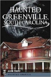

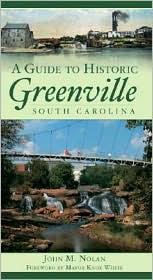

Search results from Open Library.
Recent natural events nearby
Ground air-quality sensors
Recently spotted species
Nearest stream gauge
Events
Gallery
Sources
- • Wikipedia
- • US Census Bureau (ACS 5-year estimates)
- • NOAA National Weather Service
- • Wikidata
- • NCES via Urban Institute Education Data Portal
- • CDC PLACES
- • Open-Meteo / sunrise-sunset.org
- • Wikipedia Pageviews API
- • Open Library