Browse / United States / South Dakota / Buffalo Gap
Buffalo Gap
South Dakotatown

Buffalo Gap
Total population
131
Median home value
$100,000
Bachelor's+
Median income
$54,063
Air quality index
Demographic figures from US Census Bureau · ACS 5-year estimates. Overview below cites Wikipedia and may reference a different year.
City facts
Facts from Wikidata (CC0).
Overview
Buffalo Gap is a town in Custer County, South Dakota, United States. The population was 131 at the 2020 census.
Read more on WikipediaHistory & geography
History
A very old western South Dakota town, Buffalo Gap was founded in 1877. By 1885, it was a railroad spur for the Fremont, Elkhorn and Missouri Valley Railroad line, with more than 1,200 residents. Today, the town has about 180 residents. In its early years it was one of the largest towns in South Dakota, but it received the same fate as many other towns of that era. A resident's cow kicked over a lantern and it burned the town to the ground, as happened with the Great Chicago Fire and many others. The town never fully recovered and was never rebuilt to its former grandeur. The name comes from a gap to the west of town that sheltered buffalo herds in earlier times. Although Buffalo Gap burned down several times, there are a number of historic buildings still standing. Located on State Hwy 79 between Hermosa and Hot Springs, Buffalo Gap intersects with County Road 656, an “off the beaten path” that travelers can take into the Buffalo Gap National Grasslands, Badlands National Park and the Pine Ridge Indian Reservation Part of the action of the French book La Brèche aux buffles takes place in Buffalo Gap.
Geography
According to the United States Census Bureau, the town has a total area of , all land.
Excerpted from the corresponding Wikipedia article (CC BY-SA).
Demographics & economy
Race & ethnicity
Source: US Census Bureau — American Community Survey, 5-year estimates.
Geography
Coordinates & boundaries from the US Census TIGER/Line shapefiles.
Climate
Current forecast
Forecast for Buffalo Gap, SD from NOAA NWS API.
Air quality
Current readings from Open-Meteo Air Quality API (Copernicus CAMS European reanalysis).
Industrial & pollution facilities
Natural hazard risk
Health (adults)
Walkability
Amenities nearby
Wildlife & biodiversity
Most-observed species
- American RobinTurdus migratorius Linnaeus, 1766 · Aves1,161
- Western MeadowlarkSturnella neglecta Audubon, 1844 · Aves939
- Spotted TowheePipilo maculatus Swainson, 1827 · Aves827
- Black-capped ChickadeePoecile atricapillus (Linnaeus, 1766) · Aves824
- American GoldfinchSpinus tristis (Linnaeus, 1758) · Aves650
- Black-billed MagpiePica hudsonia (Sabine, 1823) · Aves647
- Mourning DoveZenaida macroura (Linnaeus, 1758) · Aves613
- American CrowCorvus brachyrhynchos C.L.Brehm, 1822 · Aves599
Citizen-science & research observations from the Global Biodiversity Information Facility (GBIF).
Schools
Earthquake history
Most recent
- M 2.6 — 2025-06-0819 km NW of Wasta, South Dakota
- M 3.6 — 2025-03-097 km W of Fairburn, South Dakota
- M 3 — 2024-06-2922 km ESE of Hill View Heights, Wyoming
- M 2.9 — 2024-06-167 km NNE of Buffalo Gap, South Dakota
- M 2.8 — 2024-04-0419 km SW of Interior, South Dakota
- M 3.4 — 2021-03-2610 km E of Edgemont, South Dakota
Events from the USGS Earthquake Catalog (global) (FDSN Event Web Service).
Photos
Sights & places nearby
Notable people from here
Geography & sun
Elevation, sunrise/sunset and daylight from Open-Meteo. Solar climatology from NASA POWER.
Nearby airports
Public attention
Pageview totals from the Wikimedia Pageviews API.
Books about Buffalo Gap

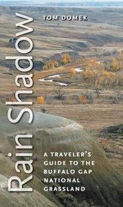
Search results from Open Library.
Recent natural events nearby
- Wildfire XU Hill, Oglala Lakota, South DakotaWildfires · 2026-08-11 · 46 mi
- Wildfire Rancher fire, Oglala Lakota, South DakotaWildfires · 2026-08-11 · 51 mi
- Wildfire Needles, Oglala Lakota, South DakotaWildfires · 2026-09-04 · 52 mi
- Wildfire Potato Creek, Jackson, South DakotaWildfires · 2026-08-01 · 62 mi
- Wildfire Potato Creek, Jackson, South DakotaWildfires · 2026-07-27 · 62 mi
- Wildfire Duhamel, Pennington, South DakotaWildfires · 2026-07-29 · 83 mi
- Wildfire Fairpoint, Meade, South DakotaWildfires · 2026-07-27 · 91 mi
- Wildfire Kohns, Campbell, WyomingWildfires · 2026-07-27 · 111 mi
Wildfires, storms and other events from NASA EONET (last 12 months, within 250 mi).
Ground air-quality sensors
Recently spotted species
Nearest stream gauge
Events
Gallery
Sources
- • Wikipedia
- • US Census Bureau (ACS 5-year estimates)
- • NOAA National Weather Service
- • Wikidata
- • Open-Meteo Air Quality (CAMS)
- • USGS Earthquake Catalog (global feed)
- • GBIF (Global Biodiversity Information Facility)
- • Open-Meteo / sunrise-sunset.org
- • Wikipedia Pageviews API
- • Open Library
- • NASA EONET