Browse / Sudan / Northern / Dongola
Dongola
Northerncity

Dongola
Total population
56,167
Demographic figures from Central Bureau of Statistics (Sudan). Overview below cites Wikipedia and may reference a different year.
City facts
Overview
Dongola, also known as Urdu or New Dongola, is the capital of Northern State in Sudan, on the banks of the Nile. It should not be confused with Old Dongola, a now deserted medieval city located 80 km upstream on the opposite bank.
Read more on WikipediaHistory & geography
History
In the medieval period the region was controlled by the Christian kingdom of Makuria, which until the mid-14th century had its capital at Old Dongola further south. Subsequently, Old Dongola became the capital of a smaller kingdom which was integrated into the Islamic Funj Sultanate in the 16th century, which ruled the region until the late 18th century. By the 1820s the town was virtually abandoned. In 1812 the Mamluks arrived in the Dongola region after they were forced out from Egypt by Muhammad Ali Pasha, establishing a small state. As their capital they chose the small town of Maragha. Growing significantly, it came to be known as Dongola Urdu, New Dongola. In 1820 Muhammad Ali Pasha invaded Sudan and the Mamluks, numbering only 300 men, abandoned the town and fled to the south. The Egyptians made Dongola a provincial capital, which it remained until the outbreak of the Mahdist revolt in the 1880s. The Nile Expedition of 1884–1885 to relieve Gordon at Khartoum passed through the area. Regiments were challenged to race up the river by boat, and this gave rise to the English regatta competition of dongola racing. Dongola was the scene of a victory by Brigadier Sir Herbert H. Kitchener over the indigenous Mahdist Muslim tribes in 1896 who later turned it into a British-Egyptian army base with the objective of collecting and storing weapons, gear and resources. Dongola was a considered an all time base for sending campaign reports to Britain, and the first English press release was issued in the name of Dongola Star, with news of the British-Egyptian army in Sudan. Kitchener's forces were known for their mercilessness, killing over 15,000 Mahdist troops in the Battle of Omdurman in 1898, and later on proceeded to kill the wounded, raising the overall death toll to…
Excerpted from the corresponding Wikipedia article (CC BY-SA).
Geography
Coordinates & boundaries from the US Census TIGER/Line shapefiles.
Climate
Air quality
Walkability
Amenities nearby
Wildlife & biodiversity
Earthquake history
Photos
Sights & places nearby
Notable people from here


People born within ~10 km, from Wikidata (CC0). Click any name for their Wikipedia article.
Nearby places in Northern
Geography & sun
Elevation, sunrise/sunset and daylight from Open-Meteo. Solar climatology from NASA POWER.
Nearby airports
Public attention
Pageview totals from the Wikimedia Pageviews API.
Books about Dongola

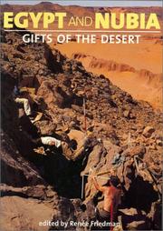
Search results from Open Library.
Recent natural events nearby
Ground air-quality sensors
Recently spotted species
Events
Gallery
Sources
- • Wikipedia
- • Wikidata
- • Open-Elevation
- • Open-Meteo / sunrise-sunset.org
- • Wikipedia Pageviews API
- • Open Library