Browse / Somalia / Sool / Caynabo عينبة
Caynabo عينبة
Soolcity

Caynabo عينبة
Total population
50,000
Air quality index
Demographic figures from Somali National Bureau of Statistics. Overview below cites Wikipedia and may reference a different year.
City facts
Overview
Aynaba, also spelt Ainabo, Ainaba or Aynabo is a major town in western Sool region of Somaliland as well as the administrative seat of the Aynaba District.
Read more on WikipediaHistory & geography
History
During the early to mid-19th century, Aynaba was the headquarters of the Soocane military faction led by the famous poet and military leader Kite Fiqi. The town was one of many temporary local centers that the Dervish movement operated from, led by the Mad Mullah's second in command Haji Sudi of the Adan Madoba subclan of the Habr Je'lo. The town was also the sight of clashes between the movement's Sufi tariqa, the Salihiyya and its rival, the Qadiriyya in 1955. Following a string of Habr Je'lo victories over the Dhulbahante after the collapse of the Dervish movement, in which they had captured many wells and reduced their opponents to a pitiful state, including expelling them from Aynaba and the wider Aynaba district, Salaan Carrabey composed a boastful poem dedicated to Aynaba called Haadaaqsi. {{Verse translation|Ararsame ma haybsado Nugaal hogashadii ceele Hanas iyo abaar kulu adoo habaqle soo guurey Caynaba hadhuub kama dartaan hoga kaliileede Ka hulleele Hagar aadankii hoobalayn jiraye|The Ararsame do not (even dare to) inquire about Nugaal and watering at the wells In the heat of the sun, suffering fierce thirst, you trudged along wearily You do not even take one vessel of water from Aynaba in the heat of the kaliil The Hagar Aadan who used to chant (to their camels, while watering them) have moved out from there|lang=so-Latn|attr1=Salaan Carrabey Haadaaqsi The Dhulbahante had previously inhabited just east of Burao. The Habr Je'lo took advantage of the Dhulbahante's weakness after the defeat of the Dervish movement to conquer much of their important wells and grazing grounds. The Habr Je'lo subsequently expanded into and beyond the Saraar plain and the Ain Valley (which includes Aynaba), pushing the Dhulbahante southwards towards the Haud: One of the most…
Excerpted from the corresponding Wikipedia article (CC BY-SA).
Geography
Coordinates & boundaries from the US Census TIGER/Line shapefiles.
Climate
Air quality
Current readings from Open-Meteo Air Quality API (Copernicus CAMS European reanalysis).
Walkability
Amenities nearby
Wildlife & biodiversity
Most-observed species
- Northern Carmine Bee-eaterMerops nubicus J.F.Gmelin, 1788 · Aves1
- Egyptian GooseAlopochen aegyptiaca (Linnaeus, 1766) · Aves1
- Gloria De La MananaIpomoea carnea Jacq. · Magnoliopsida1
- Ethiopian SwallowHirundo aethiopica Blanford, 1869 · Aves1
- BlackstartOenanthe melanura (Temminck, 1824) · Aves1
- Yellow-spotted Bush SparrowGymnoris pyrgita (Heuglin, 1862) · Aves1
- Chestnut-bellied SandgrousePterocles exustus Temminck, 1825 · Aves1
Citizen-science & research observations from the Global Biodiversity Information Facility (GBIF).
Earthquake history
Events from the USGS Earthquake Catalog (global) (FDSN Event Web Service).
Photos
Sights & places nearby
Notable people from here
People born within ~10 km, from Wikidata (CC0). Click any name for their Wikipedia article.
Nearby places in Sool
Geography & sun
Elevation, sunrise/sunset and daylight from Open-Meteo. Solar climatology from NASA POWER.
Nearby airports
Public attention
Pageview totals from the Wikimedia Pageviews API.
Books about this place
Recent natural events nearby
Ground air-quality sensors
Recently spotted species
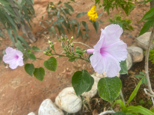
Research-grade observations from iNaturalist (within ~15 mi).
Events
Gallery
Sources
- • Wikipedia
- • Wikidata
- • Open-Meteo Air Quality (CAMS)
- • USGS Earthquake Catalog (global feed)
- • GBIF (Global Biodiversity Information Facility)
- • iNaturalist
- • Open-Meteo / sunrise-sunset.org
- • Wikipedia Pageviews API