Browse / Togo / Togo / Martyro
Martyro
Togovillage
Air quality index
Demographic figures from INSEED Togo. Overview below cites Wikipedia and may reference a different year.
City facts
Overview
Martyro, a village in Togo, forms part of the country's settled landscape. On the world map it falls within the Eastern Hemisphere, specifically at 8.097°, 1.042°. Detailed population figures are not currently catalogued in the open data sources we track. Its latitude implies a climate characterised by hot and humid year-round with little seasonal temperature variation. The location receives about 1,868 kWh/m² of solar irradiance per year and sunshine for roughly 73% of daylight hours. Open-data panels below dive into population trends, climate normals, environmental indicators and nearby places.
Summary composed automatically from structured open data on this page. See our Terms for details.
History & geography
Geography
Coordinates & boundaries from the US Census TIGER/Line shapefiles.
Climate
Air quality
Current readings from Open-Meteo Air Quality API (Copernicus CAMS European reanalysis).
Walkability
Amenities nearby
Wildlife & biodiversity
Most-observed species
- Pied CrowCorvus albus Statius Muller, 1776 · Aves2
- Fox KestrelFalco alopex (Heuglin, 1861) · Aves1
- Rock PigeonColumba livia J.F.Gmelin, 1789 · Aves1
- Vinaceous DoveStreptopelia vinacea (J.F.Gmelin, 1789) · Aves1
- Senegal MahoganyKhaya senegalensis (Desv.) A.Juss. · Magnoliopsida1
- Black KiteMilvus migrans (Boddaert, 1783) · Aves1
- Speckled PigeonColumba guinea Linnaeus, 1758 · Aves1
- Pouchetia africana A.Rich. ex DC.Pouchetia africana A.Rich. ex DC. · Magnoliopsida1
Citizen-science & research observations from the Global Biodiversity Information Facility (GBIF).
Earthquake history
Events from the USGS Earthquake Catalog (global) (FDSN Event Web Service).
Photos
Sights & places nearby
Notable people from here
Nearby places in Togo
Geography & sun
Elevation, sunrise/sunset and daylight from Open-Meteo. Solar climatology from NASA POWER.
Nearby airports
Public attention
Books about this place
Recent natural events nearby
Ground air-quality sensors
Recently spotted species
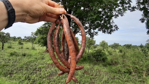
Research-grade observations from iNaturalist (within ~15 mi).
Events
Gallery
Sources
- • Wikidata
- • Open-Meteo Air Quality (CAMS)
- • USGS Earthquake Catalog (global feed)
- • GBIF (Global Biodiversity Information Facility)
- • iNaturalist
- • Open-Meteo / sunrise-sunset.org